Ordesa y Monte Perdido & Pyrénées
July 2021
In July 2021 I solo hiked a 6-day 115 kilometer loop in the central part of the Pyrenees. My route started in Parque Nacional Ordesa y Monte Perdido in Spain and crossed the border into Parc national des Pyrénées in France. Along the way I wild camped.
Itinerary |
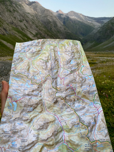
Map and GPX file |
Travel |
Gear |
About the area |
\\ July 17 | Day 1: Ordesa valley


\\ July 18 | Day 2: The Lost Mountain
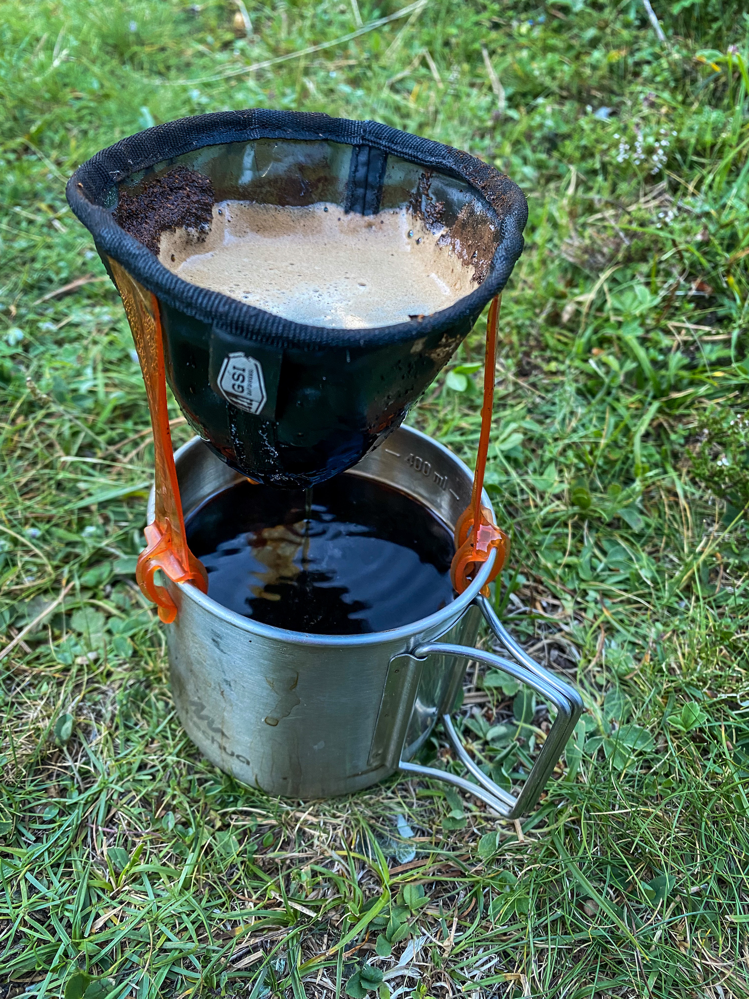
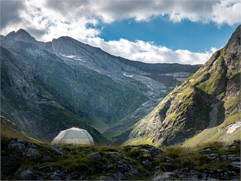
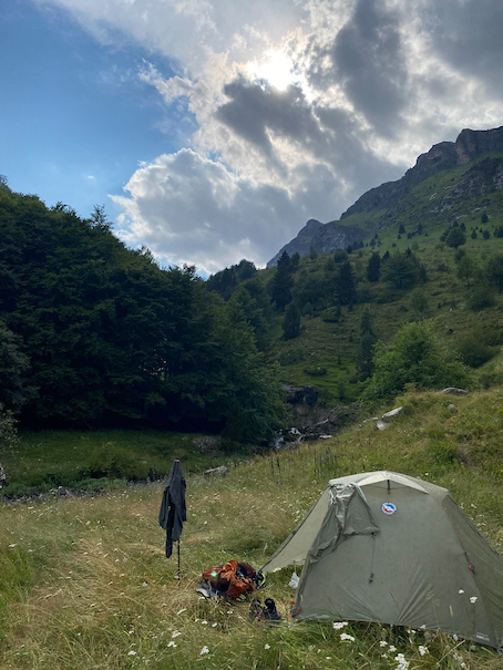
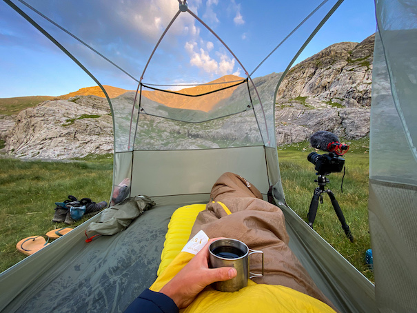
5am. Still pitch black outside. Knowing how many people were down at the refuge that might want to ascend Monte Perdido, I wanted to make sure I beat them to it. I didn’t sleep great, most likely due to the elevation: I spent several days below 500m, now I camped at almost 3000m elevation. I made coffee, waited for the first bit of daylight and set out with my headlight on full power.
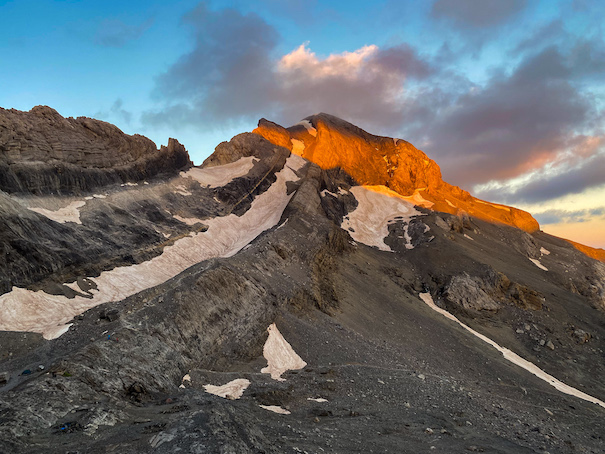
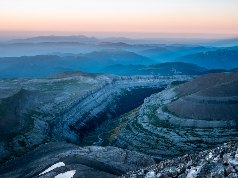
At the start of the trail to the top is a warning sign for the dangerous path ahead, but to be honest it didn't look that difficult. The first section follows a spur on solid rock up the mountain: easy progress. The trail then goes into a gully over scree (loose rock) which makes it harder, but sure not impossible. The last section I found the most tricky: up a large sheet of snow, but, as I found out on my way back, can be walked around. 40 minutes in I made it to the top, and a bit unplanned, exáctly at sunrise. The deep red sun peeked over the mountain tops in the distance casting a pyramid shaped shadow of Monte Perdido over the Ordesa valley. To my surprise people were actually sleeping in stone wind shelters. It was extremely windy and quite cold, but the 360 views of the first daylight hitting the mountain tops was unforgettable.
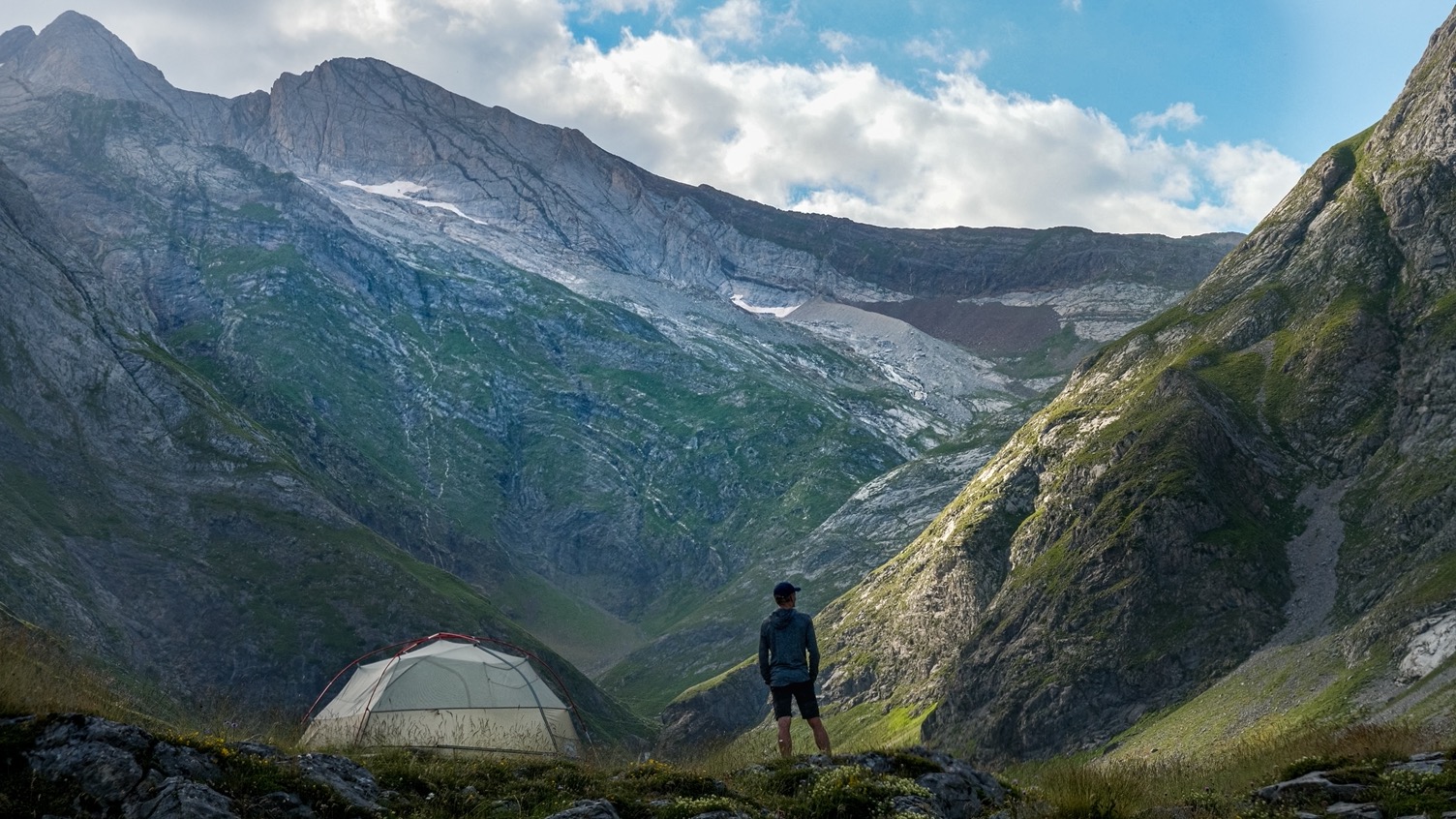
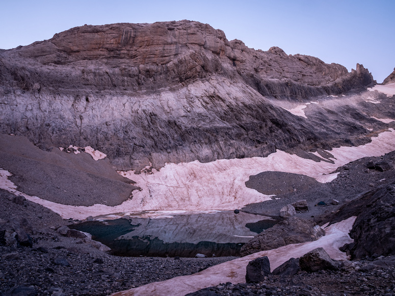
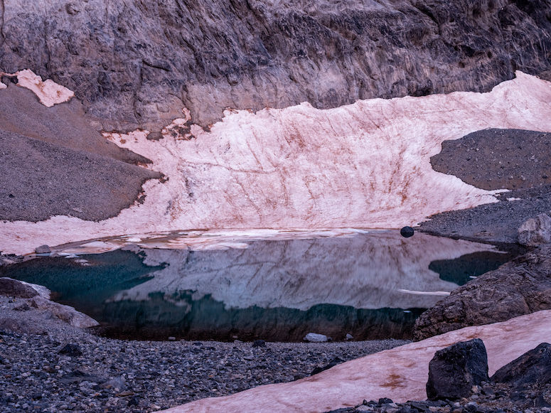
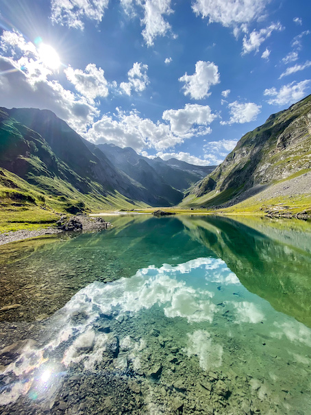
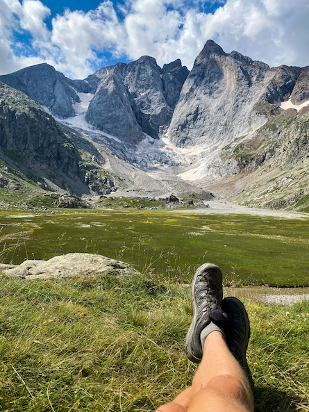
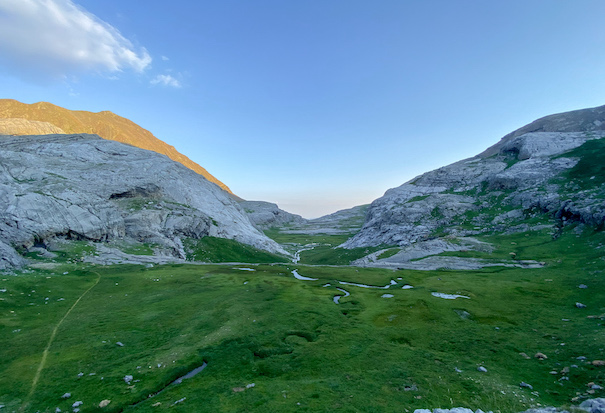
I descended back down, packed up my tent and headed out. The little ice lake near my tent lived up to its name. Last night it was free of ice, now it was covered in ice. I climbed out of the tarn via the western side and got my first views of what would lie ahead for today. Right before me the Monte Perdido glacier, and below that a flat rocky valley with a turquoise blue leak on the other side tucked below the mountain range that separates Spain from France. The valley is called Circo de Penata, and is also accessible via the more common route: a steep 1400m climb from the town Bielsa.
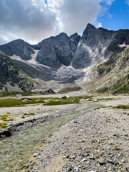
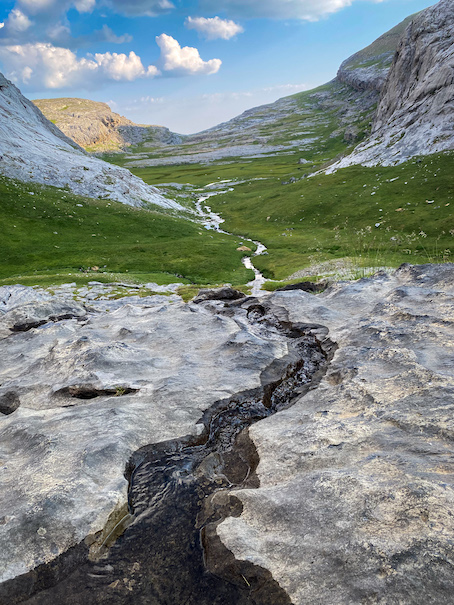
First the glacier. I had some doubts whether to do it or not. It was marked on my map as an ice-axe route, but since it was mid summer I was hoping for a thick soft layer on top. And indeed the top layer was soft snow covered in blown grit. With caution I made it down the glacier, where the real challenge arose: a steep near vertical descent of a cliff. A notch in the wall offered some natural steps from which I, with my head to the wall, descended down. For sure not a common route in the park, but I liked the adventure. The valley is very rocky with a really flat bottom, making me think it might have been carved out by a glacier. There are several small creeks winding through it, but no vegetation at all.
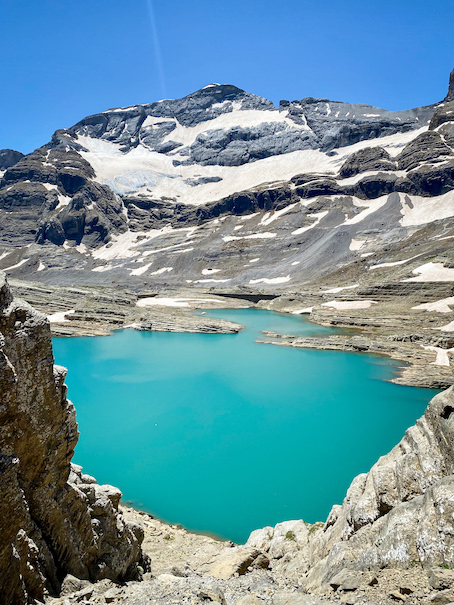
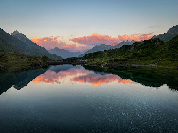
At 1pm I got to the turquoise colored lake Lago marbore. The lake is at 2600 m and covered with ice well into June, and even now I could see patches of ice floating around. A little history lesson: a dam was constructed at the lake's outlet in 1925 to store water and control the flow during the melt. The dam is 7 meters high and 70 meters long, but never really functioned well because of continual loss of water and problems with sealing the outlet tunnel. [reference, reference] When the area was included in the Spanish national park in 1982, all construction stopped. I took a short nap on one of the many peninsulas when I got the crazy idea to take a dive. I bet the water temperature was not much above freezing.
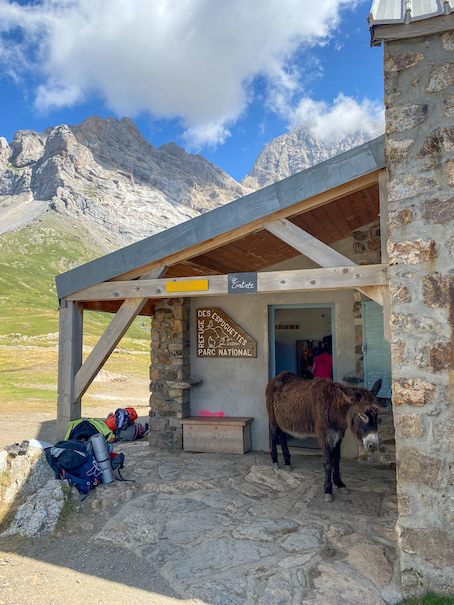
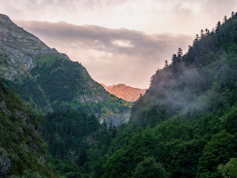
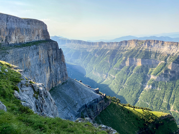
Tucked away in a small rocky mountain pass (Forqueta de Tuca Roya) on the other side of the lake is Refugio Tucarroya. The mountain pass also marks the border between France and Spain. I hiked around the lake and made it up to the refuge. The views of the lake from there are even better than before; the turquoise color of the water is really well accentuated from here. The refuge is unmanned and lies at a totally impractical location, but with those views that's understandable. I crossed the border into France and descended down into a valley of the French national park 'Parc national des Pyrénées'. The valley lies deeper than the lake, and the descent is steep and rocky. From the valley it's almost immediately up again to a mountain pass into Cirque de Gavarnie valley (also a World Heritage Site by UNESCO): a cirque is an amphitheatre-like valley formed by glacial erosion. This section is a lot longer than I initially anticipated, but definitely not boring. On the mountain pass I could see Refuge des Espuguettes in the green valley below. I could hear the cow bells echoing between the mountains. I got down the refuge and passed it further down looking for a camping spot. 200 meters down the refuge just below the treeline, I found a small creek and a camping spot.
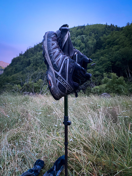
I pitched my tent on a small hill between some trees. The views were great: I looked towards the mountains on the Italian border. The valley was full of cows, which (from experience) I thought would go to a stable around sunset. I was wrong. Apparently French cows don't sleep. The bells kept ringing deep into the night, but I was so tired I fell asleep anyways. But in the middle of the night I was woken up by a strange noise close to my head. I shook awake with my heart rate pounding. Still half asleep I thought: a wolf or bear. I didn't have my rainfly on, so I turned on my headlight and shined it through the mesh of my tent. A cow! I don't think cows have really good night vision, so having a 600kg animal next to my tent wasn't so relaxing. I tried to scare it away by making some from my tent. That didn't help, instead the cow put its head down and made some bull-like paw movements like it was going to attack. I don't think I ever opened those poor zippers of my tent so fast and got out. Using my walking stick I was able to scare it away. I won't ever pitch my tent in an area with cattle ever again.


\\ July 19 | Day 3: GR10
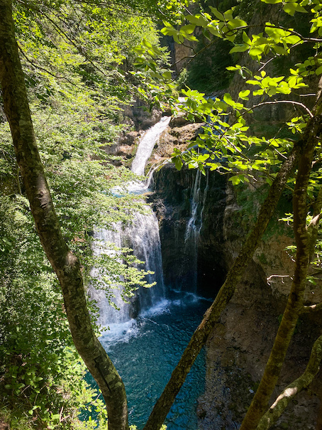
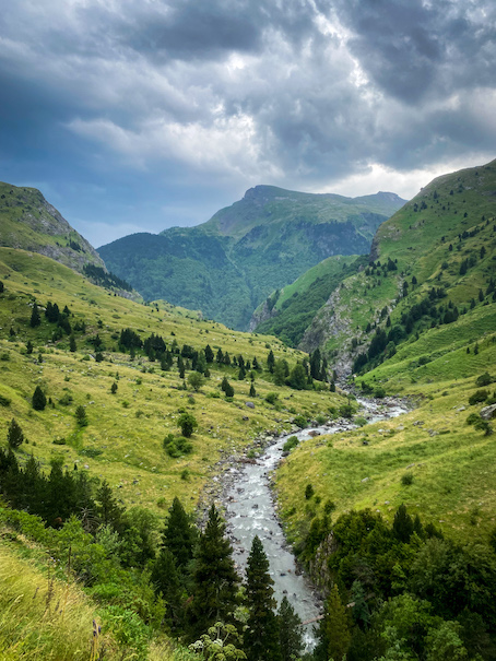
The next morning I set out around 9am. An easy day planned. The first part was all downhill to Gavarnie, the only town and change to refill my supplies on this trip. The morning was cold with a clear blue sky, perfect weather. The trail is beautiful: all downhill through a pine forest with glimps of the steep rock walls and waterfalls of the Cirque de Gavarnie. The trail is well marked and since it's closer to a road, also busier than yesterday.
Gavarnie is a small town with just over 100 permanent residents, but at least a tenfold that number of tourists. It's one of the main tourist spots of the French national park. The town gives easy access to the famous head of the valley, with the 422m tall Gavarnie Waterfalls (second-highest waterfalls in Europe), which are visible from far. In Gavarnie I had breakfast, dropped my batteries at the tourist information office for charging, did my groceries at a small local supermarket and relaxed in a park.
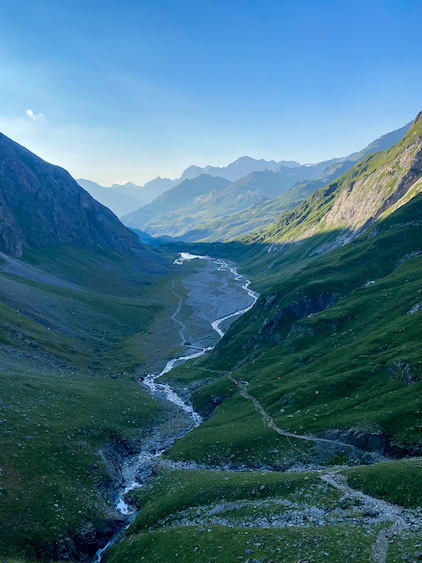
Around 2pm I continued my journey north, on the French side of the massif. The next day and a half I would be following the GR10 trail, one of the two main trails through the Pyrenees. With an overfull stomach and a backpack, I followed the trail 500 meters up the mountainside of the valley. Once up the trail is mostly flat for almost 7 kilometers to Lac d'Ossoue. In the valley down a dirt road follows the Gave d'Ossoue river to the same destination.
The trail is much easier than what I've encountered the days before: no boulder fields, no extreme gradients and all well marked. Progress was easy, but also a little boring.
Two hours later I made it to Lac d'Ossoue, a small dammed lake right before the valley flattens out and then narrows to a gorge. The lake is cold, but with the relatively warm weather and sun occasionally peaking through the clouds, it was refreshing to take a dive. I spotted several good spots a little higher up looking down on the lake. But after scouting some more I found the perfect spot: a small hill in the middle of flat valley beyond the lake. Around the hill several babbling creeks that were branching off and merging continuously. Views south looked at the clear blue water of the lake, to the north the narrowing walls of the valley and a waterfall coming down into the gorge in the back. Amazing.


\\ July 20 | Day 4: Thunderstorms!
When I was in Gavarnie yesterday with cell phone reception I checked the weather: in the forecast for today was rain and thunderstorms starting in the late afternoon. My plan for today was getting back into Spain, a route with 2 mountain passes. With that forecast in mind I left at 7:30 in the morning to be sure to make it across before the weather changed.
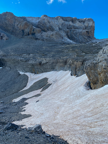
The first part was a climb up to the first mountain pass Hourquette d'Ossoue at 2734m. The trail was a lot more exciting than the flat mountainside from yesterday: waterfalls, snow patches, caves. At around 10am I got to Refuge de Bayssellance just below the pass. In the refuge they looked up the most recent forecast for me: rain at thunder well after 6pm, so plenty of time to make it to the Spanish side.
At the mountain pass you get some views of the valley beyond, the mountain Vignemal (at 3,298 metres the highest of the French Pyrenees) and the first views of Glacier des Oulettes de Gaube. You can take an out and back to Petit Vignemal (3,032m) from here, but I had to make progress today.
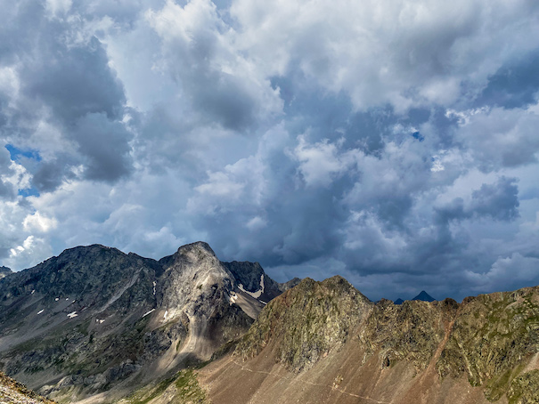
From the mountain pass it all steep-down to Refuge des Oulettes de Gaube. The views from the refuge are incredible: a flat grassy valley with steep walls with at the end of the glacier and Vignemal peak. I relaxed in the sun for half an hour having chocolate for lunch. Some clouds rolled in, but no signs of thunder any time soon. At 1pm I started the second climb up to Spanish border at Col de Mulets, off the GR10. At 2pm I made it to the pass and got a first look of the skies behind the mountain. It startled me a bit seeing dark clouds in the distance. That should've triggered me to keep going, but I didn't hear thunder or see lightning and still had in the back of my head the weather forecast I got this morning, so I made myself a coffee and had a short break. The clouds moved in faster, and the wind started to pick up. I tossed back my coffee and got going.
The ascent was steep and rocky, the descent was several kilometers long and quite gentle. I barely got started when I felt the first rain drops. I barely had my rain jacket on when I heard the first thunder. I knew it was bad: I was high up this bald mountain, with no shelter anywhere nearby. This fast change of weather is what people told me was so typical to the Pyrenees. Had I only listened to that ... I started running down the mountain as fast as I safely could. The thunder got louder and closer and moved to the mountain right next to me. A spectacular sight and even more spectacular hearing the deep rumble of thunder between the mountains. But less comfortable being out there. Luckily no lighting. I made it several hundred meters down into the valley. The rain poured so hard that I was soaked to the bone. When the thunder moved above me, I ran into a ditch near the creek. In an attempt to keep my gear dry I threw out my tent's footprint. Before I had the tent poles in place, the footprint had already filled up with water. I threw my rain fly on and crawled in. Sitting in a puddle of water I waited out the rainstorm. Glad it wasn't cold.
15 minutes later the storm moved out as fast as it had moved in. The sun started to break through the clouds and the thunder moved away. I picked up my stuff and got going right away to stay warm. Half an hour later I made it to the GR11, the Spanish counterpart of the GR10. With the sun really out I stopped to dry my tent and most of my gear. What an experience …
With no weather forecast, and it only being early afternoon, I wanted to keep going while the weather was still good. Down in the valley, the only weather forecast is looking at the sky above the closest mountain, questionable to call it a forecast. During the hours that followed I got soaked more than once, with only once a change to shelter in a small mountain hut (Cabaña de Cerbillonar). But luckily the thunder kept its distance from me.
At 4pm I was more than ready to find a place to pitch my tent and call it a day. But my water source river (Río Ara) was deep down in a gorge and the terrain was steep everywhere. From the pass the valley gradually narrows down to a gorge and gets quite beautiful. But I couldn't really enjoy it, let alone film it, I was tired and soaked for hours now. Another 90 minutes of walking the valley opens up momentarily where another creek (Río Otal) convolutes with Río Ara. I pitched my tent in tall wet grass. Just when I got in my (dry) tent, when another storm moved in with more rain and thunder.
I was exhausted: today's stage was long, with a lot of elevation gain and bad weather. And it's always this mental contrast I am fighting, here when hiking, but also with sports. On the one hand I try to push myself to find my limits and I want the hike to be over, relax and eat properly. But on the other (bigger) hand I enjoy every second of being out there and want it to last as long as possible.
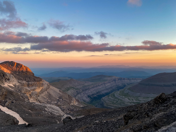
In the evening the weather cleared up completely, up to the point of clear blue skies. Unfortunately the sun was already behind the mountains, so I couldn’t benefit from it anymore. My shoes were wet, and so were a lot of my clothes, but my sleeping gear was dry, so I didn't care too much.


\\ July 21 | Day 5: Unmarked trails
The night and morning were calm and quiet: blue skies and no wind. My shoes were still soaked in the morning, and it didn’t help that I camped in waist deep grass, keeping everything soaked. The first section of the day was a 2.5km dirt road to Refuge Bujaruelo along Río Ara. Río Ara, as I found out later, is the only river in Spain that is completely undammed, and therefore great for fly fishers. Close to Refugio Bujaruelo the long awaited sun started to peak over the mountains. At the refuge I had a big breakfast and coffee while I dried some of my gear. This was the first time in almost 72 hours I had cell phone reception. No rain or thunder in the forecast, but after yesterday, I was vigilant. For the route I basically had 2 options: down through the valley to Torla (10 boring kilometers), or one more climb into the Ordesa mountains to spend the night higher up in the mountains. Of course I went for option 2.
At 10am I started the final 1000 meter climb up to Puerto de Bujaruelo on the border with France. Off the GR route, the trail is more technical and steeper, but also more fun. The trail winds through forest to the treeline and beyond. It was hot and there’s no water till 200 meters below the mountain pass.
During my water break I could not believe my eyes when 2 bikepackers came down the mountain with their bikes. The trail was so rocky and steep that there was not biking at all. Soaked in sweat they were carrying their overpacked bikes one by one over the rocks. I truly couldn't understand how they came to the conclusion this was the best option to cross the mountains. Even biking the 150km south and around the pass seemed easier than this.
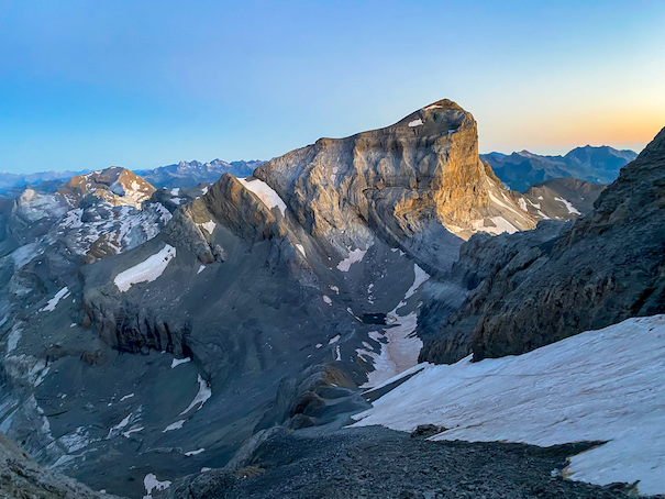
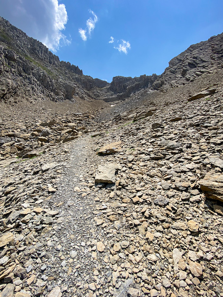
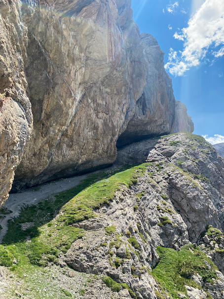
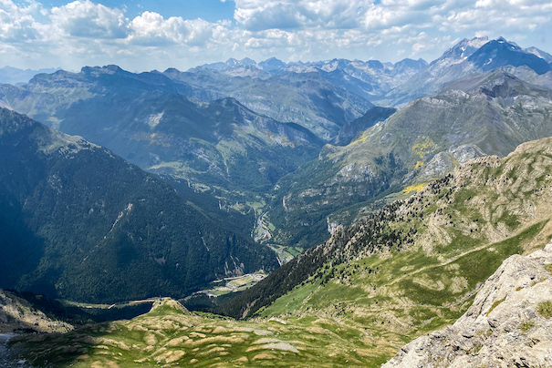
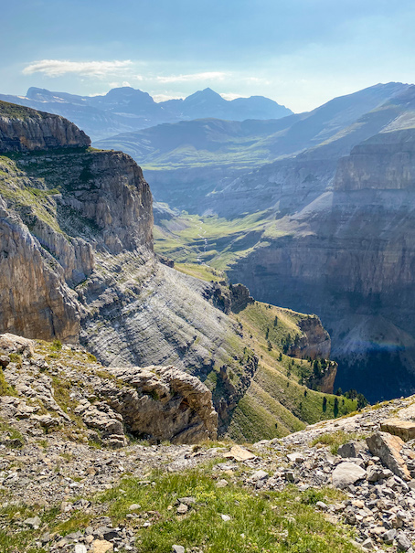
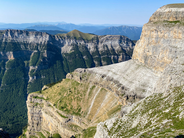
At Puerto de Bujaruelo I got off the main trail, on what turned out to be one of the most beautiful sections of this trip. The trail is unmarked and starts with a steep climb up a narrow gorge, which probably scares away most hikers. The trail goes up to a mountain pass (Forquete de Gabietou, 2515m) on loose brownish sandstone rock. From the mountain pass you look down into the valley on Bujaruelo and on the Pyrenees mountains to the north. Amazing views. On the other side of the pass the trail follows a steep mountainside that is much harder to follow and required both hands and feet in places. In the gulch that follows the type of rock suddenly changes from the brown loose rock to smooth grey rock. The trail is much easier to follow from here on. The next few kilometers are my favorite. The trail goes up and down following a ledge on a near vertical mountain side. It passes underneath overhanging rock, and behind a waterfall. It is technical at places, but in general doable. From the trail I could look deep into the valley, and see Refuge Bujaruelo where I had breakfast that morning. At the end the trail goes up a scree of loose rock to the final mountain pass (Collado Escuzana, 2728m) getting into the Ordesa Valley watershed. At the mountain pass I stopped and sat down. There was no wind and the sun was out. I sat there alone in silence enjoying an almost 360 degree view.
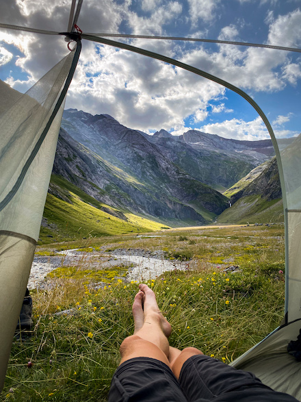
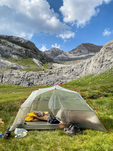
I made it down the other side of the mountain pass. After descending several hundred meters the loose rocks make way for lush green grass. I planned heading more towards the Ordesa valley for camping, but seeing these peaceful meadows I called it a day. The terrain is quite remarkable: instead of a smooth gulch, the terrain consists of several big terraces coming down the mountain, like those paddy terraces in Asia. The plateaus are green, very wet and almost perfectly flat, with a drop-off of 20 meters between each terrace. On one of these plateaus I pitched my tent. Right in front of my tent was a small creek. From my tent I looked towards the Ordesa Valley where the plateaus reform to a large green swampy plain. I took a bath in the creek watching a chamois and a family of marmots playing. What a relaxing spot.
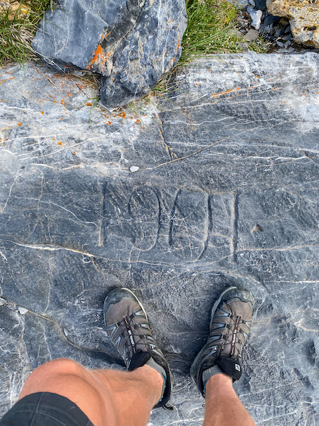
In the evening I hiked up the plateaus to the flat wetland area up top, called Humedal de Salarons. The large peaks and glaciers of the Gabieto peaks (up to 3035) tower behind the wetland. I stood there for a while and noticed something engraved in the rock beneath my feet: "1901". This simple engraving summarizes so perfectly for me why I love being in the mountains. 120 years ago someone, probably also for fun, stood here and saw the exáct same view as I did now. In those 120 years the world we live in totally changed: we had world wars and inventions such as the internet, mobile phones, gps, televisions, commercial airplanes and more. But this view has not changed. This feeling of complete disconnection from the stressful, everchanging and fast world with its continuous increasing demands is what I love. This is why I go out alone, go out in nature.


\\ July 22 | Day 6: The Flower Balcony
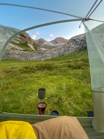
The final morning of the loop. The sky was blue and with the sun still behind the mountains, it was cold. I slept without my rain fly last night. With the full moon out not ideal, but I love looking at the stars at night and being able to look outside as soon as I wake up. Without getting out of my sleeping bag I made a cup of hot coffee and oats for breakfast.
There are several ways back into the Ordesa valley. The shortest being almost straight down to the restaurant where I started. Another way cooler option is via Faja de Flores (Balcony of Flowers). It’s a near flat trail on a ledge high up on the mountain, several kilometers long.
I made it down into the swampy valley. From above it looks like a normal flat grassy valley, but walking through it was totally different. The grass was soggy and streams seemed to appear and disappear out of nowhere. At the end the Faja de las Flores trail starts. The ledge is at places not more than 5 meters wide. On the left is a vertical wall at least 50m high, to the right a vertical drop far down to the next ledge. This section is not for people with fear of heights, but the views are totally worth it. The low morning sun illuminates the walls of the Ordesa valley beautifully, the shadows and morning haze create a spectacular view in the side valleys.
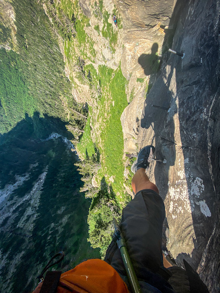
The trail winds along the valley wall for a while, whereafter the ledge widens and a side trail goes down towards the valley floor. I took this trail. It was a lot of rock scrambling at first, followed by a steep decline on loose rocks. At the bottom of this side valley I followed the creek Barranco Rivereta down when the terrain gets really steep. I scrambled down on hands and feet when I saw people in climbing harnesses. Ahead was a 50 meter long section high up a vertical wall. Spaced 50 centimeters apart were pins drilled into the wall as footsteps, while at eye level there was a steel cable attached to the wall with a lot of slack. The drop was at least 50 meters straight down. This section is probably the most scary and dangerous thing I’ve done during any of my hikes. I’m usually pretty relaxed with heights, but this even gave me sweaty hands. There is an alternative trail called Camino the Faja Canallores, which continues along the ledge towards Refugio de Goriz. But this would add several hours and would require me to climb back up where I’d just come down from. Very slowly I made it along the wall, making sure to have both hands firmly grappend on the cable with every step I took. The toughest section done, I climbed down via more pins through a narrow gully to the trail. Relieved with this section behind me I made it down towards the valley. At a trail junction I noticed a sign pointing in the direction I’d just come from: Clavijas de Cotatuero (Pegs or pins of Cotatuero), with a climbers symbol next to it. They should put up a similar sign above this section ...
The trail winds down through pine forest to the trail in the valley. Here I merged onto the wide gravel GR11 trail I started from 5 days ago and made it back to the restaurant at the start of the valley.
I enjoyed this section of the Pyrenees a lot. If I had to describe it with a single word it would be turbulent. The weather changed from sunny to thunderstorms in minutes, and the trails went from easy and gentle on the GR routes, to steep, dangerous and exciting in a single day. My favorite sections were for sure the unmarked trails in Ordesa. Even though progress is twice as slow as on the GR routes, the trails are exciting, challenging and abandoned and gorgeous. I would love to explore the Pyrenees more in the years to come.


Thank you for following along! Love to hear what you think about this itinerary! Let me know by leaving a comment below the Youtube film, or send me a message on social media!