
The Isle of Skye
May 2022
Itinerary |
Map and GPX file |
Gear |
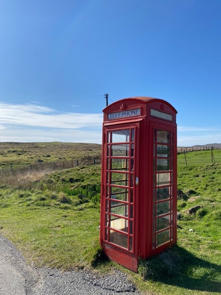
\\ February 24 | Day 1: Rubha Hunish
Red phone booth at Duntulm to cliffs north of Flodigarry via Rubha Hunish
14.3 km | 8.9 mi
526 m | 1726 ft 516 m | 1693 ft
N 57º 40.3074' W 6º 15.0384' (59 m | 1940 ft)
I arrived in Inverness Scotland a day earlier in the morning via a direct flight from Amsterdam. I'd spend the night in Inverness, since no car rental place is open on Sunday (lesson learnt: don't fly on Sunday). Although I'm not a big fan of exploring cities, I must admit it was relaxing just strolling through the old streets, and tasting a little bit of Scottish life. It also gave me a nice opportunity to pack my bag, take a little nap and get the gas bottles from an outdoors store.
The next morning, I picked up my rental van (cheapest option) at 10am and headed towards the Isle of Skye. The 2.5hr drive via Dingwald (north route) was beautiful. The reddish-brown Highlands, forest and lakes gave me a good sense what these mountains were like. The weather was quite nice, so when I got to Portree (the most central town on Skye) early afternoon, I wanted to get going asap. Bus connections in Scotland are excellent, but out here on this island there are only a couple a day heading to the few houses on the northern part of the island. So I had to wait till 3:45 to get on a bus. The hour bus ride is very scenic and by no means boring. By the time the bus got to the tiny town of Duntulm, I was the only one left on the bus. Well, ok excluding the driver of course, who was a super friendly guy.
I got off at the famous red phone booth where the hike officials begins and got going at 5pm. A little later than planned, but with at least 4 hours of daylight left.
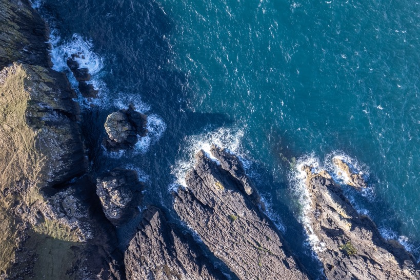
The trail heads further north to the bothi Rubha Hunish, on a cliff overlooking the lower most northern tip of the island: Hunish. Bothis are wilderness huts in Scotland. Unmanned cabins without electricity, water or toilets. Most with some bunk beds and an opportunity to get out of the unpredictable Scottish weather.
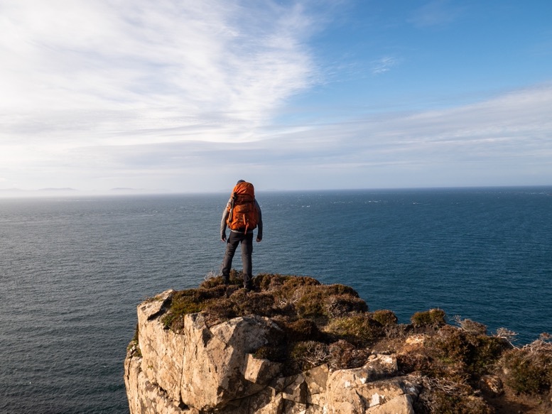
At 2km, I surely wasn't ready to call it a day, so I followed the coastline south. There are some vague trails out here, but it is obvious it is not an official trail, nor marked, but easy to follow. The northern part of the island is quite open, with scattered (white) houses and cattle. And with the cattle comes all the fences. Most of the time you walk close to a fence, and have to cross one once in a while. The contrast with my last hike in the Drakensberg in South Africa was huge. From being in one of the most remote places imaginable, to being out here. But, it was my first time hiking along the sea, nice for a change!
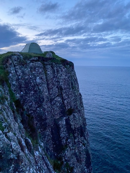
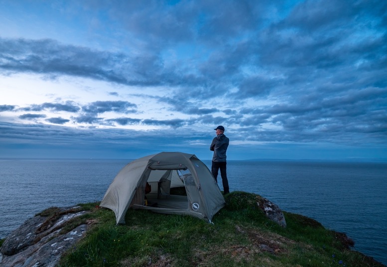
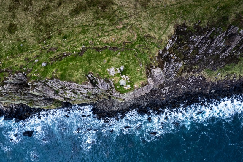
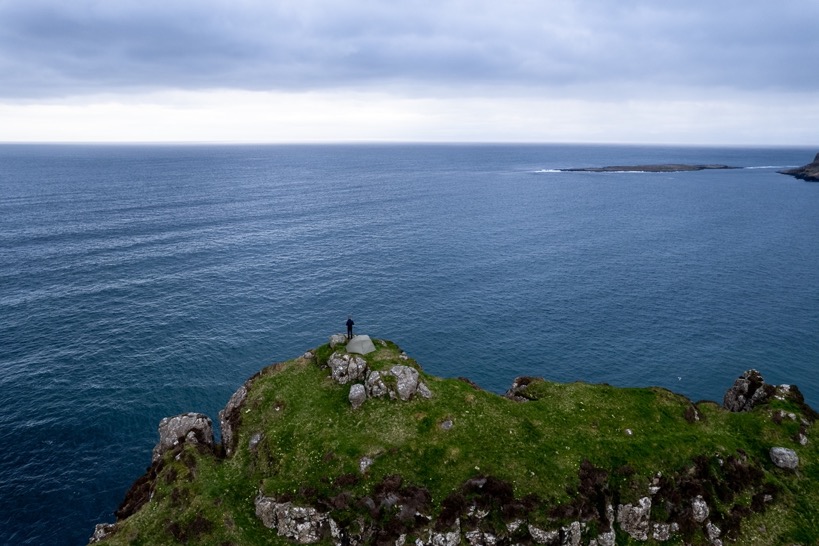
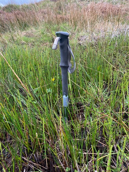
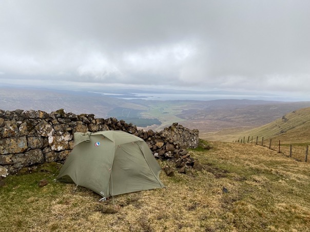
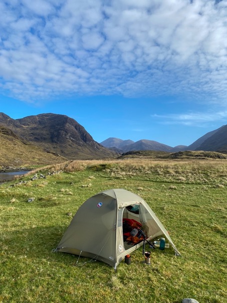
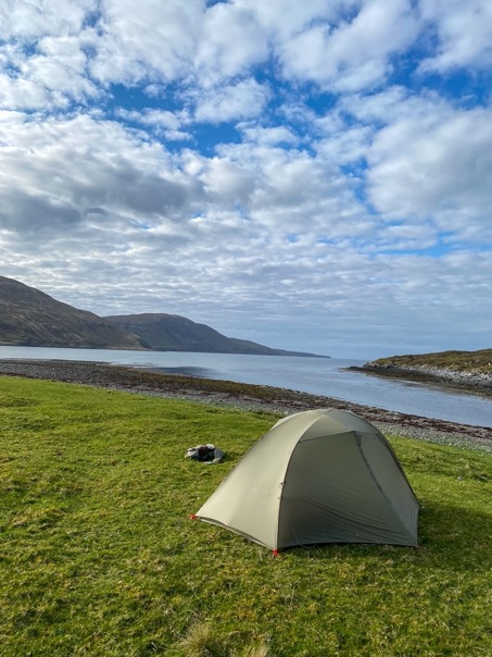
My plan was to head to some lakes just beyond Flodigarry, at the foot of the Quiraing ridge. But just north of Flodigarry, the trail drops through a small gorge to a plateau a bit lower. Suddenly I was away from all the fences, and much further from the houses. This was actually quite an ideal spot for camping! Except that the ground was so soggy in places my walking poles could completely disappear in them. However, close to the edge of the cliffs, it was a lot better, and I spotted this absurd plateau sticking out from its surroundings. My thoughts went from: 'by no means I'm going to be able to camp up there' to 'wow, it actually looks like I can camp up here' to 'how crazy would it be if I pitched my tent up here!' to 'let's pitch my tent here'. It's these moments I love most about backpacking. Finding that one crazy spot that has it all. And I love how at first I doubt and try to supress the thought of camping there, but just push through then and just do it. And it surely didn't disappoint.
For dinner I brought dried meals this time. The last long hikes I did I always found myself getting weaker and weaker day after day by not eating enough. So my attempt to solve that is to just bring tastier food. Plus, it is sooo easy.
My thoughts went from: 'by no means I'm going to be able to camp up there' to 'wow, it actually looks like I can camp up here' to 'how crazy would it be if I pitched my tent up here!' to 'let's pitch my tent here'. It's these moments I love most about backpacking.
\\ May 3 | Day 2: Onto the Trotternish Ridge
Cliffs north of Flodigary to Trotternish Ridge via Quiraing
23.5 km | 14.6 mi
1613 m | 5292 ft 1093 m | 3586 ft
N 57º 32.9937' W 6º 14.6667' (604 m | 1982 ft)
The night was calm, luckily. I surely wouldn't have camped up there with bad weather in the forecast. It wasn't as sunny as yesterday, a bit colder, but still quite good (considering what was to come).
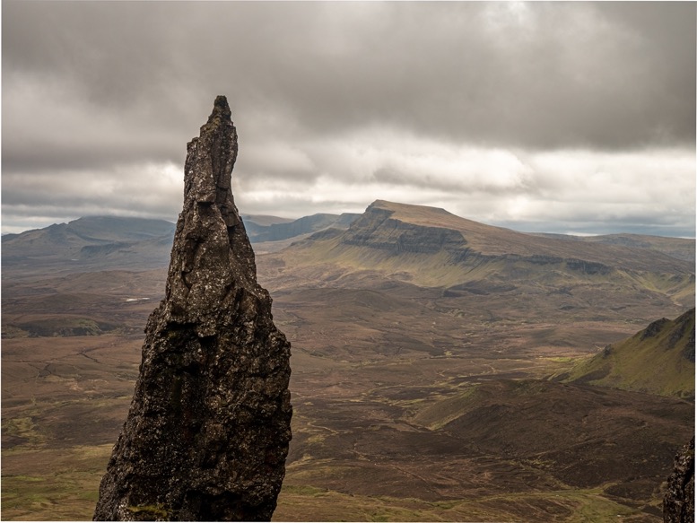
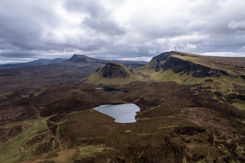
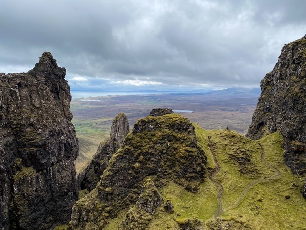
I passed the road at Flodigarry and headed up land inwards on the well maintained trail to the Quiraing. The location I had in mind to camp last night surely wasn't as beautiful as my actual camping spot. The climb is easy and brings you right under the Quiraing ridge. The trail winds around Needle rock to the Quiraing parking lot a few miles ahead. For that reason there were a lot of people out there, taking an easy day hike. I prefer no people, so I headed off the easy trail just below the Needle and on a steep and rocky climb up and around the needle. No people. Lovely! The views from between the rock formations are also a lot more exciting than from below.
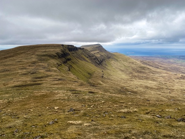
I got back onto the official trail and crossed the Quiraing parking lot after getting quick coffee at a food truck. The British have great tea, but I've had some of the worst coffee ever during this 11-day trip. Men, that coffee was terrible, but ok, nice to have something hot to drink and to get some caffeine for the climb to come. Because across the road is one of the only four access points to the Trotternish Ridge, a 30km long 700m high ridge running north to south in the middle of the island.
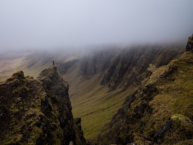
The ridge has no trails, no (natural) shelter and is one the most remote places on the island. In fact, I didn't see anyone during the 24 hours I was up there.
It's about a 600m climb to get onto the ridge, the biggest climb of the total route. Once up the ridge you constantly go up and down from peak to saddle as you head south. It got a lot windier during the day and exposed on the ridge I felt the full force of it. And there is literally no shelter whatsoever up there, not even bush or big rock to hide behind. Just vast soggy grasslands.
Usually water is very scarce on the ridge, with no stream or lakes. But it being so early in the season and it being so wet, I did not have any issue finding water. Most of it was standing water, so I was glad I brought a filter.
By 4pm I'd covered about 12-14km of the ridge. I wanted to camp near the end of the ridge at the Storr, but the sky got darker and darker, and the wind picked up even more. With the little phone signal I had I looked up the weather, and indeed a big storm front was moving in from the south-west. Time to find camp, asap.
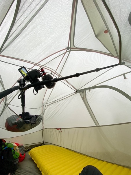
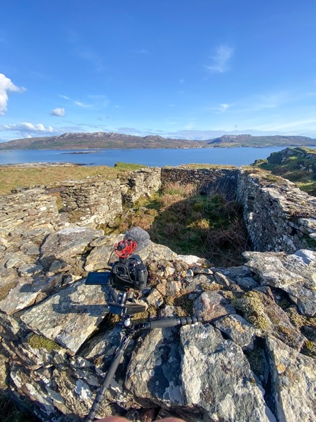
I just had gotten down to a saddle with a small pool of water and an old 1.5m tall stone wall used for sheep a long time ago. It couldn't get any better than this. I quickly pitched my tent as the fog and rain moved in. Even behind the wall I my tent was pressed out of shape by the wind curving around it.
That evening the wind picked up even more, but the rain stopped, allowing me to finally get out of that tent and explore the area a bit. The fog turns this place into a mysterious scene.
\\ May 4 | Day 3: Storm and Storr
Trotternish Ridge to Portree via Storr
15.3 km | 9.5 mi
696 m | 2283 ft 1135 m | 3724 ft
57°24'60.0"N 6°12'07.0"W
The weather wasn't much better in the morning: fog, high winds and rain. So I packed up my stuff and tried to get off the ridge asap to hopefully get out of the weather. So far the route has been as simple as following the ridge. So I set off with that same approach and confidence, even though the visibility wasn't a lot more than 50 meters. The wind came from the right front, so that made navigating quite easy, so I thought. Just a few kilometers in I noticed the wind direction rotating to the left. "That's strange" I remember thinking, but OK not impossible as the wind might be bending around a peak or something. To be sure I pulled out my phone to see where I had to go. It pointed in exactly the opposite way I was going, the direction I came from?! I immediately started doubting my phone compass. My sense of direction is usually excellent, but the compass in my watch confirmed my phone. So, what apparently happened is that just after leaving camp I diverted from my route when the ridge splitted up. The direction I took slowly bends to the right, ever so slightly that I didn't notice it in the fog. Now I had to fight my intuition and hike 'the wrong way' to get back on the trail. Strangely enough, very hard to do, if your (usually excellent) sense of direction tells you to go the exact other way. A few kilometers back I got back onto the right trail and continued my way.
The rain and wind kept pounding for quite some time on the exposed ridge. Luckily, after 2 hours the rain decreased, making it a lot less wet with just the fog and wind.
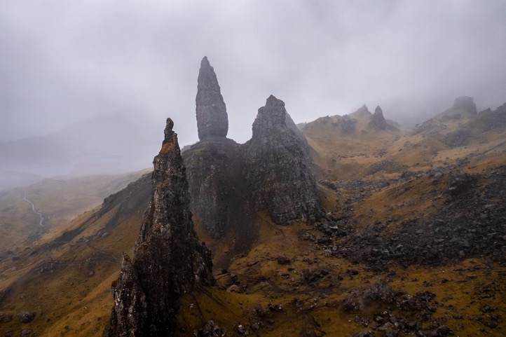
At 1pm I got closer to the old man of Storr, a famous freestanding rock pinnacle. In good weather I would've gone up to the ridge above it, but there was no point in doing that now. Winding down underneath the ridge to Storr the trail gradually got better, and when in sight of the rock formation, the amount of people increased as much as the rain decreased. The old man of Storr is a 4km hike on mostly easy trails from the nearby parking lot, and thus a popular and easy hike for most.
Out of the clouds, the weather was somewhat better. But I had enough of the rain and wind, and with another section higher up along the coast, I didn't really feel like doing another 4 hours of hiking. I got a ride from a friendly local to Portree, as the next bus wouldn't come for another 2 hours or so. I'd heard that the Scottish are friendly people, but this definitely confirmed that. I don't think I've ever gotten a ride that fast.
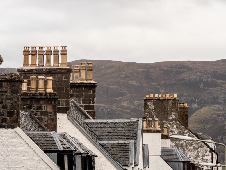
In Portree, I enjoyed a good coffee and lunch and explored the town for a few hours. I'm not a city-lover type of person, bit this little town kept me entertained till I could go check into my B&B. I'd found this B&B via a social media group, since there was basically nothing available in the area (it turned out that exactly this week was the first 'normally busy' week again after Covid). And it surely was a great B&B: clean, spacey and with a good whisky ready at night, thanks Marion!
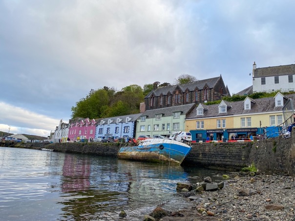
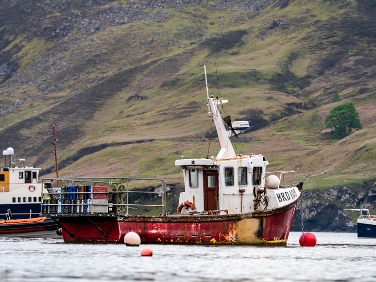
In the evening, I walked down to the harbor, got some fish & chips and watched the boats swirling around their ankers just off shore. The weather: surprisingly nice: no rain, no wind and a pleasant temperature. In so many ways so different from last night.
\\ May 5 | Day 4: Into the Cullin Hills
Sligachan to the Scavaig River (Loch Coruisk)
16.7 km | 9.5 mi
628 m | 2060 ft 681 m | 2234 ft
N 57º 11.8307' W 6º 09.4248' (5 m | 16 ft)
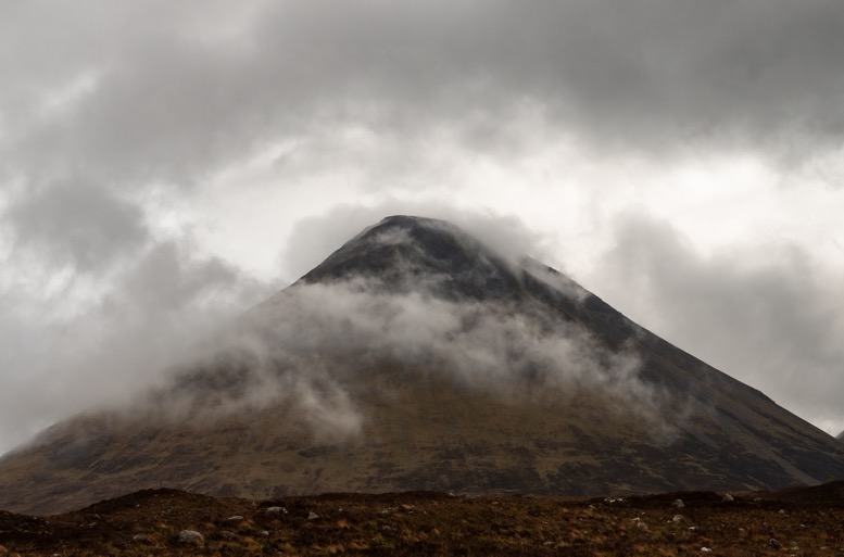
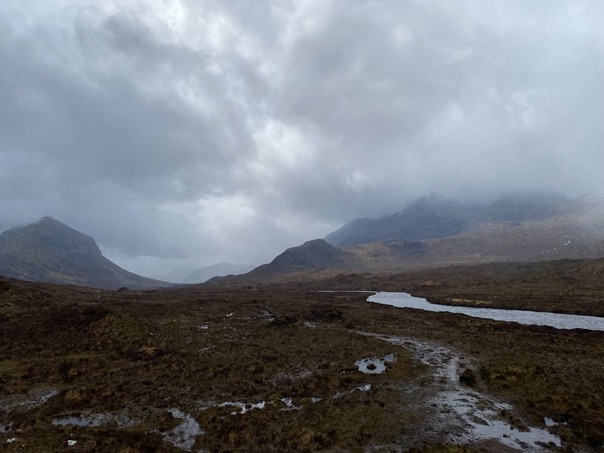
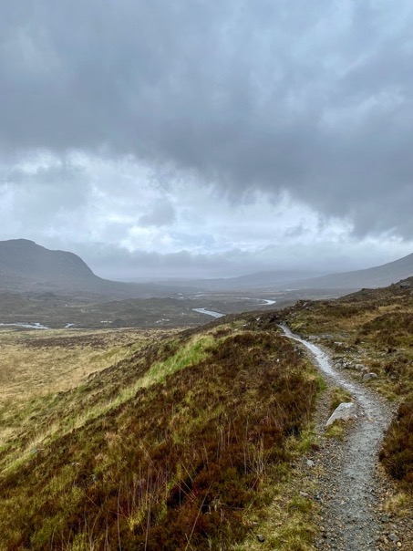
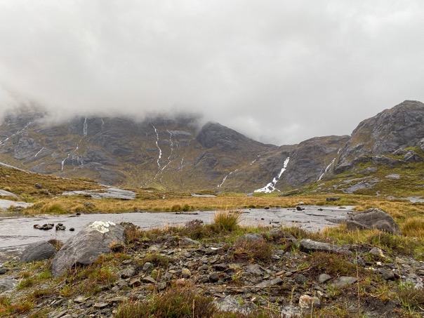
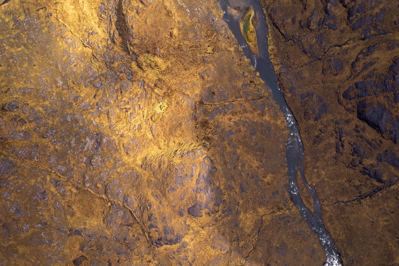
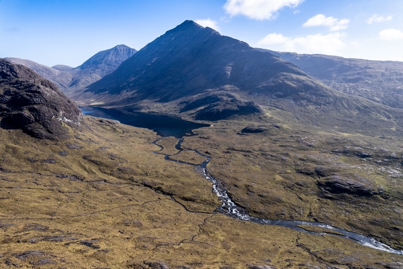
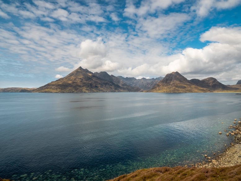
The morning was rain rain rain. I drove south to Broadford where I planned to finish in 3 days, parked my car and took a bus back to Slichigan. Up front I'd decided to skip the stage Portree-Slicigan, as it's considered the least impressive part and I simply didn't have the time to do it. Just when I got to Sligachan the rain stopped. Ahead were the Cullin Hills. I don't know why they call it hills, because these hills are mountains. The scenery is really different from the northern part of the island that is dominated by the long ridge and flat lands that run to the steep cliffs at the ocean. These Cullin mountains are more remote, untouched and run straight into beautiful lochs and sea. This was probably the part I looked out to most.
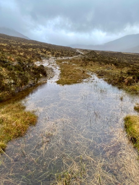
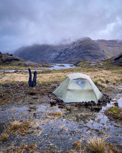
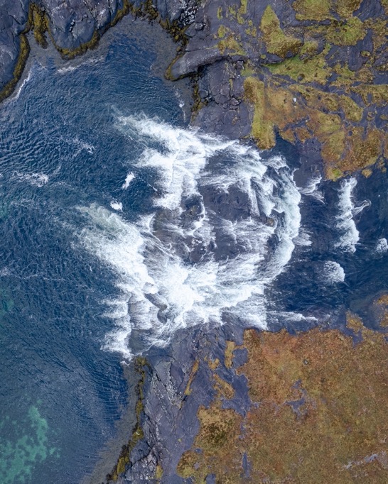
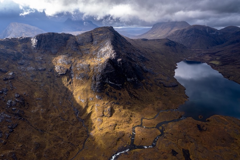
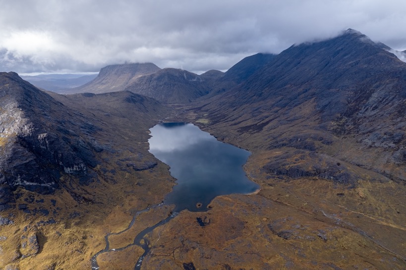
From Sligachan it's an easy 7km hike through glen Sligachan between the Red and Black Cuillins to a trail intersection. From here the unofficial Sky Trail heads south through the valley, while the other trail climbs over a mountain to the remote Loch Coruisk, at the heart of the Cullin Hills. I was up for the challenge and wanted to see the true wild part of this area, so I headed up and over. The weather gradually got worse, with now a constant headwind and rain. All I wanted to do was get over that mountain to a bothi near the loch. So I pushed against the head wind and rain that got worse the higher I got. Arriving at the top, all that was left was a long descent, which I assumed would be as easy as the ascent. But the nice trail ended up top and down was just mud, rocks, mud, mud and more mud. It was horrible. Every step was wet, and by then the rain made its way through and around my rain clothing. But I knew: 45 minutes more and I'll be warm and dry inside the bothi. 30 more minutes ... 10 more minutes ... 200 more meters, just this last creek crossing and I'll be there. And that is how far I got. That last little creek, the outflow from Loch Coruisk straight into the sea, was no longer a little creek by all that rain, but a raging 20m wide river 3 meters deep. There was no way I would be able to cross that. I followed the creek to the sea to see if there was any possibility of crossing, but I only got more discouraged as I saw the river plunge into the sea via a wild waterfall. And there I stood in the rain and wind: wet, getting cold and no place to stay inside. It's a strange feeling I've only experienced once before in my life. That feeling of seeing your plans fall apart in front of you, a moment you're not willing to accept, because the alternative is ten times worse. The moment you honestly don't have a good answer for the question: 'what now?'.
And that is how far I got. That last little creek, the outflow from Loch Coruisk straight into the sea, was no longer a little creek by all that rain, but a raging 20m wide river 3 meters deep. [...] And there I stood in the rain and wind: wet, getting cold and no place to stay inside. It's a strange feeling I've only experienced once before in my life. That feeling of seeing your plans fall apart in front of you, a moment you're not willing to accept, because the alternative is ten times worse. The moment you honestly don't have a good answer for the question: 'what now?'.
I had to make a choice, and fast. Going back was no option, as that would've taken me at least 5 hours. I briefly considered hiking to the next bothi on my route 4km away, but that would've taken me over some tricky trails above the ocean; I was too tired for that, plus there was another creek crossing just before the other bothi that I doubted doable now. So camping it was. I looked for a camping spot for 20 minutes. There was literally no flat area that wasn't under 10cm of water, let alone flat and sheltered from the wind. I spotted a small semi-dry patch of gravel and realized that was as good as it was gonna get. I threw out my tent's footprint and secured it with some pins. Then the poles and then the real struggle: the rainfly. It was so windy it took me 4 attempts to get it over the poles, having it almost blown away several times. I then crawled under the tarp into the puddle of water that's already collected under there. Trying not to think about the comfort and warmth of the bothi, I took off all my soaked clothes, and pitched the inner tent from the inside (fun fact: the inner tent floor is not waterproof ...). I put on the only dry clothes I had left (a t-shirt and down jacket) leaving my down sleeping bag inside my bag to keep it dry. At least I'd reached the bare minimal level of comfort again.
When the rain finally stopped later that evening I secured my tent with all the lines and boulders I could find and put on my wet clothes to have them dry as much as possible (it's very uncomfortable, but the fastest way to dry stuff).
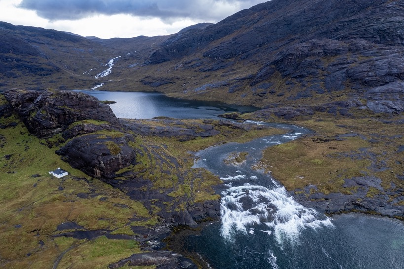
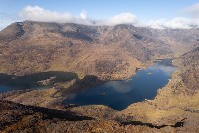
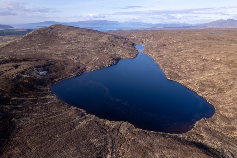
Now I was finally able to take in some of the amazing scenery around me I totally ignored before. Several waterfalls around me, steep black barren mountains and the big loch in front of me tucked in between these mountains. I hiked up a little hill and got a good view of the blue ocean and the greenish shallow waters close to shore. This island initially felt much less wild than any other place I've hiked before; for that I might have underestimated nature a little. So close to the habited world, yet so at the mercy of nature. I was glad I had a good plan B, and even C and D. A rollercoaster of emotions, and some good lessons learned.
That night was the most uncomfortable night I've ever had in a tent. Rain and strong winds all night, with wind gusts pushing my tent down towards me, not to mention the damp clothes I took with me in my sleeping bag to dry. I didn't get any real sleep at all, kept awake by the rain and the fear my tent would rip. In the dark I came up with a plan of what I would do when I had to evacuate. Not the sweet dreams I'd hoped for. At 5am it got so bad I put it by hand against the fabric to dissipate some of the energy of the gusts of wind. At 6am the wind and rain finally died down, and I got about 2 hours of good sleep.
That night was the most uncomfortable night I've ever had in a tent. Rain and strong winds all night, with wind gusts pushing my tent down towards me, not to mention the damp clothes I took with me in my sleeping bag to dry. I didn't get any real sleep at all, kept awake by the rain and the fear my tent would rip.
\\ May 6 | Day 5: Easy day in the bothi
Scavaig River to Camasunary Bay via the Camasunary bothi and the Bad Steps
9.9 km | 6.1 mi
369 m | 1211 ft 409 m | 1342 ft
(m | ft)
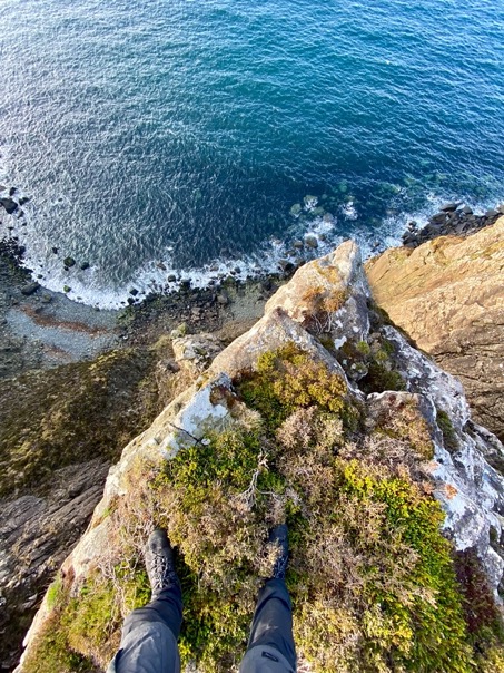
At 8am, very tired, I got up. I surely wanted to sleep more, but with this break in the weather, I had to get out of here. With a good look on the majestic loch and waterfalls I made my way along the coast toward the unofficial Skye Trail route. First came the Bad Step, a narrow ledge on near vertical smooth rock formation with nothing to hold on to. To the right is a 10m (30ft) drop to the ocean. It is not overly difficult, but it does take a bit of nerve, particularly as one mistake could see you slithering down over the rock and plopping into the sea below. But reassuringly, the water is probably deep enough without any rocks. I gave it a try, but turned around about halfway. I didn't know to go up or down there, but with the wet rock there was no room for error. The thought of falling into the ocean ... For some reason the ocean always scares me more than anything else. I guess it's just a lack of experience: I've never lived or hiked near an ocean before, and feel like I'm not really an ocean-person.
I found a higher route a bit up that was easier and made my way along the peninsula.
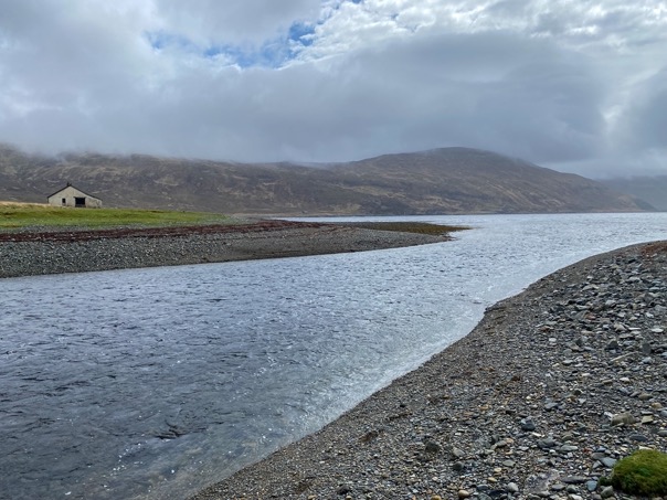
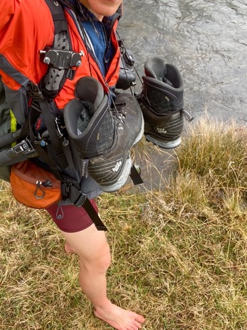
After about 4km I got to the creek I doubted was crossable yesterday, and indeed it was a river too. I hiked up and found a really wide section with 2 islands in between. The water didn't look too deep, and there weren't any trees or dangerous rapids downstream, so I decided to give crossing it a shot. The alternative of 6km of wet moorlands seemed way worse to me, plus I knew crossing it would be a big moral boost. I took off my pants, unclipped my backpack and with my shoes around my neck I started the crossing. I immediately noticed the rocks were smooth and slippery, so I took my time, making sure every step was stable and secure. These are not the moments to rush, even though you want to get out of that cold water asap. Section 1 and 2 were fine, water below the knees. Section 3 was most tricky with water up to my thighs towards my groins. With every step I plowed my foot through the slippery top layer of better traction and every slowly made it across (twice, stupid camera).
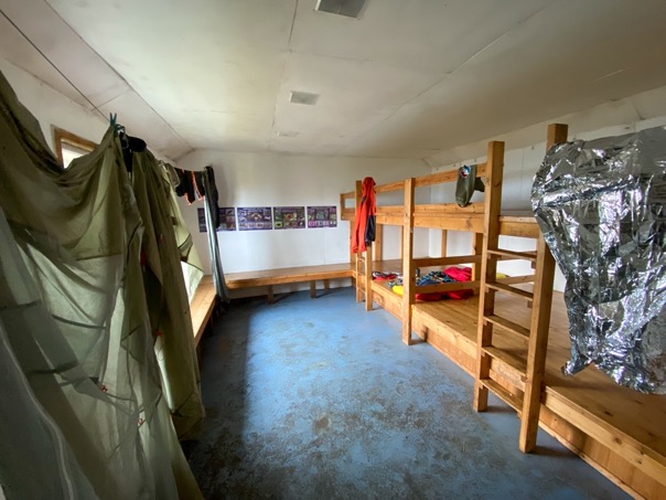
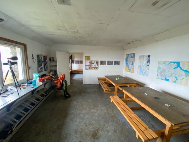
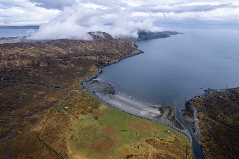
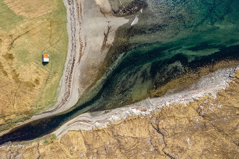
On the other side, morally boosted, I made it to the bothi on the beach of Camasunary bay 2km ahead. The bothy had a general room for cooking and eating, and another with bunk beds that could sleep at least 12 people both with a window overlooking the ocean. I hung out all my wet stuff, got some snacks and crawled into my sleeping bag as small rain showers passed by outside. The combination of sleep deprivation and knowing how uncomfortable it can be are golden for some good sleep.
I planned on staying there for the night, and I would've wasn't it for the fact that weather cleared up, I missed the sound of the ocean and other people came to the bothi that night (weekend with good weather, so my late starters for weekend trips). So 30 minutes after sunset, 2 hours after bedtime, I decided to grab all my stuff, and head for the other side of the bay to pitch my tent. It's these moments I love. A wild idea (shall I stay in bed, or grab my stuff now and head out) that becomes reality without having to discuss that with anyone. I pitched my tent on the grassy beach and had the best night of the trip.
So 30 minutes after sunset, 2 hours after bedtime, I decided to grab all my stuff, and head for the other side of the bay to pitch my tent. It's these moments I love. A wild idea (shall I stay in bed, or grab my stuff now and head out) that becomes reality without having to discuss that with anyone. I pitched my tent on the grassy beach and had the best night of the trip.
\\ May 7 | Day 6: With sun back to Broadford
Camasunary to Elgol and Torrin to Broadford via Suisnish, Boreraig and the Marble Line
30.7 km | 19.1 mi
976 m | 3202 ft 941 m | 3087 ft
N 57º 11.522700' W 6º 7.022160' (5 m | 14 ft)
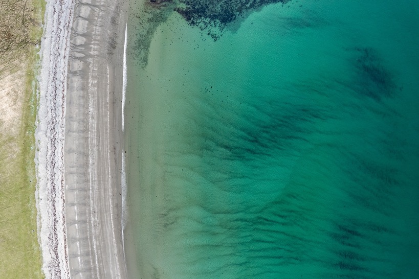
The best morning of the trip. Calm sunny weather that makes you wanna hang around the tent all morning, and so I did. It wasn't before 11am before I headed out for the final stage to Broadford. The first part is on a high trail along the coast to Elgol, a tiny village with a harbor to bring tourists close to the Cullin mountains. A pretty section for sure with amazing views of the mountains rising out of the ocean in the distance. In Elgol, I got a coffee and some fresh food. With the short day yesterday and easy start this morning I still would've had 35km ahead of me to get to Broadford via the official route. Instead, I got a ride to the little town Torrin down the road, from where I started the official last stage of the route after grabbing some lunch at the famous Amy's Place Tea Room & Gifts cafe.
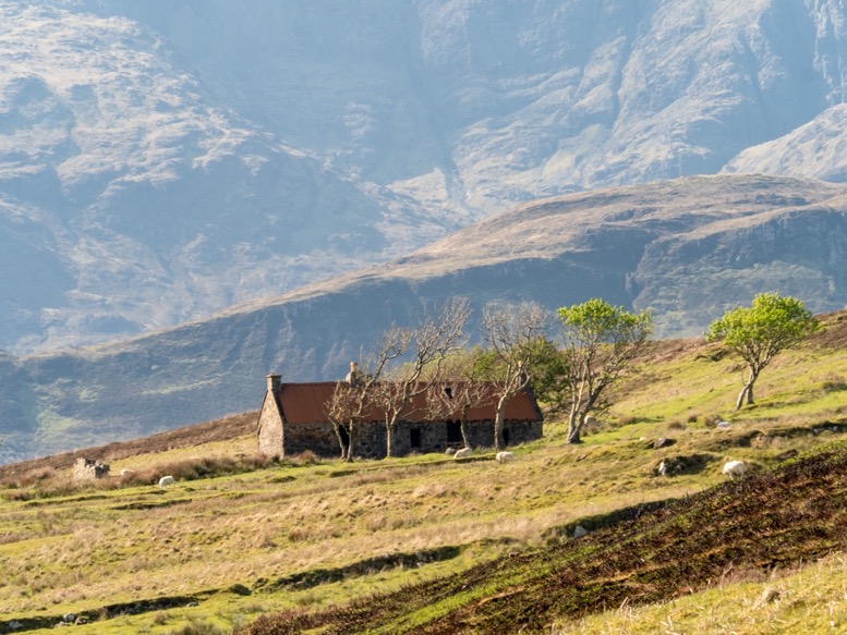
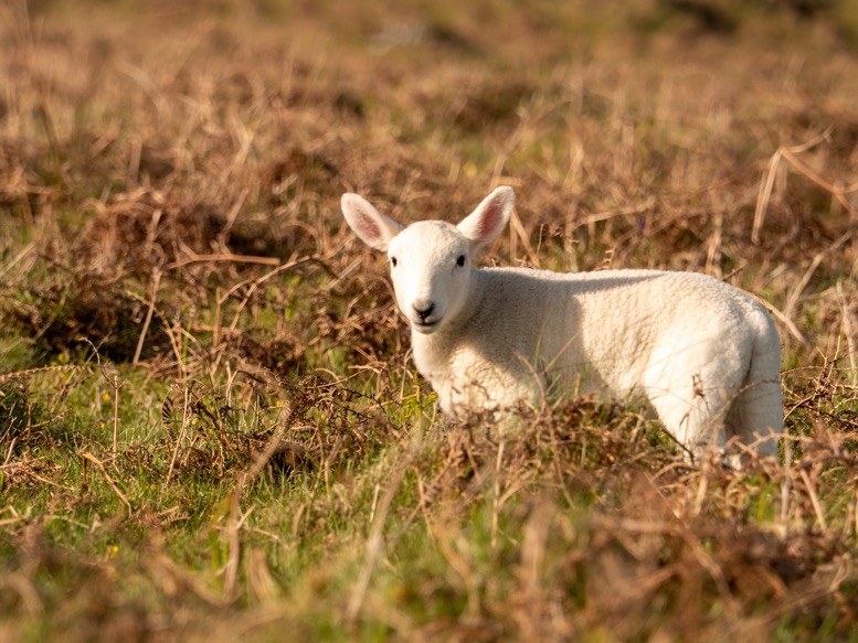
This last part was probably one of the most boring sections, but the weather was nice and sunny, and with some rough days behind me and some mileage ahead of me I didn't care so much. The trail winds along the coast of a peninsula with some good ocean views before heading land inwards to Broadford. The terrain is hilly, but not close to the terrain in the Cullins or on the ridge. The point of the peninsula has quite some history. The Suisnish and Boreraig people that used to live here were kicked out by Lord MacDonald in the early 1800s to make place for the more profitable sheep. From one day to the next they were put out on the street. The ruins of their houses are still there on the isolated and inhabited tip of the peninsula. Some people described it as a mysterious and haunted place, but I didn't feel any of that whatsoever.
The last climb landinwards raises to some higher moorlands that are colored beautiful dark red in the low sun. The last 3km to Broadford are on a trail where once laid the Marble Line railroad track to transport marble from these hills to Broadford. At 8pm I made it to Broadford, the official endpoint of the trail after a 33km day.
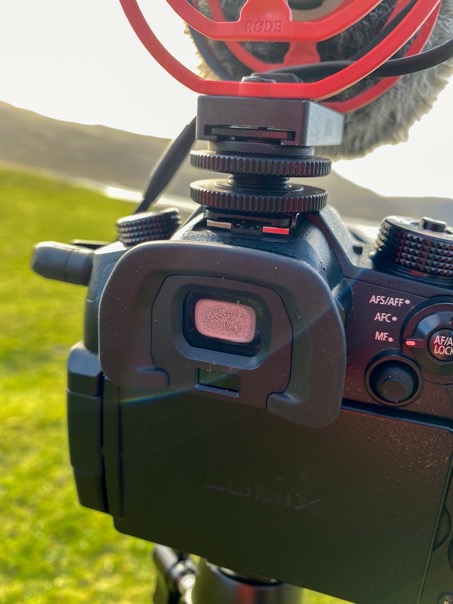

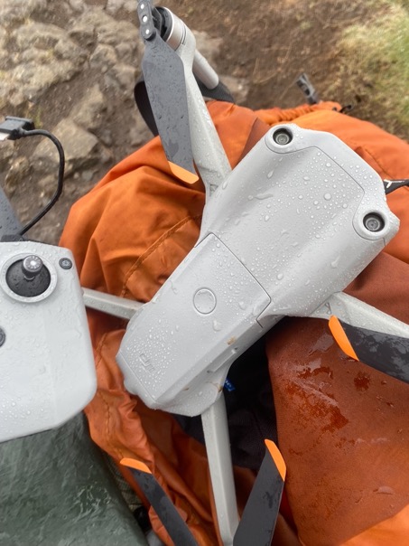
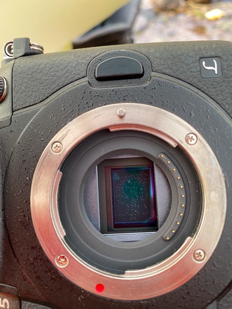
This trip was again an adventure, but a different adventure than any other trip I've done. The island isn't as remote and wild of a place I'm usually hiking. I found myself on trails and in sight of houses many times. This made me perhaps underestimate how harsh and tricky nature can be, even though I was within hours of civilization. The biggest challenge was by far the weather; the worst I've ever had on a hike. This made filming really difficult, fighting moist in my camera and lenses and salt on the sensor. But that is the reality of making films like these, nothing is scripted, you never know what shot might be around the corner, or what the weather will do. But that same unpredictability drives creativity and hopefully prevents me from getting into an easy-to-shoot-film-habit.