The Peaks of the Balkans
July-August 2022
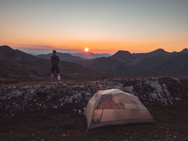
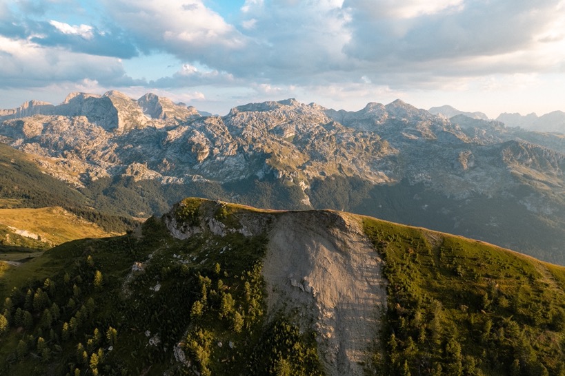
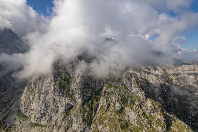
\\ July 22 | Day 0: Top of the mountain
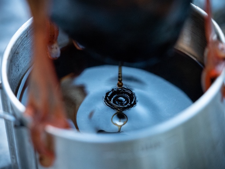
Unlike my last visit to this area in December of last year, I decided to fly to Tirana, the capital of Albania, instead of Podgorica, the capital of Montenegro. The main reason for this decision is the ease of renting the car (no fee for crossing the border) and the direct flight. I arrived in Tirana late afternoon, waited in the extremely noisy arrivals hall where construction was going on, got my bag and was brought to the rental car company 10 minutes from the airport by a private driver. With the rental I set out for the 3-hour drive to my overnight stop on top of the mountain pass Qafa e T'thores stopping by in Koplik for some groceries and gas for my liquid fuel stove. The latter I just bought after learning the hard way in December that they don't sell threaded gas canisters in any of these countries here.
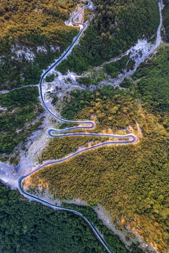
The 3-hour drive was only about 150 kilometers, which surprised me when planning this trip. Apart from a 5 kilometer section, there are no highways, even though starting in the capital city and driving through some pretty significantly sized cities. There were only 2-way B-roads, going through all the small villages. And in a country where people literally just park in the middle of the road and pass traffic jams ghost driving expecting the other lane to get out of the way, you imagine how you don't even average 50 kilometers per hour.
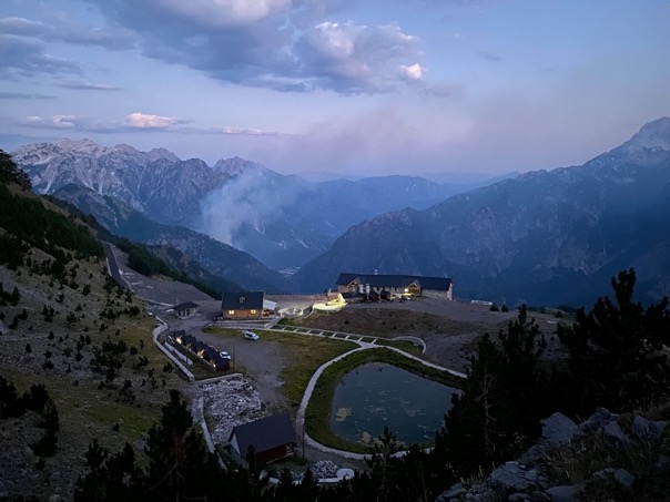
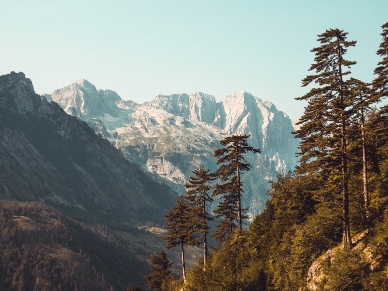
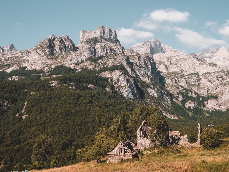
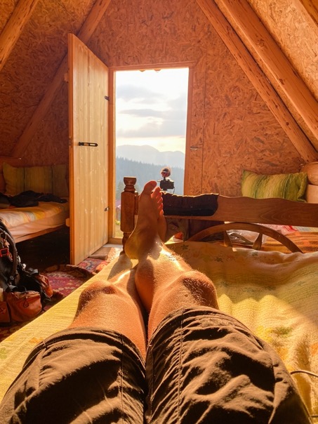
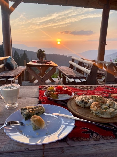
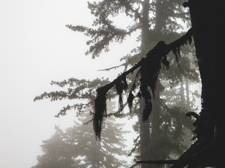
My first night I had booked at Buni i Bajraktarit on the mountain pass I got stuck at last year in the snow. It seemed like a great place to spend the night, just 30 minutes from Theth and dirt cheap (13EUR). And what a great place it was. Just a bit higher up from the main road there's a small restaurant and 8 small huts with a great view down the mountains east. The whole area is surrounded by mountains with short, but thick and old evergreen trees. The 2 person huts have a small entrance, a small window, 2 beds and a wooden deck outside. Very basic, but very atmospheric and cozy. At nights the stars come out and it is extremely quiet, much more so than the touristy town of Theth. And, not to mention the food: delicious. Truly my favorite stay in this region.
\\ July 23 | Day 1: Cowboy camping in Valbone
Theth to Valbone via Valbone pass
23.5km | 14.6mi
1800m | 5800ft 1500m | 5000ft
With my backpack packed, I sat down for breakfast at 8am. (Albanian) pancakes ofcourse. As usual I felt slightly nervous, especially considering this was a 12-day long trip, but even more so I was excited. The weather and its forecast were perfect, the thing that often worries me the most (yes you Scotland).
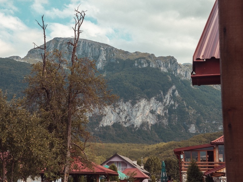
I drove down to Theth and parked my car in the public parking lot. Theth has a great but also weird vibe to it. The road over the pass has recently been repaved, but the smooth asfalt just stops beyond the bridge, where all the roads are rocky and gravel; more like a riverbed, actually. There is very little general infrastructure that usually makes a town 'touristy'. No flower beds, no sidewalks, souvenirs shops or whatsoever. Just a bunch of rough roads, and dozens and dozens of guesthouses, signs for those guesthouses, improvised campgrounds and a few restaurants. Tourism is really starting to boom in this area, and that's clearly visible from places like these. There's construction going on everywhere, and nothing seems finished. There's a tiny convenience store in town, but cards are accepted nowhere.
Last winter when I snowshoed to Theth, it was almost completely abandoned with 90% of the local population moving to the city in winter and without any tourists. Now the whole town had come alive with the weather. Quite satisfying seeing the two sides of this town.
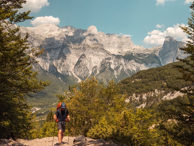
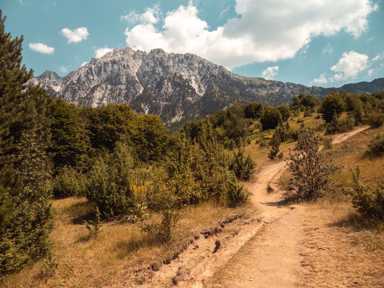
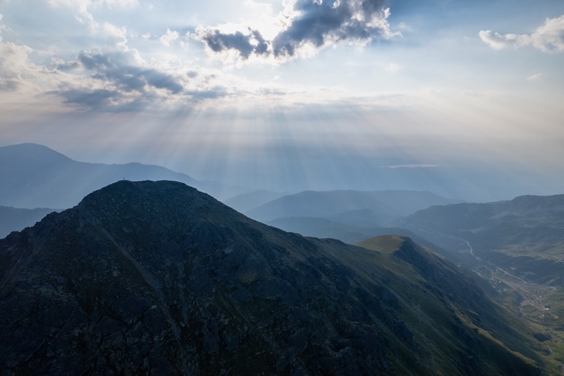
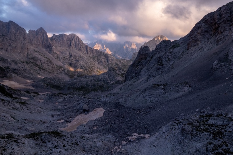
I started my hike at 9:45 to be exact. First up was the 1300m climb to Valbona pass, the same pass I attempted last winter. Then I had to turn around about 100m below the top. The climb had taken me 5 hours, but the higher I got the more snow I encountered. When I sank neck deep into the snow (with snowshoes on), my progress getting slower and slower and the chances of avalanches increasing, I had decided to turn around and change my plans. Now progress was a lot faster, although the heat came with its own challenges. Most of the trail lies in beautiful forests, with a spring and cafe about halfway. The last part of the (by then mostly pine) forest opens up and the steep last climb in the sun to the mountain pass starts. Along the way I recognized most of the area from last winter. But although I had been there, it still felt like I was there for the first time. It all looked so different, that I basically had to convince myself that I had been there before. But it was fun, especially attempting to recreate some of the exact same shots from last winter.
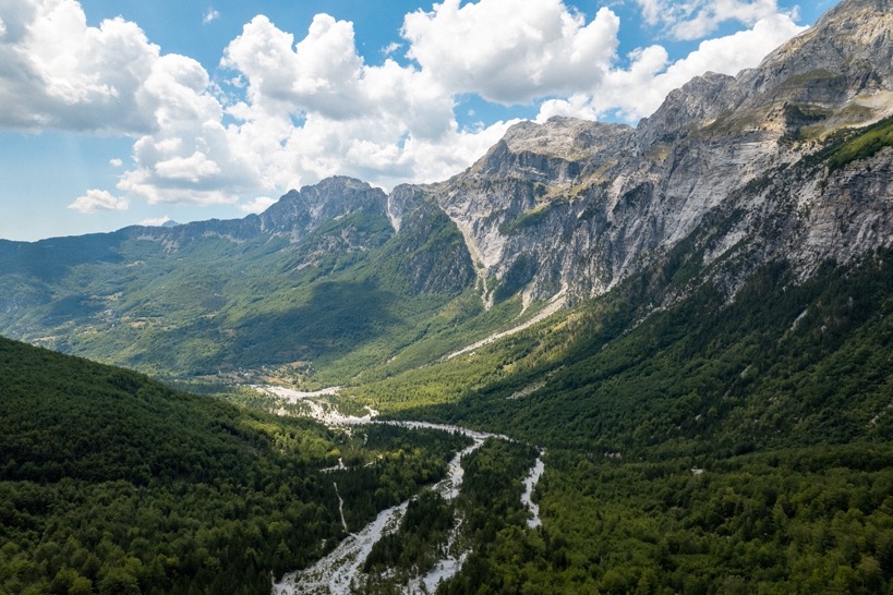
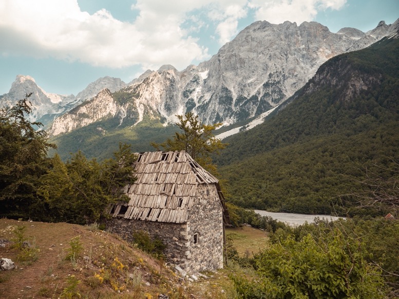
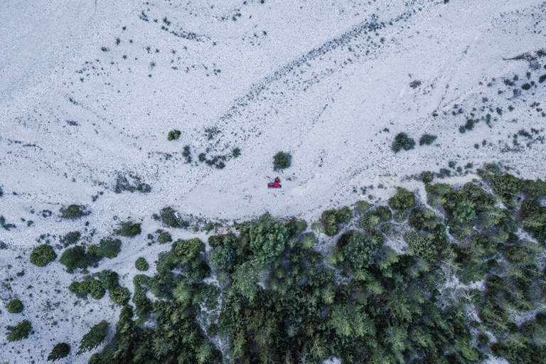
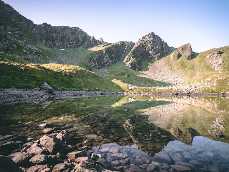
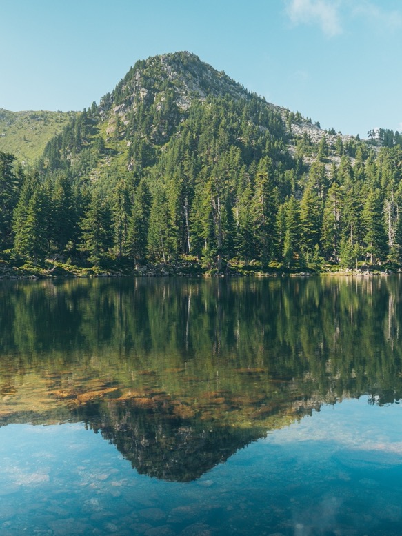
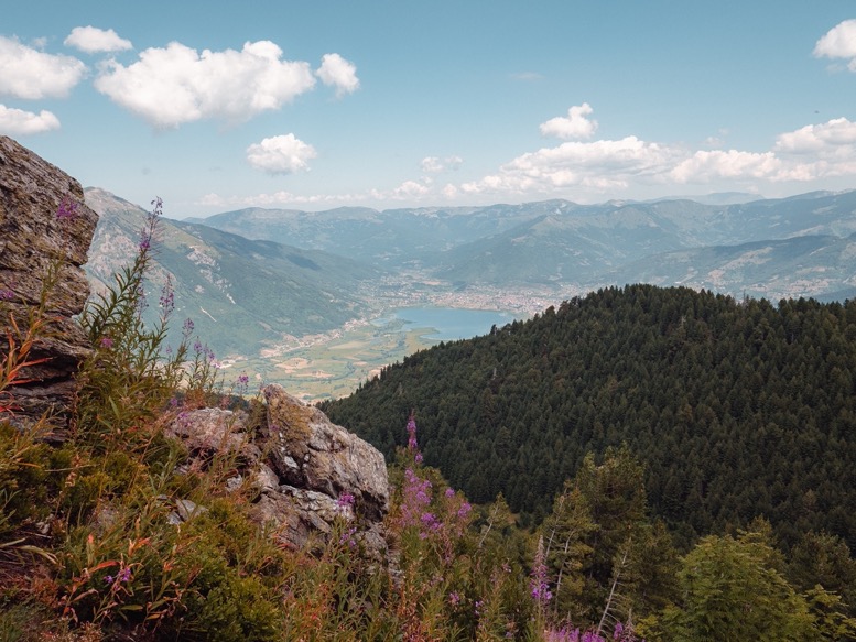
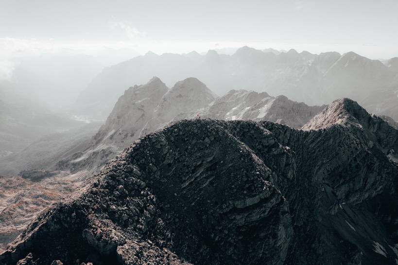
The views from the pass are great, especially into Valbona valley, the side I had never seen before. The descent is steep at first, but very gradual in the last part, which most lies in the forest. Very characteristic about this and Theth's valley are the large gray, almost white, gravel fields formed by the streams and river. Higher up in the valley there is no water flowing, but looking at these sometimes 400m wide gravel fields it suggests there is quite a bit of water flowing earlier in the year.
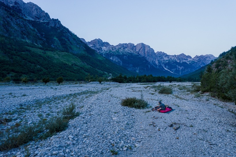
The trail merges with the paved road at a hotel, from which it's another few kilometers to the 'center' of Valbona, which again is not the typical town center of a touristy place. It was the end of the afternoon, and I was ready to find a campsite. I merged off the trial towards the (dried-up) river. I already realized that this time of the year, there is very little water around. Creeks are mostly dried up and all the springs are built around by the locals. Following the river down in search of water I finally heard the sound of water in the distance. And indeed ahead the river started flowing, magically appearing out of the gravel bed, probably flowing underground for quite a distance.
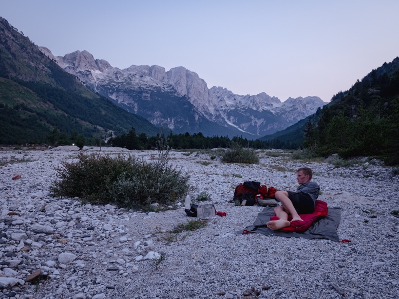
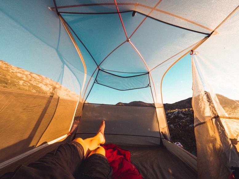
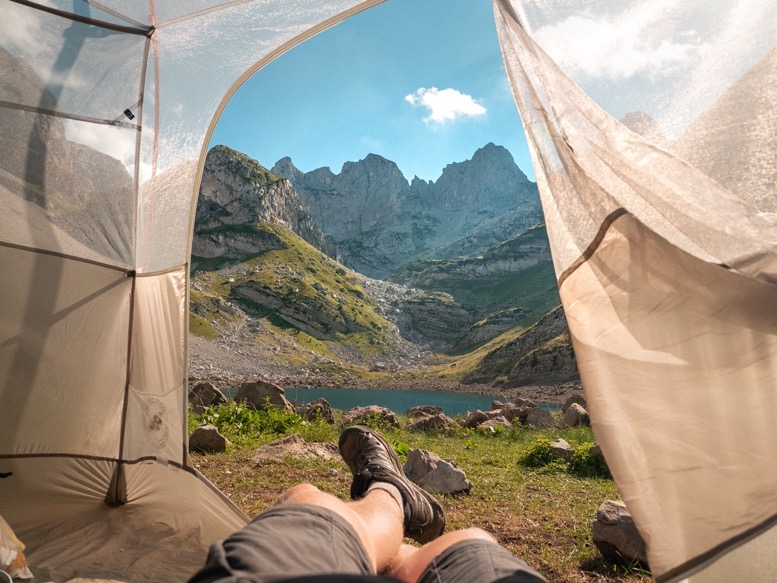
After some searching I found a couple of decent campsites around, some even on grass, but I ended up just close to the treeline on the river bed gravel. I was really tired, perhaps also because I didn't drink enough today. I just sat down, recharged and relaxed for a while but didn't feel like pitching my tent just yet. After dinner temperatures were still high, so in the end I decided not to pitch my tent at all, and just cowboy camp for the night. My first time doing this actually.
And a good choice it was. Temperatures dropped a little during the night, but it was still pleasantly warm, and most importantly there was no wind.
\\ July 24 | Day 2: The day I cut myself
18.8km | 11.7mi
1600m | 5200ft 1400m | 4700ft
It only takes a day for me to get into the rhythm of backpacking: going to bed just past sunset (8pm), waking up by the first daylight (5am). It feels so natural, but I always fail to continue this rhythm when I get back from a trip. Probably because it's simply (healthy) boredom that makes me go to bed so early here, and the modern technologies (screens and lights) that keep me awake way past sunset when I am at home.
I made coffee, watched the sun rise over the mountains in the distance, packed my stuff (really quickly, because no tent) and set out at 7am. Passing by a small cafe I took my opportunity to recharge some batteries and have a second coffee.
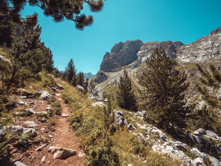
I took a detour from the Peaks of the Balkans (POB) route. Instead of following the valleys to Çerem, I went over the Qafa Prosllopit and Qafa Borit passes. The ascent is a steep 1500m climb, for the first part mostly in forest, then breaking out of the forest into open rocky terrain with no vegetation other than grass. The forests with its rocks reminded me of the Sierras, above the treeline it very much resembled Los Picos de Europa in northern Spain. It is a beautiful route with, especially compared to yesterday, very few people. From the highest point, the route slowly descends passing through some more subalpine meadows and rocky terrain. I passed by a cave, which by itself is not so special around here, but there was a strong very cold breeze coming out of it. Even so cold that the moisture in the air condensed creating a foggy breeze. In the cave was a deep shaft going down. Just 5 minutes in the cave made my walking poles cold to the touch, like it was winter.
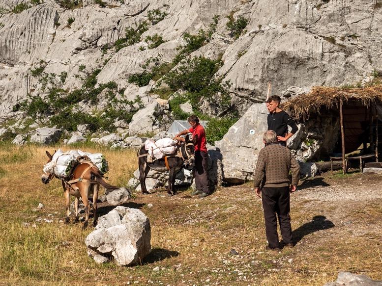
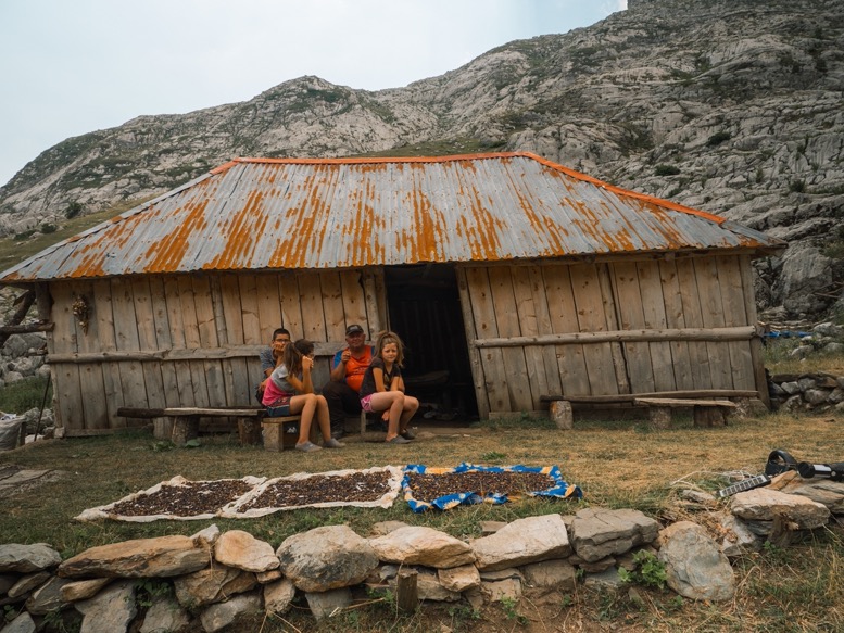
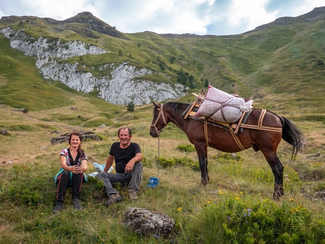
At the pass I started my descent down towards Çerem passing by the first springs of the day. In the distance I could spot a small shepherd's hut, but as I spotted it, the people spotted me and motioned me to stop by for a coffee and yogurt. A small family of mum, dad and 2 children were sitting outside their tin and rock shed next to their drying blueberry harvest. Mum spoke a few words of English and explained to me that they lived out here 2 months of the year with their small herd of cattle. No electricity, no cellphone reception or internet, no running water except from a spring and no real toilet. I wondered what they do in the evenings. I enjoyed a homemade yogurt with honey and blueberries and Turkish coffee (for which they charged European prices; smart) and filmed parts of it. It seemed like they had never seen such equipment before, and they didn't seem to know what Youtube was.
All was going really well this day. I felt good, was making good progress, and I was not far from the last climb to my projected campsite when disaster struck. For some reason I did not pay attention and slipped on a wet rock. I remember falling away and down from the trail on a large pile of branches and being dazed since I never fall. First thing I checked was the camera on my chest; all seemed ok. Then the other gear and physical stuff; all ok. Then myself; not so much ok. I got a bad cut on my right shin. Only a few centimeters long, but quite deep: I could see the muscle inside. Bummer. I sat down, took my shoe off and cleaned the wound with water, hand alcohol (not ideal, but better than nothing) and sterilized wipes. I then got my superglue, pressed the wound together and sealed it with a thick layer while being stung by at least 200 mosquitos. It's this multi use application I bring superglue for. And it worked! It stopped the bleeding. I wrapped it up with some bandages and continued my way to the next village.
As I got closer, the skies turned darker and thunder moved in. I increased my pace on the descent while trying not to put too much pressure on my leg. With just a kilometer or so more to go, it started raining. Just a few hundred meters from the town the lighter rain turned into heavy rain. Droplets so thick they turned white. Undoubtedly beautiful actually, but I knew that if I hadn't fallen, I would have shelter by now.
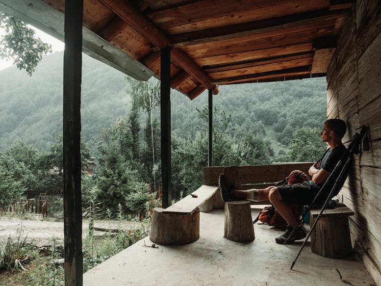
In Çerem I quickly hastened to the first shelter I could find, a small veranda of an old building. I was soaked, but it was far from cold so I didn't really mind. After the rain showers, I walked over to the guesthouse not far from my shelter. Even though I cleaned the wound quite properly, I wasn't entirely sure. Luckily for me there was a 6th year medical student and doctor in training at the guesthouse. They totally didn't mind having a look at the wound and cleaning it better. Unfortunately there was no suture kit around, so after the cleaning it was back to superglue and pressure bandage. Thanks Mirthe, Charlotte, Hester and the others from the guesthouse for helping me out there!
I stayed at the guesthouse that night not doing the last climb for my planned campsite. The closest town with a small medical center was Valbone, about 2 hours on gravel roads by 4x4. The next few days I would go further away from civilization, so I would rather see how I felt in the morning, and make a decision then to continue or not.
\\ July 25 | Day 3: Sunset above Döberdol
27.1km | 16.8mi
2100m | 7000ft 1100m | 3700ft
It took me a while to fall asleep last night with my leg pounding. But the wound remained closed, and I could put some pressure on it. After breakfast, I packed my stuff and set out for the next stage towards Döberdol. I took it real easy not putting too much pressure on it. I had originally planned to get to the Gjeravica today, the highest peak in Kosovo, about 5 hours past Döberdol, but with the early stop yesterday and my slow pace today I knew that wasn't going to happen. I still had an open day in my itinerary on day 9 for exploring the Grebaje valley a bit more. Instead I moved this extra day to the upcoming days towards Plav.
The climb out of Çerem is not spectacular. I chose the very gradually sloped gravel road for the 500m elevation gain. The road crosses into Montenegro and then the route branches off onto a nice trail through forests. The trail was a warm welcome for the boring section so far, but it also meant much steeper grades and uneven terrain. Putting a lot of pressure on my leg expanded my calf and thus increased the chance of the wound opening up again. So progress was sooo slow, and since I used my arms a lot more to push me uphill, my shoulders started to hurt. The trail luckily wasn't too extreme, yesterday’s terrain would have been worse. In Montenegro it follows the side of a mountain through more forest, winds back into Albania, descends steeply for a few hundred meters (the most annoying section of the day) and then makes the final ascent to Döberdol. The trails were beautiful, but I couldn't enjoy it to its fullest. My shoulders were now sore and I was annoyed by being so slow.
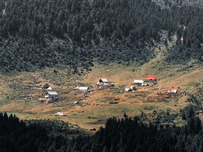
Döberdol is a small shepherd's town, with almost as many guest houses as sheep. Most sources online depict it as a primitive village with no electricity or any other luxuries. But, with the increase of tourism in recent years that isn’t true anymore. Electricity is basically everywhere, and at guesthouses there is even wifi.
I relaxed at one of the guesthouses for several hours with some of the people I'd met yesterday and spent some time with on trail today. Late afternoon, I felt a lot better again, and set out solo again. I usually don't meet a lot of people on trail, either because there aren't any, or because I choose not to (I'm way more creative when I'm alone). But the last 30 hours the circumstances sure were different, and I'd actually enjoyed the company quite a bit.
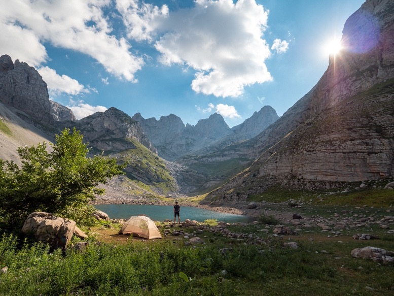
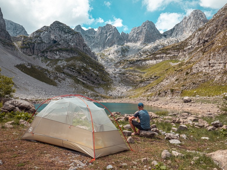
I climbed out of Döberdol to some lakes I had spotted on the map in the hills above the village. The streams of water coming out of these hills ensured me there certainly was water up there. With a little unplanned detour and 2 hours of climbing I got to a high point in these hills and found a great campsite with a distant view west. Perfect. The lakes were lower and some distance away, but as always I prefer a view of comfort.
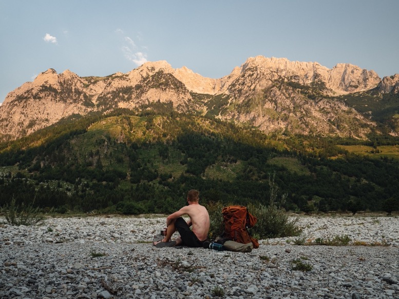
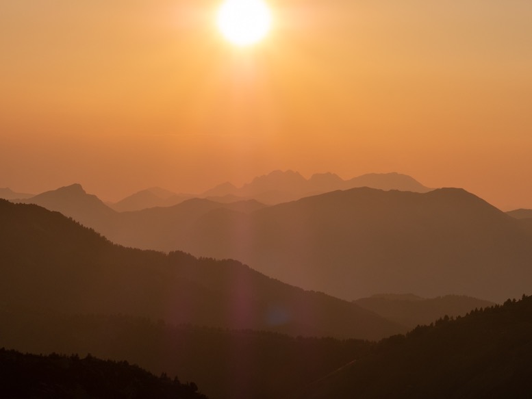
The sun set perfectly in front of me. To my surprise I had still hiked 27km today and gained 2100 meters. All day, except for the last few hours, I felt like I was getting nowhere, while I actually covered quite some distance.
At night there was no wind, but temperatures dropped to 6C and the moisture in the air condensed so much that I had water on my sleeping bag that I had to wipe up at night.
\\ July 26 | Day 4: Gjeravica (highest peak in Kosovo)
15.8km | 9.8mi
1200m | 3900ft 1100m | 3500ft
Although I had planned for yesterday to be an easy day, it still turned out to be a pretty big one. Today would be real easy for sure. The morning was sunny with little wind. I enjoyed my cup of coffee and set out later than usual. The Dutch government has a website with travel advice for all countries. Especially during covid this was particularly useful due to travel insurance conditions. Checking this website before this trip I noticed a permanent warning for the border of Albania with Kosovo stating: 'The color code is yellow for the hilly areas on the border with Kosovo. There are still uncleared mines.' Well, here I was, in the hilly areas on the border with Kosovo, off the beaten path. I didn't feel like I was in direct danger, otherwise I would have seen warning signs around here and/or read about it elsewhere. But still, such thoughts wander through your head. Just to be sure I stepped on rocks instead of grass whenever I could.
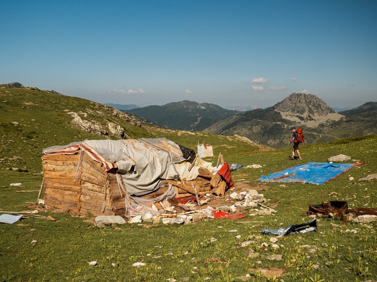
From my campsite I needed to get to the Ali Peja mountain pass, which was just a few kilometers away. Instead of going down into the valley again and then climbing up the same distance again, I cut the route short by following the contour line of the mountain, making my own path. This worked pretty well, and before I knew it I was at the bottom of the last few switchbacks to the pass. There was a small house there that literally looked like it was built from the first pieces of scrap people could find and then, once put together, was blown up. The house was so crooked that it seemed like a little push would tip it over, and there was stuff literally everywhere: plastic tarps, stoves, bathtubs, ropes and every other random item you might think of. There was no one home, but it seemed like a summer dwelling for shepherds.
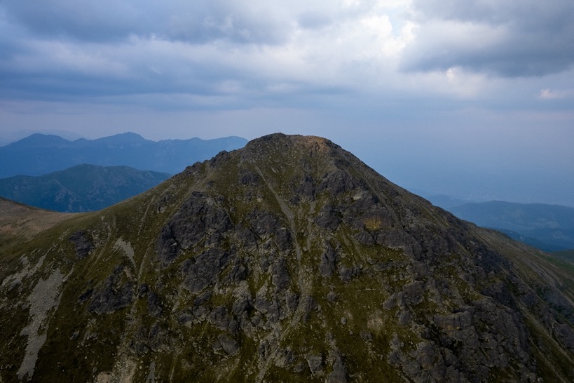
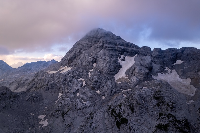
At the top of the pass I got my first look of what I was up to today: Gjeravica, the tallest mountain in Kosovo. In the far distance I could see the peak with its recognizable twin peak a little lower next to it. It seemed so much further than what I had imagined.
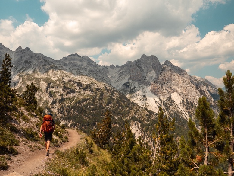
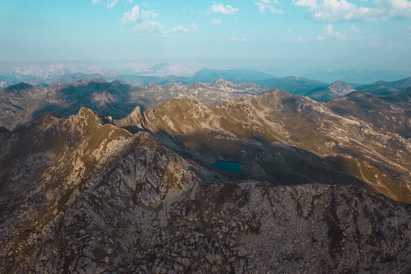
The trail winds along the mountain, gaining and losing very little elevation. A quite enjoyable walk, without any people, a good trail and nice views. At a small mountain lake (Veliko Jezero) I settled down, washed some clothes and relaxed for a while. I felt rather exhausted after three long days partially because of my fall.
Beyond the lake, the trail climbs steeply for a few hundred meters to the base of Gjeravica. The summit suddenly didn't look so far away anymore, and the trail leading up was not so steep. From the base, a ridge, I went down to the other side to two alpine lakes. The big one, a well visited one by others, was too crowded for me, so I visited the smaller lake, which I referred to as Salamander lake because of the dozens and dozens of cute salamanders that roam it. Camp sites were plenty, all very comfortable with flat grass. But I of course picked one of the less flatter spots but with the best view of the lake a little down and Gjeravica. As I waited for the sun to set to make the final ascent to Gjeravica an old shepherd from Kosovo with his sheep passed by in the distance. I was extremely surprised how smoothly and fast this old guy with his walking stick got up and down some pretty sleep slopes leading his sheep to the best grass.
At 6pm I packed the necessary gear (which with all the camera gear is still like 70% of my usual weight), and headed up the mountain. The hike up took me a little more than half an hour, and apart from the last hundred meters or so, it was easy going. During the afternoon it had gotten cloudier and cloudier, and with mostly overcast and a haze in the distance, views weren't as distant as I had hoped, but were still beautiful. The wind had died down almost fully, and with no other people up there, it was quiet. I could vaguely look into Kosovo to the east, but better towards Albania and Montenegro to the west. The sun peeked through the clouds every now and then, making for some great lighting conditions.
My plan was to wait an hour and a half for sunset, and head down just after. But with the sun getting behind some thick distant clouds, I knew the sun wasn't going to show itself anymore today. So, half an hour before sunset I headed down back to my tent. 20 minutes later, I took a quick wash in the lake and had dinner. What a relaxing day it had been.
\\ July 27 | Day 5: The best food
Base of Gjeravica to Samels Cottage via Babino Polje
24.1km | 15mi
800m | 2500ft 1400m | 4700ft
Being above 2500 meters, I expected temperatures to drop towards zero considering last night, so I put my rainfly on for extra heat. But that turned out unnecessary after all, with temperatures just above 10 degrees.
The morning was blue and sunny again. I tracked back towards the mountain pass I came up over yesterday, from where I continued my way along the mountain side west towards the Peaks of the Balkans route. The route had very little elevation change and therefore must have been one of the fastest sections of this trip. Scenery was great, passing by another alpine lake and then off trail (I lost the trail there for a bit) through some (tiny) pine tree meadows towards the POB trail. Blueberries, wildflowers and great potential campsites everywhere.
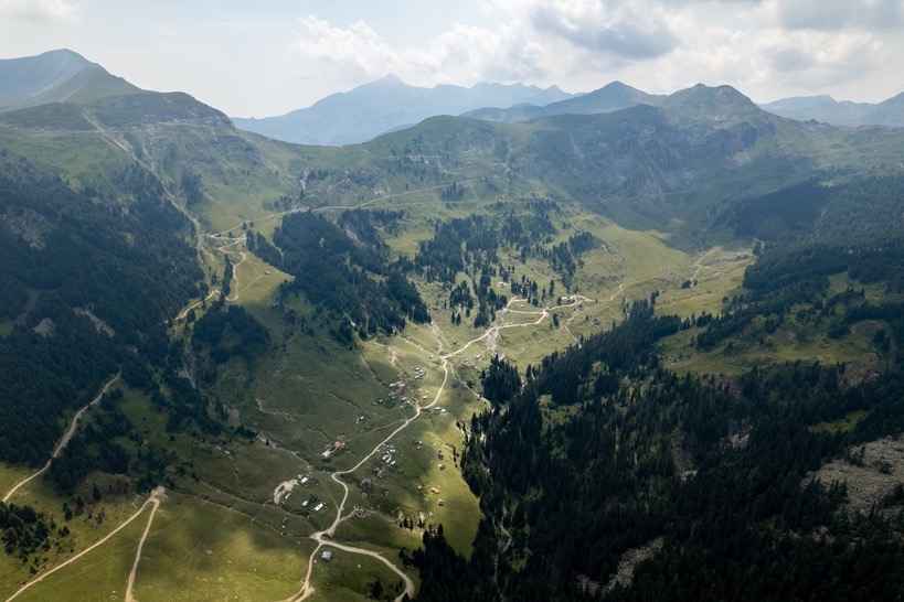
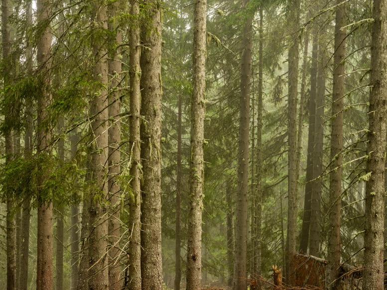
After climbing to the saddle I crossed the POB trail and headed down into the valley straight towards Babino Polje. The gravel route down to a small village at the edge of the national park zigzags down the mountain. I found some fun cattle trails through the forest cutting the route (but definitely not the time) short. From the village it was several kilometers on a gravel route down towards Babino Polje. Even though it was all gravel, it wasn't so bad. Most of the road lies mostly in the national park and thus has some (for this area rare) old pine forests.
I arrived in Babino Polje on the POB route early in the afternoon and sat down for lunch at one of the guest houses. If it wasn't for the big sign inviting me in, it sure was for the owner that waved me towards the guest house looking out for hikers hundreds of meters away. The guest house is, like many many on the trail under construction. Tourism is really starting to boom all along the POB route. Local guest houses are investing a lot in upscaling their accommodations or building new buildings everywhere along the route. Most of it is only halfway done and I rarely saw construction going on. Nevertheless, you are invited everywhere open heartedly and served food from temporarily outdoor kitchens.
Just 2 miles up the road along the POB route lay my stay for the night at Samelova Koliba Prokletije, or Samels Cottage. This small family farm serves the best food on the entire route, period. Everything is homemade, grown in their own garden and from their own cows. Dinner with traditional dishes was amazing as the sun set right in front of me. Oh, and the food was so much I had stomach cramps afterwards. And I can eat a lot.
\\ July 28 | Day 6: Foggy forests to Plav
Samel's Cottage to Plav via Lake Hrid
19.8km | 12.3mi
700m | 2200ft 1400m | 4700ft
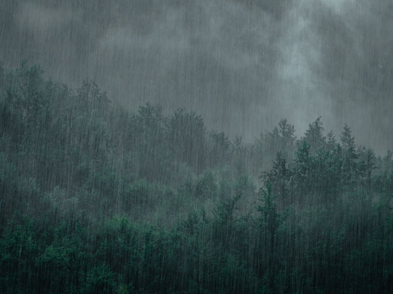
I don't think I've ever been this lucky with the weather. The evening of day 2, when I stayed in a guesthouse unplanned, it poured rain. This night a big rain front with thunderstorms passed over early morning when I was again comfortably inside. All the nights in my tent so far had been dry and pleasant. What are the odds? (3/5 nights outdoors, 2/5 nights rain. (3/5)*(2/5) = 24% chance.)
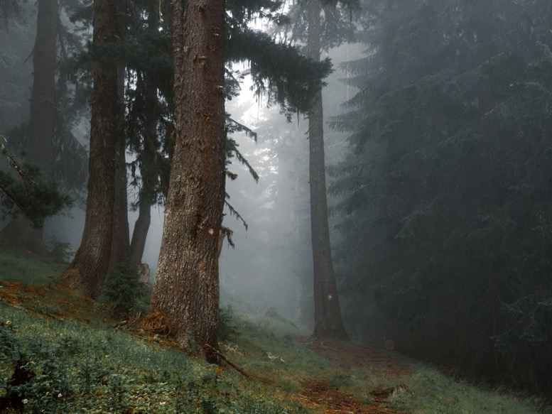
The morning started with fog in the valley. I took a timelapse during breakfast (again great food) expecting the fog to break up spectacularly as the air was warming up. But the opposite happened, and by the time I headed out at 8:30am, it was even foggy everywhere. But it could not have been on a better section. Just past the cottage the trail heads into dense pine forests of the national park, and with the fog that place was just magical. The fog dampened out all the sounds, while the combination of fog and moss on trees made this place look mysterious and beautiful.
I was barely making progress stopping everywhere to take shots. I love a good forest more than anything; so much to see, so much variation.
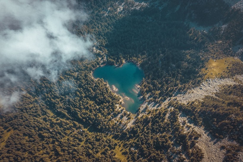
After 5 kilometers of uphill going, I got to Lake Hrid, a big alpine lake in the middle of the forest. The fog just started to move out, opting for some great drone shots. From above the lake and its surroundings look perfect and untouched. On the ground, I felt a little sad. This pristine lake showed so many signs of humans, that while part of me wanted to enjoy it, the other part of me wanted to get out of there as soon as possible. Dozens and dozens of living trees around the lake are partially burned at the base by campfires, there is toilet paper and human waste everywhere, not to mention the regular (burned) trash. People have been scraping their names in so many of the trees, some of which were still fresh and at least 50 centimeters tall. The fact that there is a gravel route a few hundred meters away doesn't help that fact, but I mostly feel like this is culture. Where in western Europe or the US it is just not done to do things like this (it is still done, but not at this scale), here these things are just accepted or ok to do. At least that it is how I experienced it. Alongside many trails trash can be found, and this is even worse on roads where trash seems to be more common than trees. I remember from last winter finding candy wrappers in my steps in the snow I made just days earlier. I am not intending to sketch these people as careless or bad, because there sure are a lot of pristine places.
From the lake, I followed the gravel route down, then merged with the POB trail down towards Plav. This section is pretty steep in places, and after the rain from last night slippery too. The trails were gorgeous again through dense pine forests and meadows and there were no other hikers. At the edge of the national park, the forest opens up and makes room for farm land. The trail gets less steep and follows a quiet gravel road to Plav.
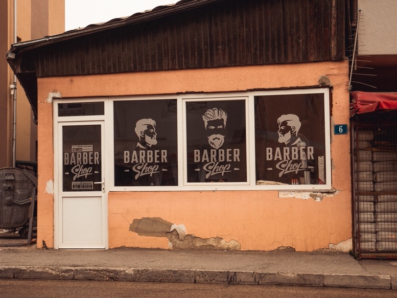
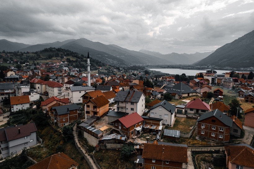
In the afternoon I saw the red roofs and lake of Plav, the biggest town in the loop. After spending almost a week in the mountains and small villages, this town of less than 4000 inhabitants felt alive. Small stores along the roads with chaotic traffic, with people everywhere. It definitely contributes that this is very social culture. People spend a lot of time chatting on the streets, in one of dozens of barber shops or drinking a coffee at a coffee shop.
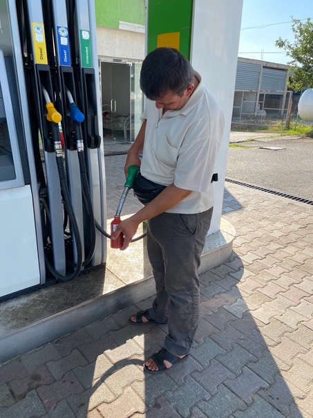
I got my resupplies for the next 2 days at a grocery store, 300mL of gas at a gas station for my stove and got the necessary bandages at the pharmacy for my leg. At the small hotel (or guesthouse, whatever you want to call it) I relaxed and recharged the batteries. The latter I wasn't able to do with the small solar panel at the guesthouse yesterday.
At night the town felt even more alive and got a lot more pleasant. It wasn't hot anymore and the main road through the city center got closed off. Children played outside and people were socializing over dinner and drinks at one of the many cafes. A culture of contact. In that aspect it is much different from the Dutch.
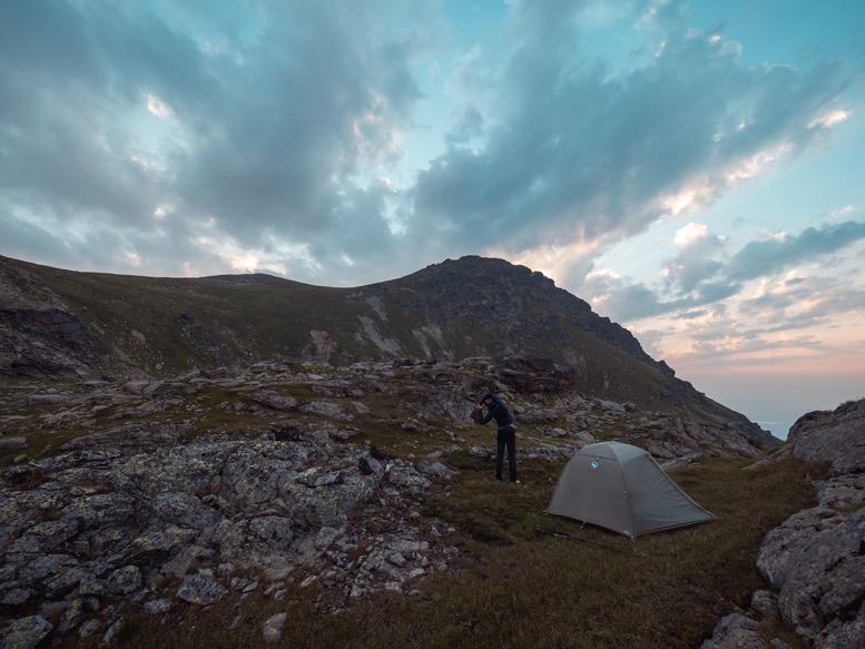
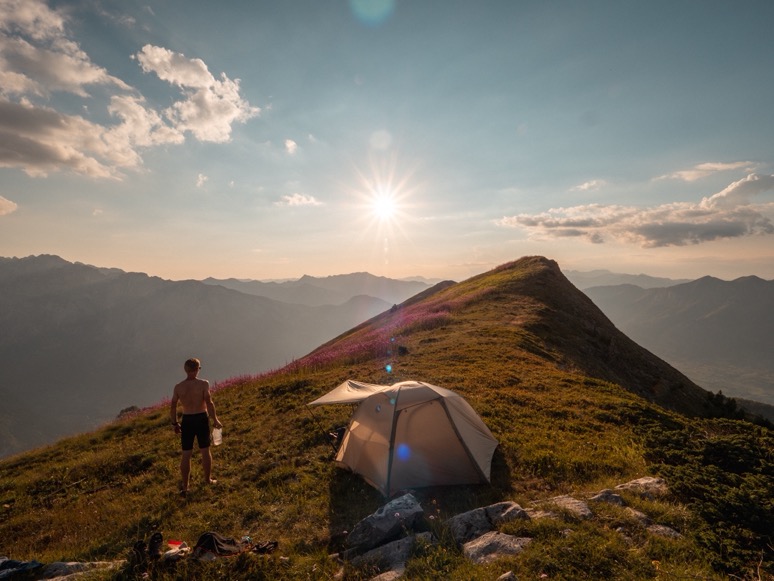
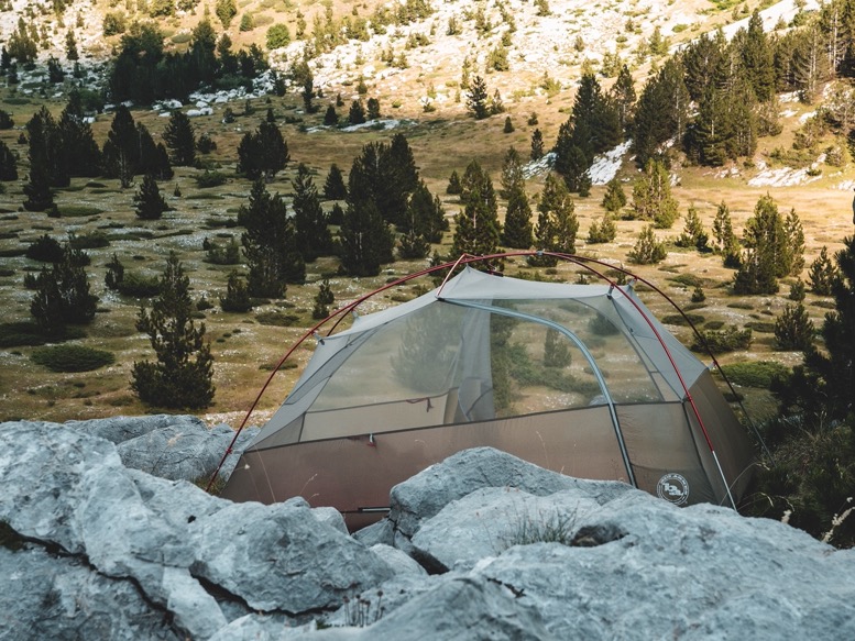
\\ July 29 | Day 7: Camping on top of the mountain
Plav to Pukli krš (peak)
20.7km | 12.8mi
1900m | 6200ft 900m | 2800ft
After sleeping inside for 2 nights inside it definitely started to tickle again: I needed to sleep outside again, away from all the busyness and luxuries. My plan for today therefore was simple: climb up the mountain and find an epic campsite.
The morning started foggy, which in my opinion always gives this peaceful vibe. Sounds are muffled and without the ability to see more than a few hundred meters, it gives this intimate feeling of really being into the moment, not seeing what lies ahead or behind you.
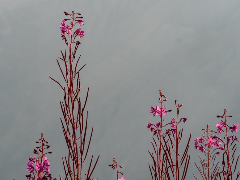
The ascent was quite simple for the most part. Just a long gravel road with switchbacks for the first 800 meters of elevation gain; progress was fast. When the road reaches its highest point, a trail branches off and at a much steeper angle climbs through deciduous forests to a meadow filled with purple flowers. At the spring I sat down and had a carrot. If it weren't for the dozens of flies, I probably would have zizzed off in a little nap.
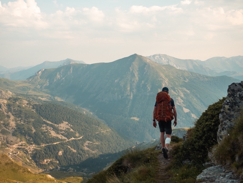
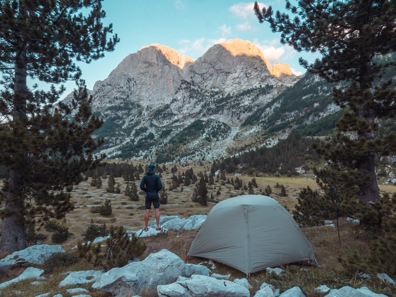
The last section to the highest point (Maje e Borit) is very steep, but that's how I usually prefer it. Up top, I could look over the ridge to the other side of the mountains towards Plav and its lake. What a great view.
From here, the trail follows a ridge. It was sunny, hot and without any thees there was no shade. Following the ridge the views got better and better: to the south I looked to the barren rocks and roughest peaks of the Accursed Mountains. To the north the green mountains and deep valleys towards Plav. This sure was the place I'd been looking for to camp. On the map I had spotted a few small lakes close to the ridge. Two of those I could spot early and by the color and size I realized that was far from drinkable. Following the ridge I could finally spot the other one, but upon checking it out, it was the grosest water I had seen so far. This small artificial lake, probably made by local shepherds, had frogs in it and smelled like poop from a distance. Perhaps in a life threatening situation I would drink it with my filter, but although I ran out of water and was getting a headache, I definitely wouldn't drink this now.
The southern side of the ridge is baren with mostly rock and some grass, but the other side was a lot lusher and greener. Following a gully down I spotted some wet ground, and even further down that turned into a tiny stream with some small puddles. This water was drinkable, and although not much, enough to stop my headache and find a campsite.
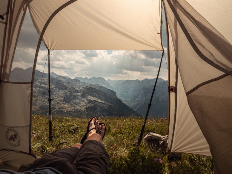
Back up the ridge, I set my eyes on one of the tallest peaks on that ridge. A trail winds underneath this peak, but the last part was a lot of scrambling. Up top I found exactly what I was looking for: a relatively flat grassy spot with 360 degree views. After getting rid of some of the worst thorny plants, I pitched my tent as a sunscreen and was finally able to relax with an amazing view.
A few hours later, with the warmest part of the day behind, I made my way down back to the trail beneath the peak to search for water. I ran into a shepherd. Asking (by sign language) the guy where I could find water, he first offered me his bottle of water. Explaining to him that I was camping up that peak (to his surprise) and needed more water he pointed down explaining I had to descend on the north side: 'dole, dole' (down, down). What a friendly and joyful guy.
Following some sheep trails down the mountains the vegetation quickly became thicker and thicker. 200 meters down I started following a little stream down the mountain. After some solid bushwhacking, I found a big pool of fresh water, away from any cattle. I filled my 3 1-liter bottles and my 3L drybag I use for my sleeping bag. There was no way I was gonna do this again later today or tomorrow morning.
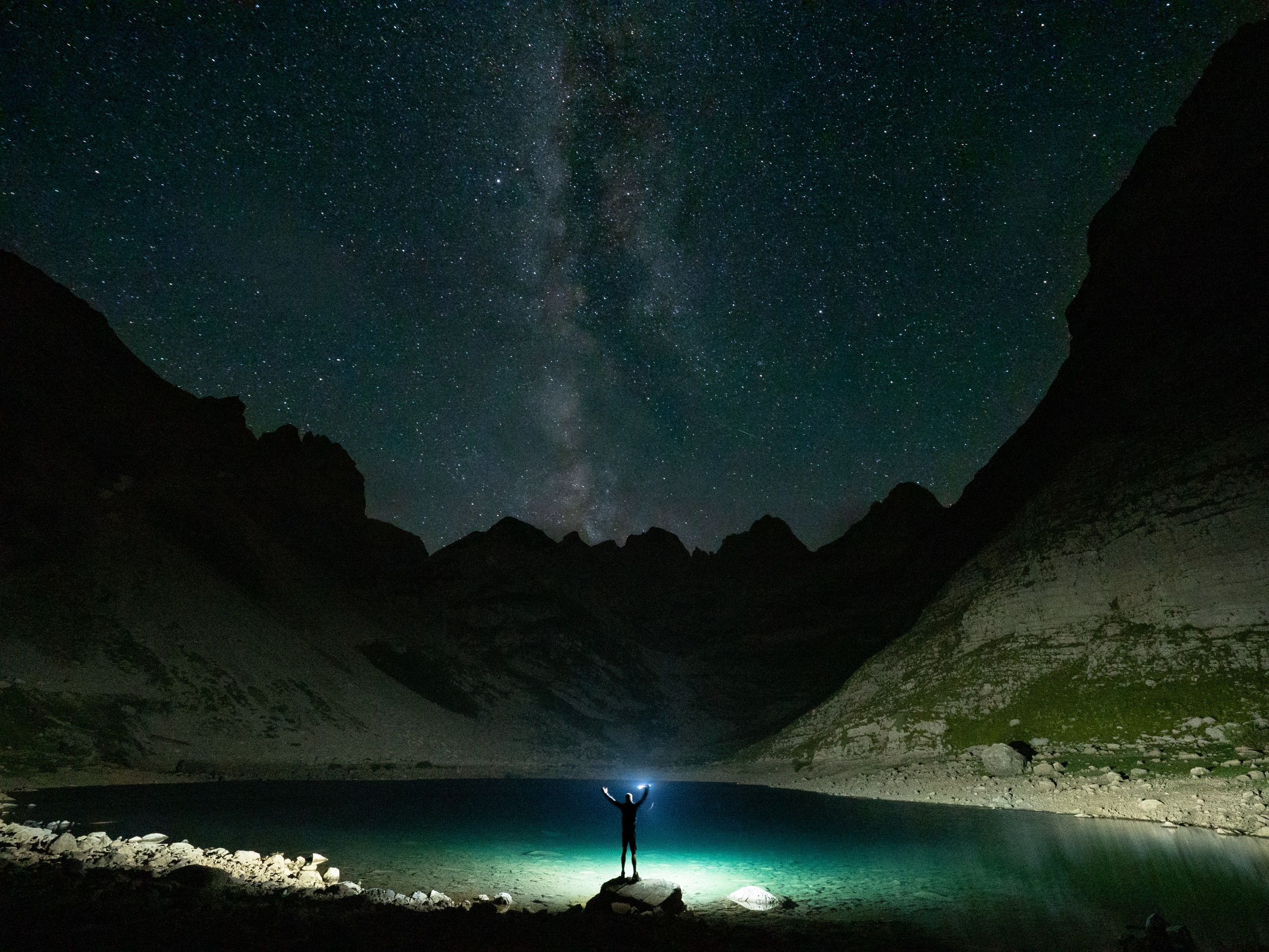
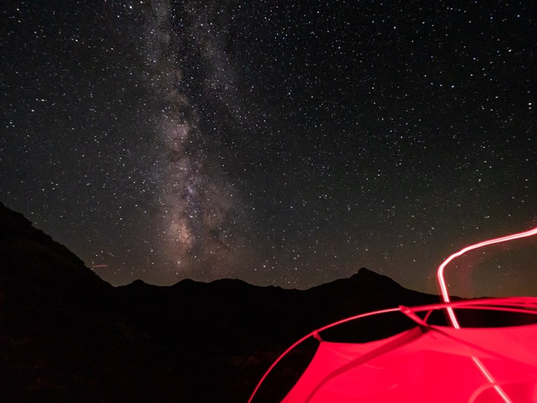
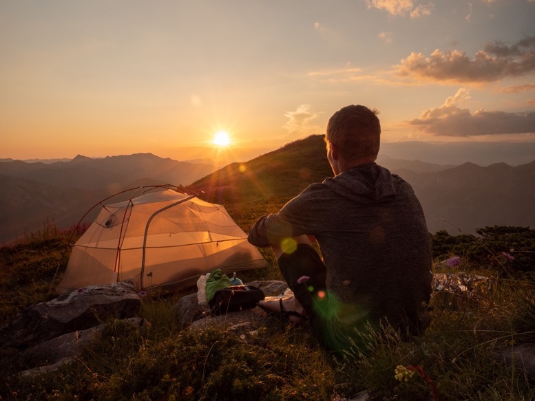
That evening was one of the most peaceful ones of this trip. As the sun slowly setted, I refreshed myself with some of that precious water, and made dinner during sunset. Nostalgic like last winter I got Wudy cheese sausages with pasta and some soup powder. There was basically no wind and the temperature was pleasant. At night the milky way revealed itself perfectly above the rough mountains to the south. My mission for today: 100% accomplished.
\\ July 30 | Day 8: 70% descent and best sandwich above Grebaje valley
Pukli krš (peak) to Valušnica (peak) in the Grebaje valley via Vusanje and Gusinje
22km | 13.7mi
1700m | 5400ft 2000m | 6600ft
The first days of any backpacking trip, I wake up around twilight and full of energy I get up immediately. But now, after more than a week on trail, I started to notice the chronic lack of sleep. Getting up was getting harder and harder by the day and it wasn't until the sun hit my tent that I forced myself to get out of that warm sleeping bag.
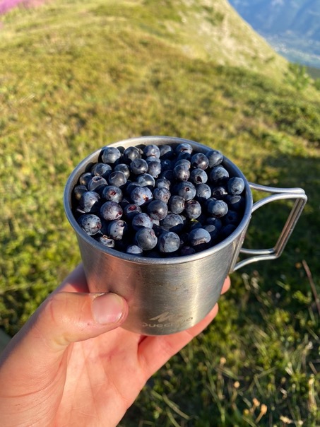
My campsite was surrounded by blueberries, and I mean lots and lots of blueberries. The bushes lower down the mountain had either been partially plucked by other hikers, or on a larger scale for commercial purposes by the locals. But up here no one had touched them, and with the amount of sun they got, they were big. I collected a mug full of them and mixed them up through my oatmeal with powdered milk, a bit of sugar and cinnamon. Absolutely. the. best.
The POB trail doesn't follow this ridge, but crosses it a few kilometers earlier and then slowly descends into the valley to Vusanje. On the map I had seen several other trails going down from the ridge straight to Vusanje. This seemed like a great plan. What I didn't do however, was check the gradients of these trails. The first part above the tree line wasn't too bad. The trail isn't used that often, thus overgrown and at times a bit hard to follow. But below the treeline, I got into some real sketchy sections. The trail was fully overgrown with an average gradient of 53% over the almost 1000m descent, with a 300m long section of over 70%. I literally had to hang from tree to tree not to tumble down the mountain. Wondering how I managed to get into such a situation again, I could actually see the fun of it. This was another adventure, and as long as I was getting down, all was fine.
It took me 2 hours of sliding and holding on the trees and branches to get down to Vusanje. It sure didn't feel that long to be honest.
From Vusanje I quickly got a lift to Gusinje, 5 kilometers down the road where I'd spent some time last winter. I got myself a coffee on one of the many busy terasses, and got food for the next night. I then tried to get a lift into the Grebaje valley. This valley, not on the POB trail, is one of the most extreme valleys in the area, with some of the steepest slopes and highest peaks. Getting into the valley is not as exciting as the Poljanska valley on the POB route (and for that reason probably not on the route), as it is a 7km long paved route with not many views. After asking the few cars that headed into the valley, an unofficial taxi driver offered a ride for 20 EUR, which I accepted. I rather spend my time up in the mountains than waiting in a town in the burning sun.
The trail up is about 3 kilometers long, gaining 700 meters of elevation. The trail luckily lied in a cool forest, but quite popular and busy this time of year. . It was past 2pm, and I still didn't have my lunch, which I planned to have on trail. I had set my eye on a spring on the map about halfway up. Since I already ran out of water and was getting hungry I basically ran up the mountain. I felt great! Getting to the location where the spring should be, there was no spring at all. I asked some people coming down, if there was water any closeby, but no, there wasn't. Lucky for me they offered me their liter of water so I could at least make it to the top comfortably. Another miracuously fast climb later, I got to the meadow below just behind the Grebaje valley where there was plenty of water. Time to slow down and relax a little. It was around 4pm, and with just a 100m climb or so to go, I was almost there. And the longer I waited, the quieter it would be up top.
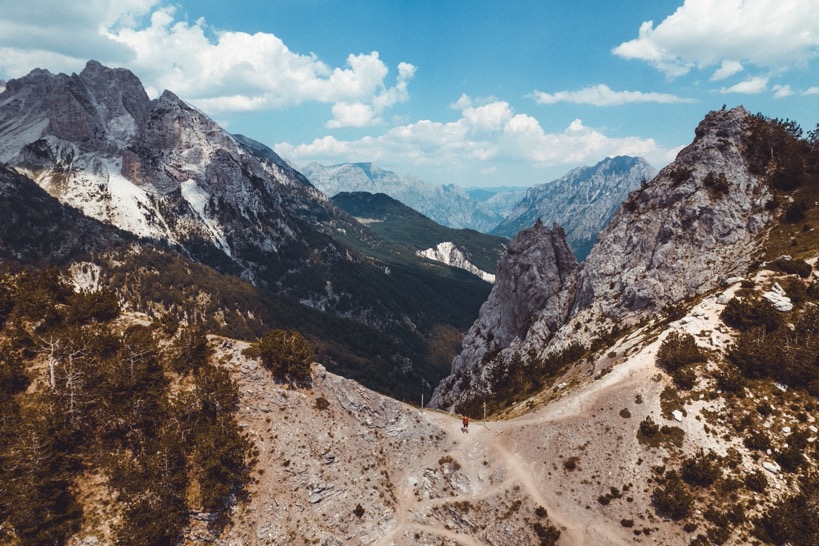
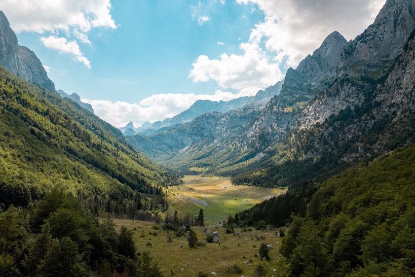
Just past 4pm I'd ascended the last hill and got to the ridge of the Grebaje valley. I was stunned. Below me was a sheer almost vertical drop of several hundreds of meters. On the other side of the narrow valley were peaks at least twice the size I was standing on towering over the valley. I had camped on the other side of these peaks last winter, but since this valley is much lower, the peaks look even more gradiose. The trail follows the ridge passing over some smaller peaks. Just before the biggest one I found a great camping spot, right next to the trail. With some bad weather and thunder rolling in, I didn't want to take my chances of camping up top, so I pitched my tent right there. The views were still not bad at all. Dark clouds filled the sky around me and I could hear the sound of thunder echoing through the valley. But all the rain passed by. The thunder had for sure scared away all the other people. I was alone.
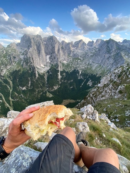
After a quick back down and up to get water at the spring, I ascended the last bit to the peak close to my tent for dinner. The wind had died down completely, and some rays of sunshine were illuminating the peaks gorgeously. For dinner I made a massive sandwich with hummus, salami, vegetables, cheese and mayo. This meal is high on my list of best camping meals ever. The dinner-view is probably on number 1.
\\ July 31 | Day 9: Easy day to Vusanje
Grebaje valley to Vusanje via Gusinje
15.7km | 9.8mi
300m | 1100ft 1200m | 3900ft
Full of excitement I opened my tent to get a view of the mountains in the morning sun. Fog. Thick fog. Well, not as I'd hoped.
I slowly made a coffee, then breakfast, then walked the ridge a bit, then slowly started packing, all in the hope the fog would dissolve. But 4 hours of waiting later, I could see the valley floor every so often, but the peaks were still in dense fog. I packed my stuff and headed out.
There are some great trails in this area. I had initially planned to spend another night in this area, weren't it for the fall on day 2 that cost me this extra day. Alternatively I had planned a nice ridge walk back towards Gusinje, but with the fog, there was no real point in doing that. Plus, as energized as I felt yesterday, so tired I felt today.
I descended down in a valley parallel to the one I came up on, directly heading towards Gusinje. The trail was mostly deserted, only passing a few shepherds on the way down.
In Gusinje I had a little break, then made my way back towards Vusanje to spend the night. I hadn't felt this tired the entire trip. But the visit to the Grebaje valley was well worth it.
\\ August 1 | Day 10: Valley of the lakes
Vusanje to the valley of the lakes
16.5km | 10.3mi
1300m | 4400ft 500m | 1500ft
After a good night's rest in a proper bed, I felt re-energized. Except that I did not. Where I'd felt at my best 2 days ago getting up in the Grebaje valley I felt at a trip-low today. I was tired, and when I got going after breakfast I had a headache because of the tiredness. But I have felt like this before, and I knew I just had to get through it.
I first made my way to Vusanje, then onto the POB trail heading into the Accursed Mountains. I'd been exactly here last December. Then the roads were icy (I even had trouble getting up the steep icy road to Vusanje) and the trails were full of snow. This time progress was much and much faster, and as I headed into the national park, I soon started to feel better. The national park doesn't have a gated entrance like most American parks. However, at the wooden entrance sign, an park official was collecting entry fees. A staggering 1 euro.
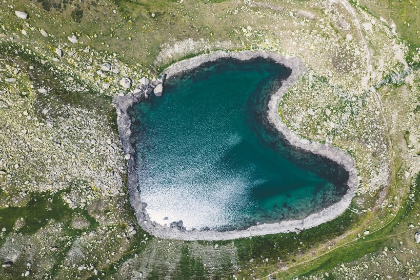
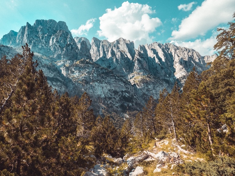
After a few kilometers I got off the POB trail, and towards the valley of the lakes. I had seen this valley on a map last winter, and had actually planned on visiting it, were it not for the impassable snow pack. The trail winds up to a small meadow with an abandoned building and a spring, then steeply climbs 400 meters through dense forest before breaking up into subalpine pine forests giving the first views of the valley. This is really my favorite type of landscape: mountains, alpine meadows and lakes and some pine trees here and there. This elongated valley has several year-round lakes, two bigger ones with crystal clear blue water. On all sides the valley is enclosed by steep rock faces that, even though the valley is already at 1800m elevation, tower above the valley.
I made my way through the valley to the far end, where I pitched my tent. Before me the deep blue alpine lake, with on the far end some of the tallest peaks and the trail towards Jezerca, the peak I would climb tomorrow. My favorite campsite of this trip.
I took a little swim in the lake, something I hadn't done earlier because of the wound on my leg (and to be honest, I hate cold water most of the time, but this water was pretty warm actually).
For dinner I made some pasta bolognese with salami, creamy cheese, bell pepper and herbs. I feel like I'm getting better at this.
The sun had not even set as I crawled into my sleeping bag at 7:30pm. Tired and a big day tomorrow. I watched the last rays of sunshine hit the peaks from my sleeping bag as I dozed off.

\\ August 2 | Day 11: Maja Jezercë (highest peak in Albanian Alps)
24.5km | 15.2mi
1800m | 5900ft 2100m | 6900ft
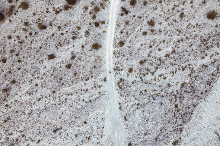
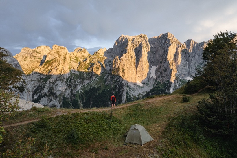
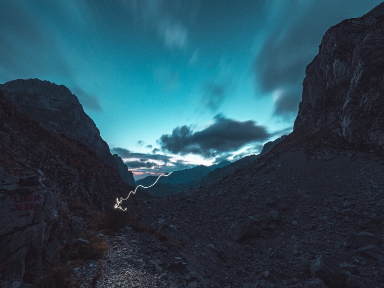
The reason I'm so tired is pretty obvious. It was 12am when my first alarm rang. I got out to take some cool and creative photos of the milky way at the lake, then started a timelapse.
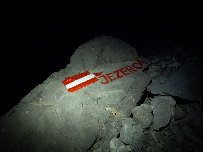
Next alarm: 4am. Time to start the ascent to Jezerca, the highest peak in the Albanian Alps. I made a coffee, secured my tent just in case, and got going. It was still pitch black outside, but for the first part the trail is easy to follow.
As the first sunlight started brightening up the sky, I got the first obstacle that I sure wouldn't want to cross in full darkness: the snow patches. Hidden between the tall peaks these high valleys get very little sunshine, so ven in August, there are still some pretty large areas covered in snow. This early in the morning, the snow was still icy. Crossing these steep slopes without spikes was dangerous, and thus I had to walk around most of them, taking lots and lots of time. I believe that the dangers of snow on slopes are underestimated by many. One misstep and you start sliding fast with little opportunities to stop yourself as you gain speed fast. I remember having such an experience on the Tour du Mont Blanc. I wasn't even sliding for more than a second, but stopping was painful and cut open my hand.
The trail towards the peak is marked with 3 types of markings: the classic cairns, old red marking and the new red markings. On the snow it was almost impossible to follow any mark, but having circumvented the snow, I quickly found myself on a decent trail going up.
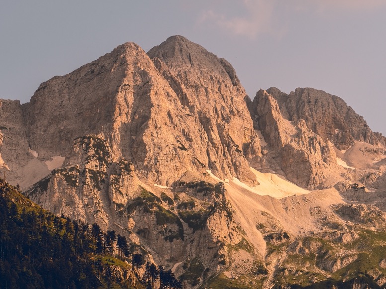
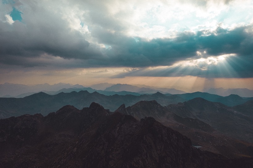
Early in the morning it was still mostly cloudy, but with the sun shining at a low angle through the clouds, the lighting conditions were just stunning. The tall vertical spear-like peaks towards the west turned orange at the base, as the tops were still covered in the clouds. Getting good shots here was no issue; wherever I pointed the camera, I got a great shot.
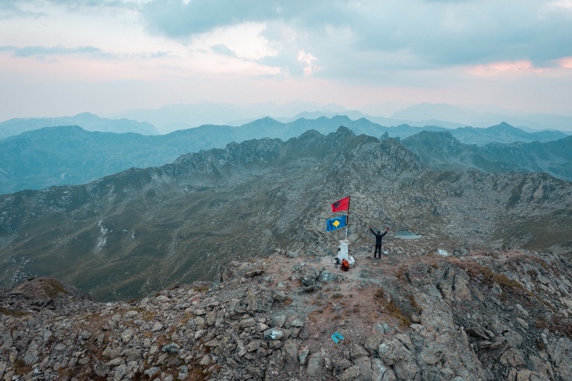
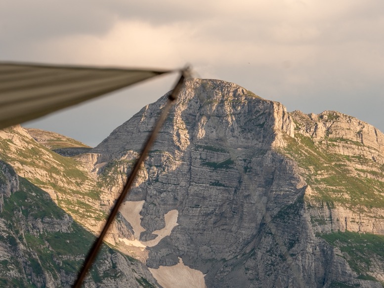
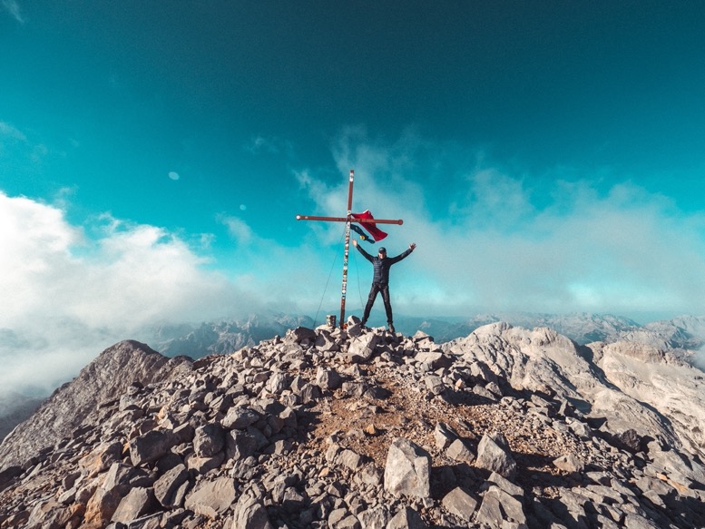
Several hours and 500 meters of elevation gain in, I got to the saddle of Jezerca. So far the trail had been not too steep or technical, but that changed here. From the saddle it's a technical and steep ascent to the summit. Climbing boulders, traversing steep screes, and walking on some ledges following one of the marked routes. It surely didn't require special climbing gear, although a helmet would have made it a lot safer.
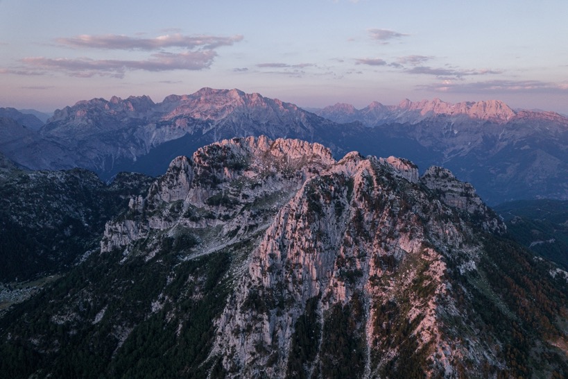
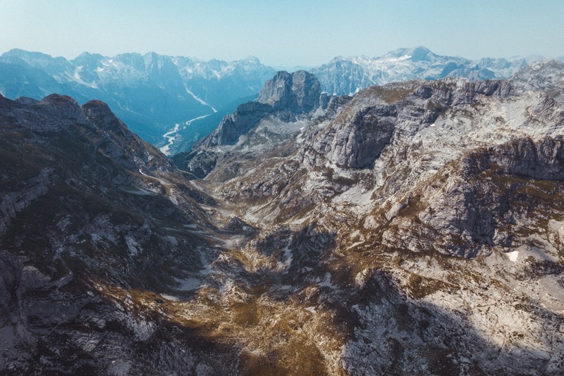
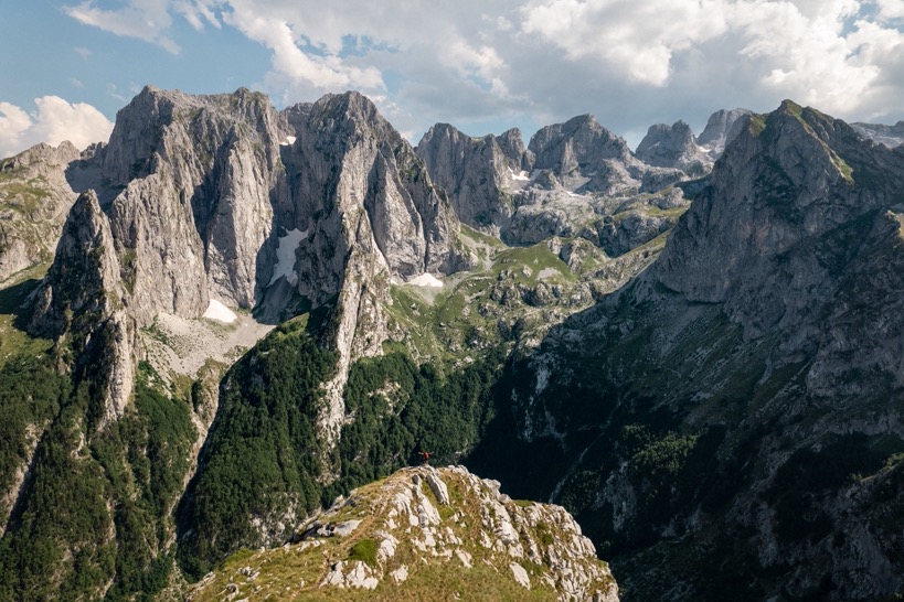
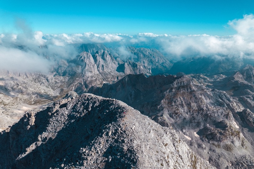
At 10 am I made it to the top. This was really the highlight of this trip. The challenging but great climb up, the perfect lighting conditions on the way here and now these literal 360 degree views. I could look down into the Valbona valley, to Valbona pass and on the other side into the far end of Theth valley. I could see Gusinje and the peak of Gjeravica, that I climbed 7 days ago. This was basically the center point of the route and I could see the whole loop I had done so far. The best views were west towards the Poljanska and Grebaje valley. This area is full of sharp speared peaks; and the peaks were still partially covered into the clouds. What a highlight of this trip!
Almost an hour and a half later, I descended back down. My hands had gotten pretty cold by now by the howling winds up here. This for sure went a lot faster than the ascent, especially the last part over the snow that now had a soft top layer instead of ice.
Back at the tent, I took a power nap, made a coffee so strong I wouldn't even call it an espresso anymore and set out further down at 12:30pm. 2 hours later I had backtracked the trail to the POB trail. From here I got deeper into the Poljanska valley, the one I camped in last winter. It's funny, because I knew the trail, but still had to convince myself all the time I had actually been there before, that's how different everything looked. Everything was so green, lush and easy going. Much different from last winter.
In the Poljanska valley I recreated some shots and found my exact campsite from last winter. Now fully overgrown and full of insects I sat down where my tent stood when it was -15C and I could barely feel my toes. I was a lot lower to the ground now, which also made recreating some tripod shots impossible. Which season I liked most? Winter. With the snow it was so much more peaceful, everything was untouched and perfectly smooth, plus there were no mosquitos or ants crawling over you. In winter I could easily maneuver through the same forest that was now full of branches, loose rocks and blackberry bushes. Plus, the slope was so steep that by no means I could pitch my tent here now.
As I said goodbye to this valley once more, I made the final steep ascent of the day to a big meadow closer to Theth. Towards the end of this meadow was a small summer settlement of shepherds. Several small huts of old sheet metal and plastic sheets protected the beds made out of sticks. Behind the huts was a small spring, the only one in miles and miles.
Quite easily I found a cool campsite, on a small cliff overlooking the meadow. Not perfectly flat, full in the wind, etc, but at this point those are more like wishes than requirements.
The last night on trail. As I watched the last sunshine hitting the pine trees down in the meadow, I sat back and reflected. I felt exhausted, mostly by the lack of sleep, because physically I felt just as good as day 1. Averaging just short of 21km and 1400m elevation gain (and drop) each day for the last 12 days, this was one of the biggest trips so far. The Tour du Mont Blanc too was 12 days, but focused less on filmmaking back then, I got a lot more sleep. Apart from the little accident on day 2, this trip could not have gone any more prosperous. The weather had been perfect, and so had been the trails and campsites.
\\ August 3 | Day 12: Down to Theth
14.6km | 9.1mi
500m | 1800ft 1300m | 4200ft
Easy morning. Coffee. Waiting for the sun to hit for some cool shots. Et cetera. I might make it sound like a habit, but I enjoy it every time; mornings are my favorite.
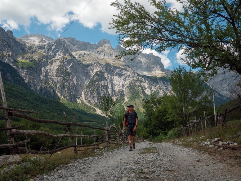
The last part to Theth is a few smaller climbs through sub-alpine terrain all the way to Qafa e Pejës, the mountain pass above Theth. Then it is a looong and steep climb down into the valley. The trail down is truly one of the most fascinating works of trail making. The trail is never too steep, and zigzags over small plateaus and along slopes with vertical drops severl hundreds of meters down.
Once in the valley floor, the trail continues for another 5 kilometers or so to Theth. In the winter I had walked this trail 4 times, adding up to 5 times now. I visited another old campsite from last winter, then started counting down the kilometers, then meters to Theth. At 2pm I was back at my car, which by now was full of dust. Mission accomplished.
It's funny. I hadn't felt any muscle pain in the last 12 days, nor did I feel like I was physically getting weaker. But now that I had finished, it felt like suddenly all the exhausing came out at once with sore muscles and a constant feeling of tiredness that evening, and the next few days to come.
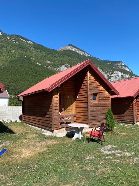
I spent one more day in Theth, spending 1.5 hours to recreate the opening shot of the film at the church, copying all the footage (having at least 3 copies by now), and starting the edit. The next night I finished the trip where I had started it: at the small cabins on top of the mountains. The circle was complete.