The Dolomites
October 2022
\\ October 7 | Day 1: Wildcamping in the Peitlerkofelgruppe
Passo Rodella, Forcella de Putia (2361m), Forcella della Roa (2617m), Val della Roa
18km | 11.2mi
1600m | 5400ft 1300m | 4200ft
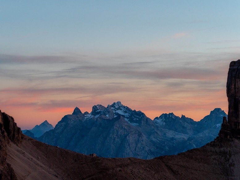
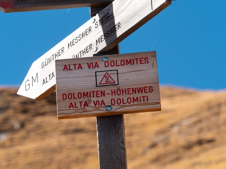
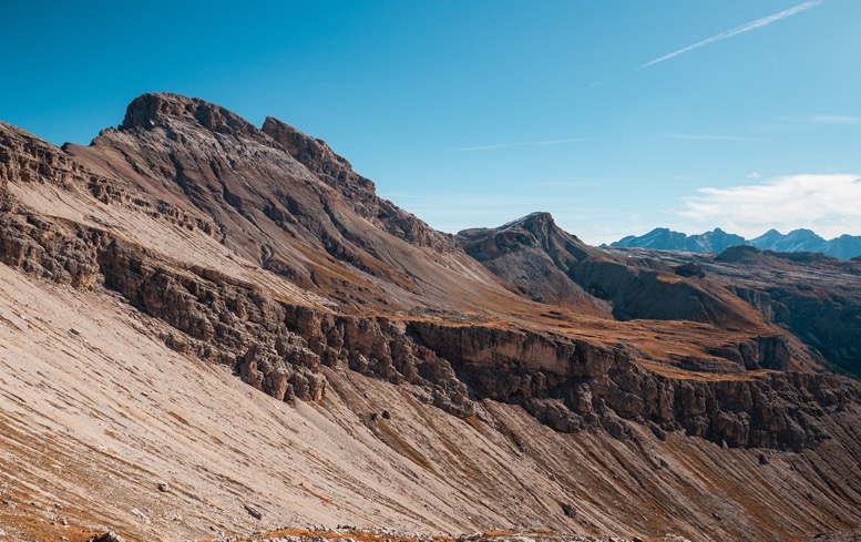
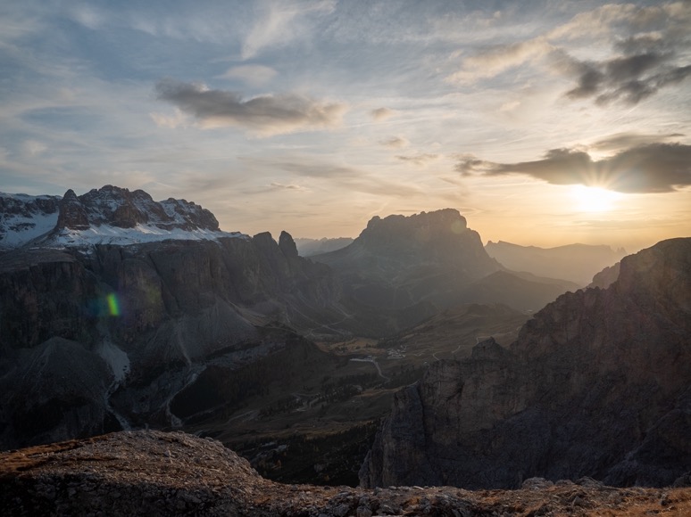
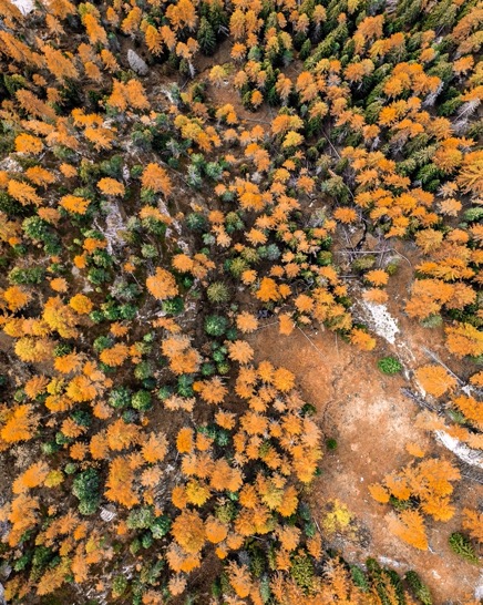
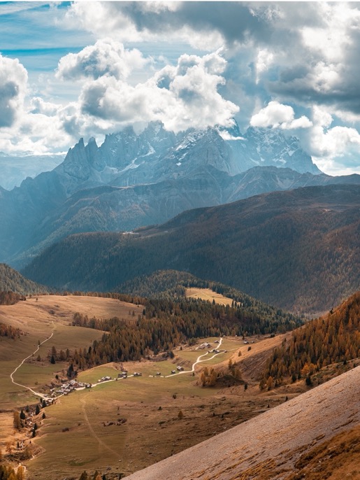
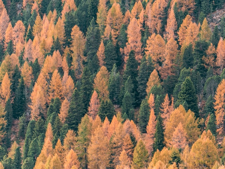
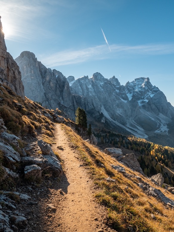
I started my hike at around 2pm from Passo Rodella. Not the official start of the Alta Via 2 (AV2) route, but with the flexibility of transportation in the region I decided to not do the full AV2, but only the most exciting and extreme parts. There are several stages that are not super exciting crossing several ski areas to connect make it a continuous thru-hike. Still under the tree-line, the autumn colors were beautiful, just as I expected the Dolomites to be in Fall. The sky was perfectly blue and contrasted perfectly with the yellow larch trees.
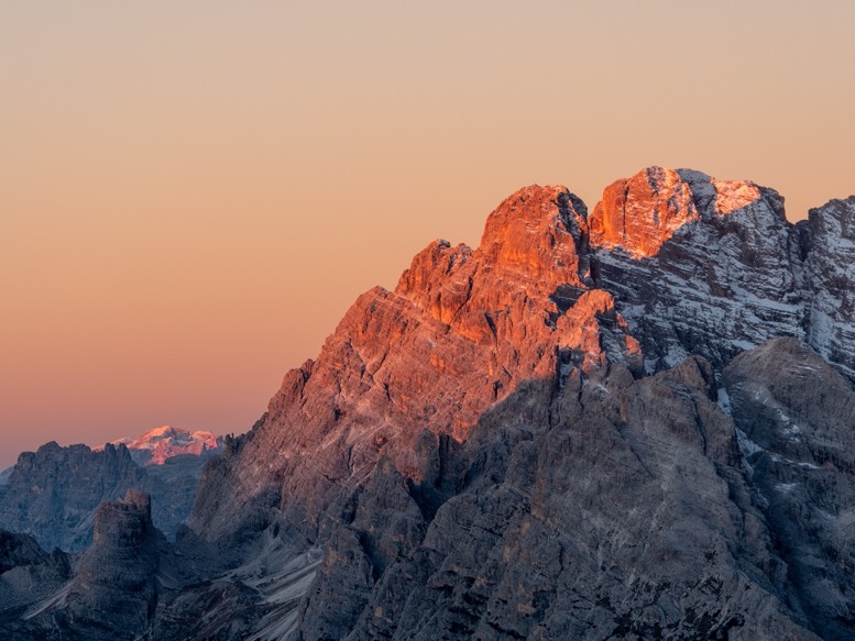
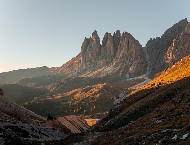
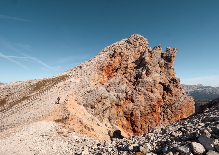
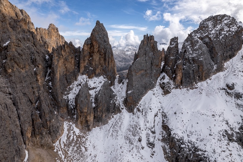
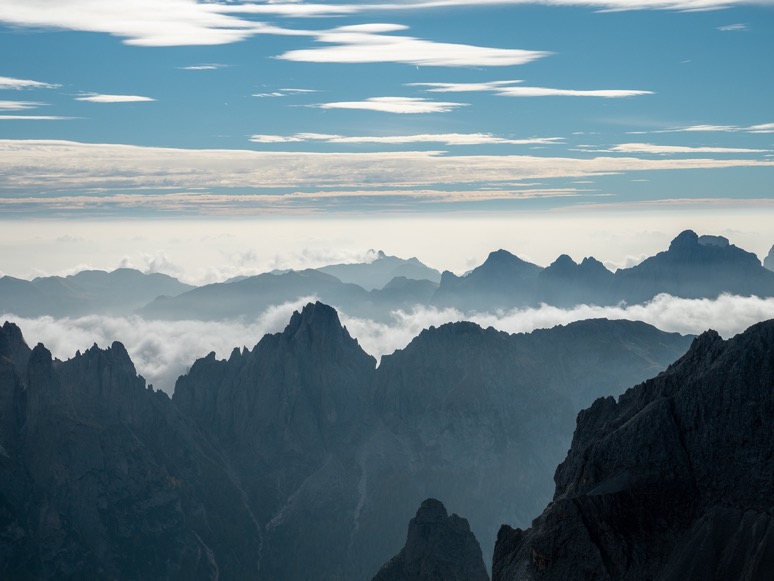
The Dolomites are not a continuous mountain group, but instead dozens of smaller kinda round mountain groups separated by beautiful wide valleys. I headed up the Peitlerkofelgruppe, straight up to the mountain pass Forcella de Putia (2361m). This late in the year the sun was already behind the mountains by late afternoon. I passed over the pass into the sun, and headed south. The trails were easy to follow and well marked, also nothing too hard. I had planned to camp in the valley Val della Roa just over the mountain pass Forcella della Roa (2617m). The pass, which I had to cross from the north side, was pretty steep (45 degrees) and full of ice. I'd brought my micro-spikes, but left them in the car, since I wouldn't get really high in the first few day anyways. Besides, there are very few situations where you actually need them. Normal snow, or ice on minor slopes are no problem at all to cross without spikes. But it so happened to be that this section was steep, and full of solid ice ... This pass probably took me 4 times as long as it would have with spikes as I slowly and carefully slid my way up the mountain.
At the pass I got my first view of the valley below. The low angled sun lighted the valley in a dark yellow color. Beautiful. The rock in the Dolomites is very porous and therefore are infamous for holding very little water. It was bone dry everywhere. The AV2 headed up towards the next mountain pass, buy instead I branched off the trail, and headed further down into the valley in the hunt for water.
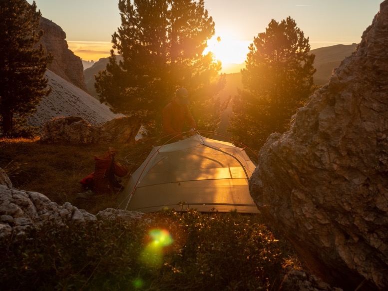
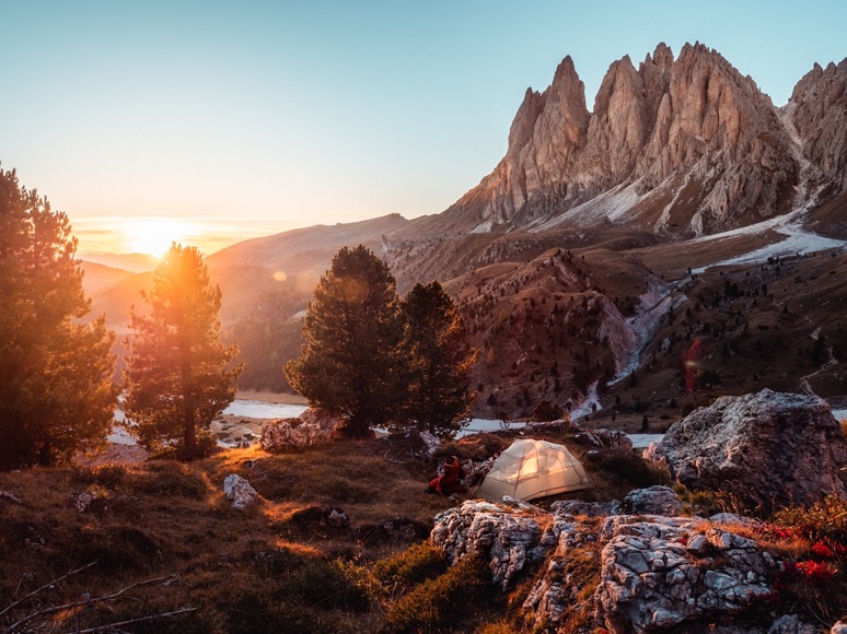
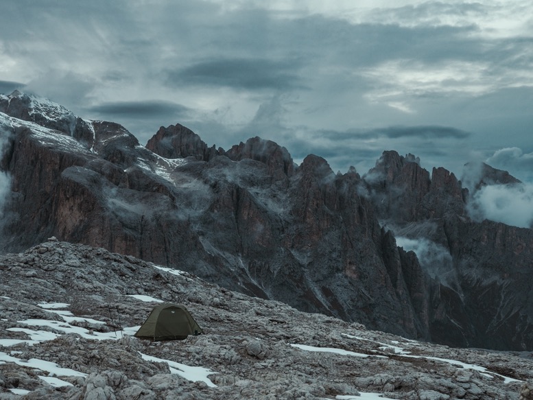
The amount of planning I do for a trip differs quite a bit. As a filmmaker I want to plan everything, to ensure I get the best angles and most cinematic campsites. As an adventurist I want to plan as little as possible. Not knowing where you might end up at night, and having a lot more of those 'wow moments'. This constant battle between these interests makes it that I sometimes only have a global idea where I'm going, while other times I walk around in Google Earth playing with the sun position to find that one perfect spot. For this campsite I'd done the latter. When I spotted the big rock surrounded by the pine trees, I recognized it immediately and headed down to pitch my tent.
The sun was setting right in front of me while I pitched my tent and enjoyed the perfect silence of the place. With the sun set, and the cinematic-me in me fully satisfied, I headed further down the mountain in search of water. On my map I had spotted a spring about 2.5km down, but very luckily I found a brand new animal trough not so far down with water in it. Saved me a lot of extra miles.
\\ October 8 | Day 2: Camping on top of the cliffs
Val della Roa, Forcella de Forces de Sielles (2505m), Refugio Utia de Puez, Forcella de Ciampei (2469m), Sass da Ciampac (2667m)
13.2km | 8.2mi
1200m | 4100ft 800m | 2800ft
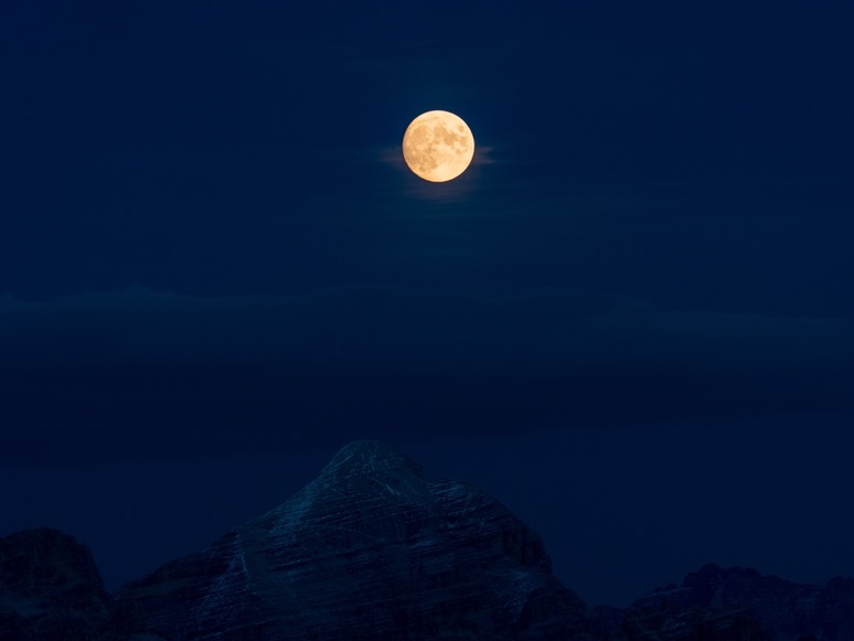
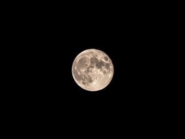
The night was just below freezing, but with my winter camping mattress and sleeping bag, it didn't feel cold at all. I didn't even put on my rain fly, which might have been useful to block some of that that bright light from the full moon.
A coffee and breakfast later, I headed back up the trail I had come down on yesterday, then merged with the AV2 trail and headed up towards the pass Forcella de Forces de Sielles (2505m). From there the trail sort of bends around the valley above some steep cliffs. By the time I passed (the closed) Refugio Utia de Puez I had passed several people on trail. It was Saturday and the weather was calm and sunny. The best part of camping high up in the mountains is that you don't see anyone from 4 hours before, till 4 hours after sunrise. And in the off-season you might go days without seeing people at all.
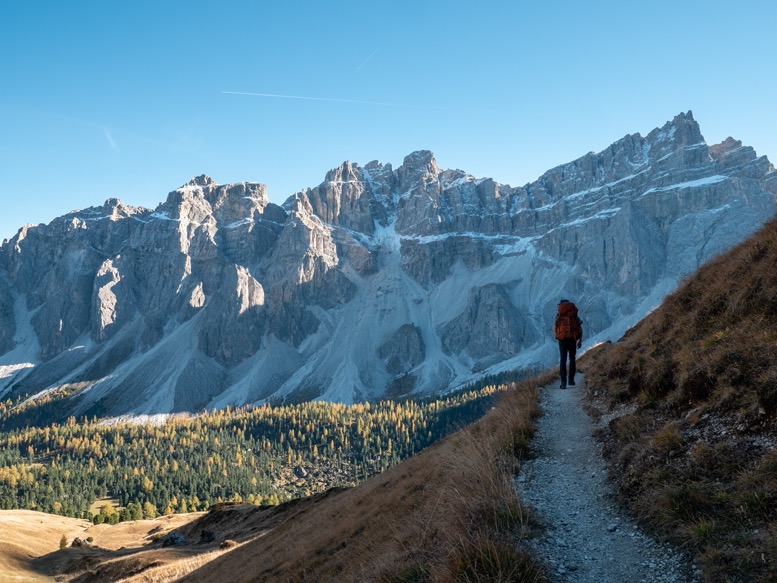
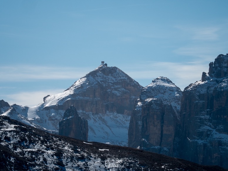
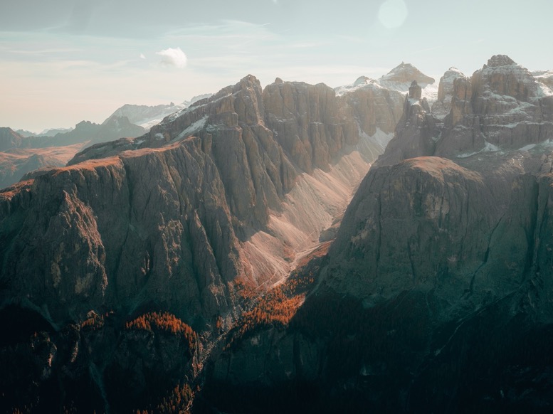
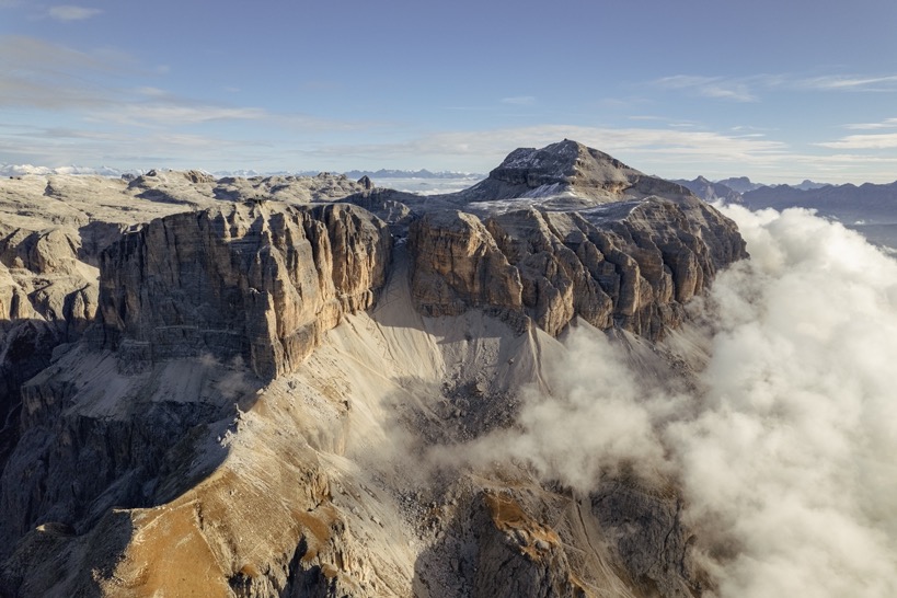
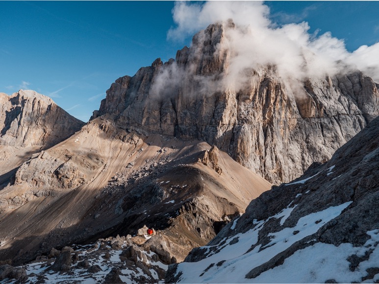
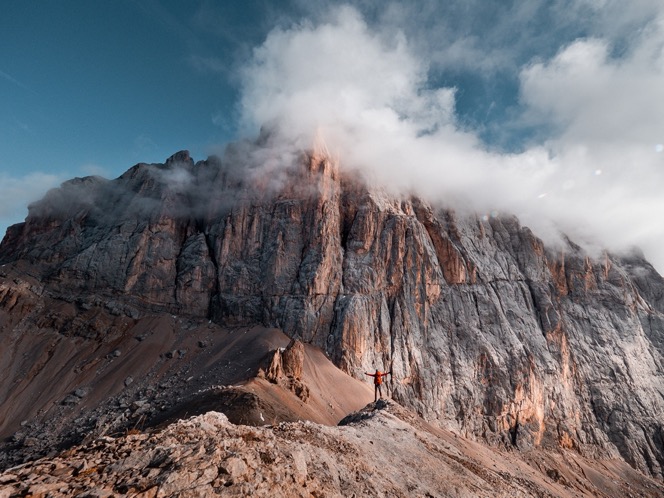
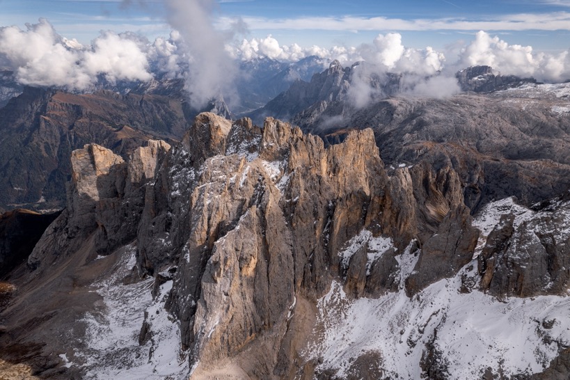
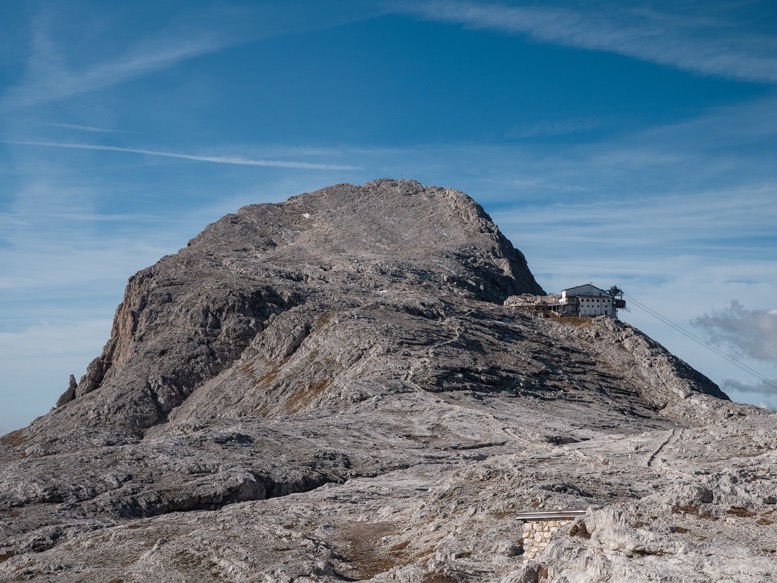
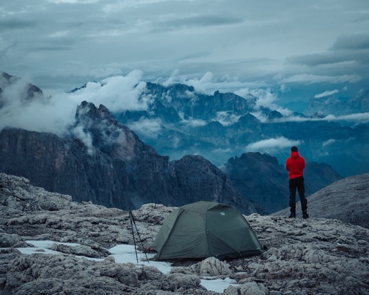
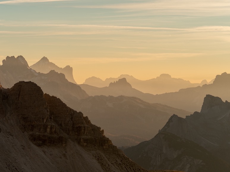
I had planned quite an easy day. The AV2 trail runs by the lake Lech de Crespeïna underneath the peak Sass da Ciampac (2667m). The 2A side trail does go over the peak, and with plenty of time left in the day I headed up towards that peak. The climb isn't particularly hard, and the views are really amazing, looking towards the Gruppo del Sella, which I would head into tomorrow. With the sun hitting the mountains at a very low angle, the steep walls of the mountains looked hazy and even more magnificent. On Piz Boè, the tallest peak of the Gruppo del Sella, I could see the rifugio Piz Boè sticking out.
My plan for the night was to either camp on or near the top, or near the lake down near the AV2 trail. Although it would have been a lot easier to get water at the lake, the views were so great that I chose to stay up top. With still some hours of daylight left, I spent some time reading and relaxing before looking for a camp spot. There were several flat and sheltered options away from the edge, but I ended up pitching my tent on an almost flat spot right on the cliff's edge. Just a meter or so from one of the two openings of the tent was a sheer 400m drop down, while the other side was slightly more gradual. That spot sure made for some great drone shots. Filming with a tripod is always more difficult in such a location; no matter where you place it, you never get the tent and the background in one shot (tripods are too low).
With the sun setting behind the clouds, the moon rose beautifully above the mountains. Down in the valley the sounds of the Ferraris racing up and down the hairpin roads slowly died down.
\\ October 9 | Day 3: In the fog, through the snow, to a winter refuge
Sass da Ciampac (2667m), Furcela de Cir (2469m), Passo Gardena (2121m), Valle Setus, Refugio Franco Cavazza al Piscidù (2587m), Val di Tita, undernearth Sas de Mesdi (2955m), Refugio Boè
16km | 9.9mi
1300m | 4100ft 1100m | 3500ft
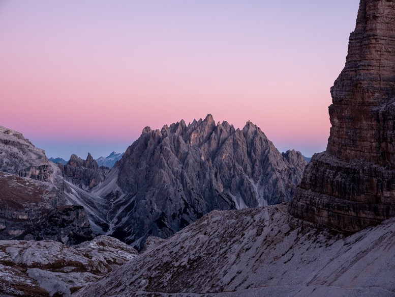
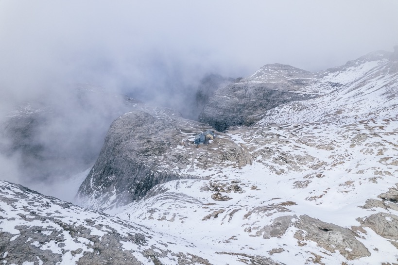
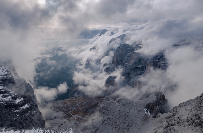
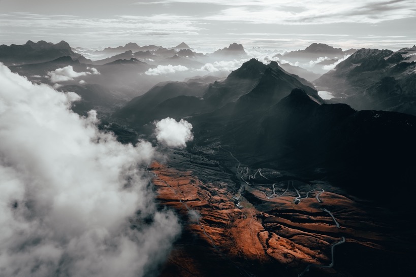
The weather changed drastically overnight. The calm sunny weather had been replaced by windy, cold and foggy weather. As expected, not as hoped for. But I didn't really mind to be honest. With my rain clothing on, I packed up my stuff and started the way down the mountain. The downside of fog is that there are very few views, the upside is that everything looks so peaceful and at the same time mysterious. Plus, when the clouds move out for a moment, you are surprised by the spectacular views, instead of seeing them coming from miles ahead.
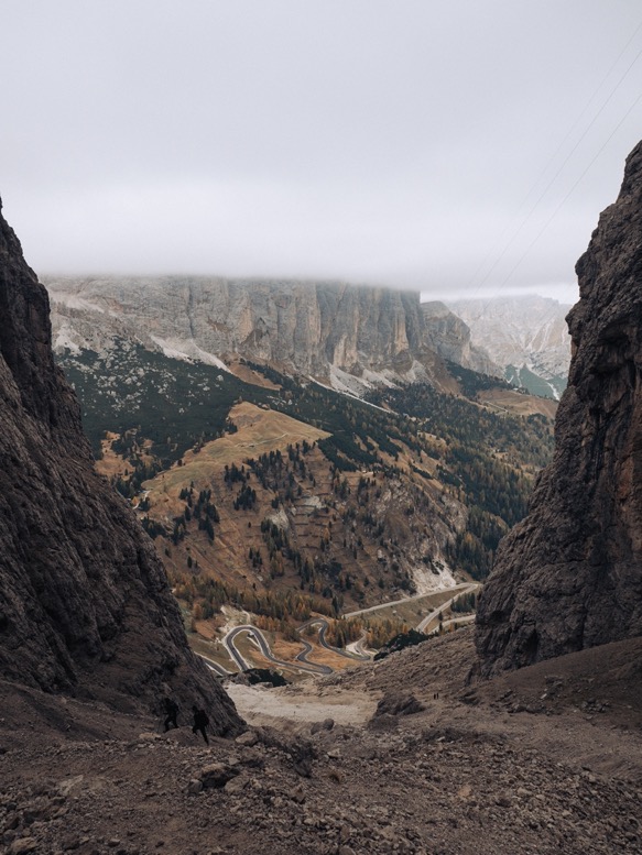
Late in the morning I made it to the pass Passo Gardena where I met up with my parents, whom I had convinced to take a vacation in the Dolomites with their RV, to swap batteries, and recharge with a proper lunch. Part 2 of the day was heading up into the Gruppo del Sella, whose tall peaks and steep mountain passes already daunted me when seeing them yesterday. Being below the clouds, the tall peaks looked even more mysterious. The trail, numbered 666 on this section, winds up through a narrow and steep gorge. Looking up all I could see were the grayish rocks of the scree and the vertical brownish walls hidden partially in the clouds. Looking down the narrow gorge offered some stunning views of the green valley below with the hairpin road winding through it.
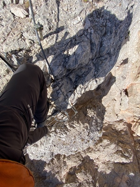
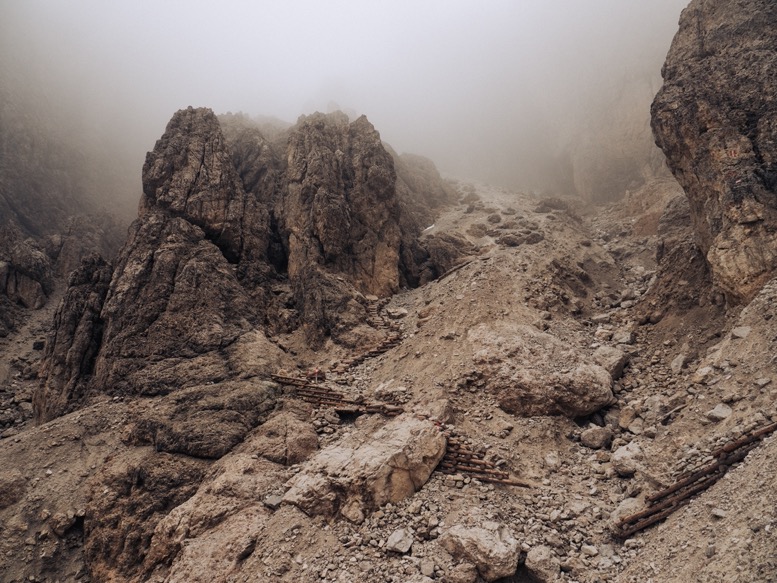
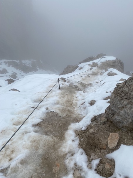
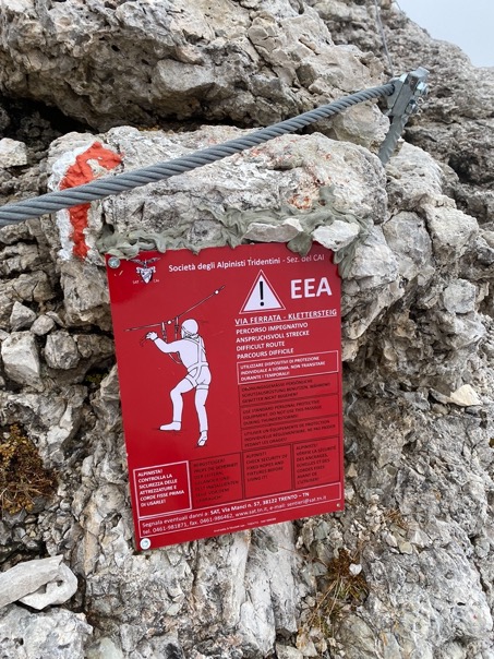
As I made my way up through the steep canyon, the trail got technically more difficult. I passed by some amazingly engineered sections of trail where the trail was kept in place by wooden structures. As I passed into the clouds, I got to the first real section of Via Ferrata, or iron trail. The Dolomites are full of these kinds of sections: steep technical trails with steel guiding cables for securing oneself to. The difficulty of these sections differs: some sections are near vertical, while other sections like these are quite easily done and would even be possible to do without the steel cable (in my opinion). For that reason and the fact my pack weight was already well above 20kg I didn't bring a harness.
This particular section was quite long (30 minutes). Reaching the top, I gained a few hundred meters and was walking on some snow patches. Being out of sight of the valley below, and fully in the clouds, it was dead quiet. Such an eerie but beautiful feeling.
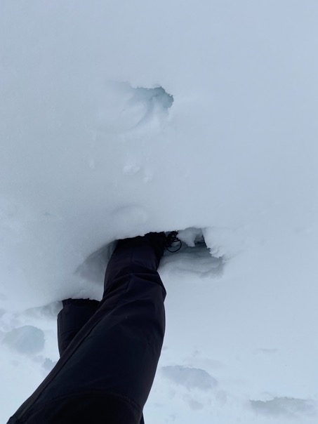
I passed by the (closed) Refugio Franco Cavazza al Piscidù (2587m) and climbed up further to the highest point of the day: just underneath Sas de Mesdi at 2955m. With the trail being on the north side of the mountain, the snow got deeper and deeper, till everything around me was covered in a good 20 cm of snow. The fog was thick, but navigation wasn't particularly hard. At that moment I realized how much I have grown over the years, how comfortable I was feeling being in such a hostile environment. Years back I would have worried realizing the trail was even going higher, but now I was calm, relaxed and fully enjoying the challenge. I realized that if I had to, I could comfortably spend the night here, in the deep snow. I think it's the result of pushing myself over and over, gaining experience with all the mistakes I made.
Passing over the mountain top the snow disappeared as snow for the sun, figuratively, because I hadn't seen the sun all day. Passing one last section of Via Ferrata on a narrow ledge with a steep 200m drop, I noticed I was approaching Refugio Boè much faster than expected.
Refugio Boè has a winter room, meaning it has an unmanned room open all year, for free. There is no lighting, no electricity and no heating, just a few beds with blankets out of the wind. That's luxury compared to camping out in the wind in the cold. And this one was particularly nice, being only several years old.
As the sun was setting, the clouds were finally breaking up, revealing the bizarre surroundings to me. I was looking up straight to Piz Boè (3152m) and into 2 gorges with vertical drops on both sides. What a place to spend the night alone.
\\ October 10 | Day 4: Gruppo della Marmolada - the red bivacco
Refugio Boè, Forcella Pordoi, Passo Pordoi, Malga Ciapela, Val de Ombreta, Pas de Ombreta (2702m), Bivacco Marco Dal Bianco (2700m)
18.4km | 11.4mi
1700m | 5600ft 1100m | 3600ft
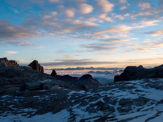
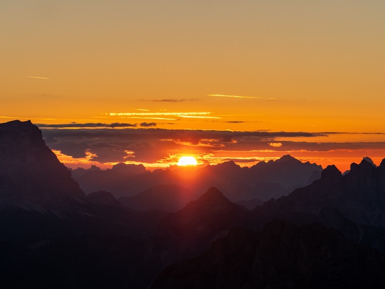
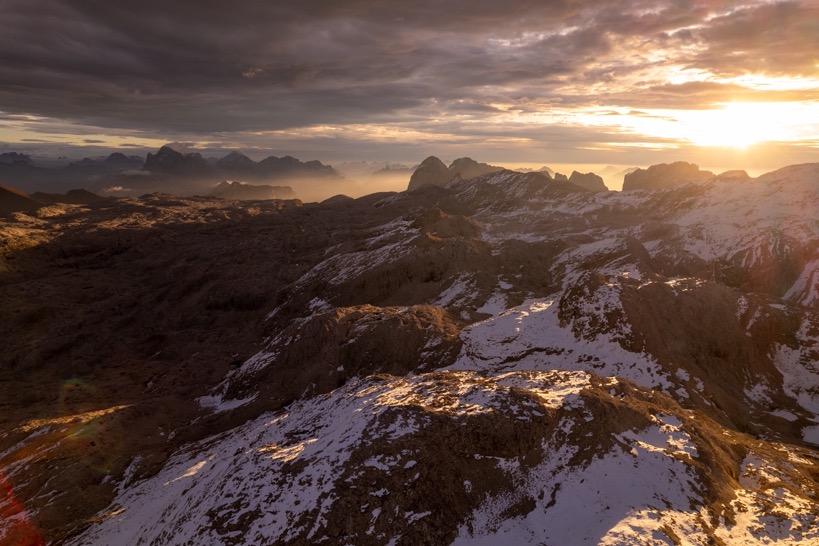
Speaking of perfect mornings. I got up before sunrise, made a coffee, or 2, or 3. Had breakfast and was out just as the first light was hitting the mountains outside. It was perfectly clear again, and with the clouds hanging in the valleys below, I was walking above the clouds on this cold cold morning.
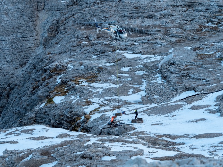
Just as I made my way out of the bowl the refuge was located in, I heard a deep rumble, as if a massive wind was picking up. Before I could realize what it really was I saw a helicopter skidding over the edge of one of the canyons and coming to a hover just above the edge. 3 guys jumped out and the helicopter fell back down, gaining not a single meter of elevation gain too much. And just like that I wasn't alone anymore in a split second. In the next 20 minutes, the helicopter flew back and forth lifting things out over the edge. I still don't know exactly what maintenance they were doing up there, but it must have had something to do with the refuge. Kinda cool to watch.
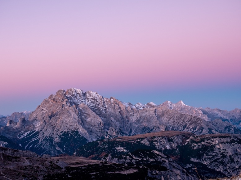
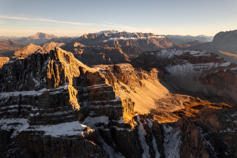
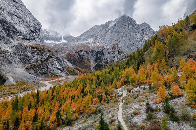
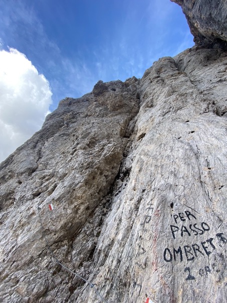
I made my way to the pass of Forcella Pordoi and its refuge and made my way down one via a gorgeous descent to Passo Pordoi. With my private transport waiting, I drove around the next (not so extreme) stage to the Gruppo della Marmolada, with the tallest peaks of the Dolomites. With fresh batteries, I started heading up towards the Marmolada glacier. But I didn't get far. Last summer a large piece of the glacier had broken off, causing a massive landslide killing 6 people on the trail that directly runs underneath the glacier. With the terrain still unstable, the whole area was still closed off to the public. Time for plan B. The Marmolada massif has an interesting shape. The northside, or front so to call it, is angled very uniformly at about 45 degrees and fully covered in snow and ice. But at the top, the mountain drops 1400 meters vertically into the valley Val de Ombreta. Plan B was to drive around the massif to Val de Ombreta and hike up from here, at the backside of Marmolada. Same elevation gain, but just slightly shorter, and as I realized later, maybe even prettier.
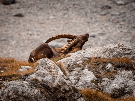
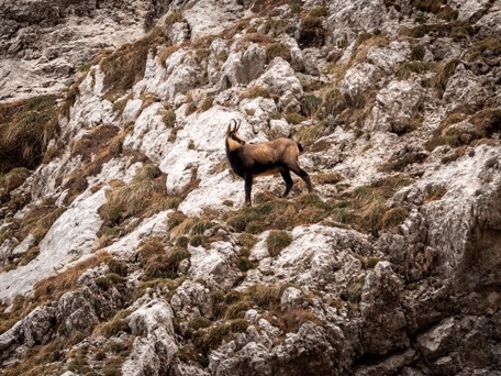
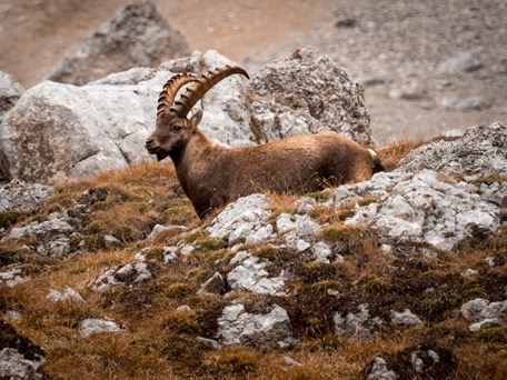
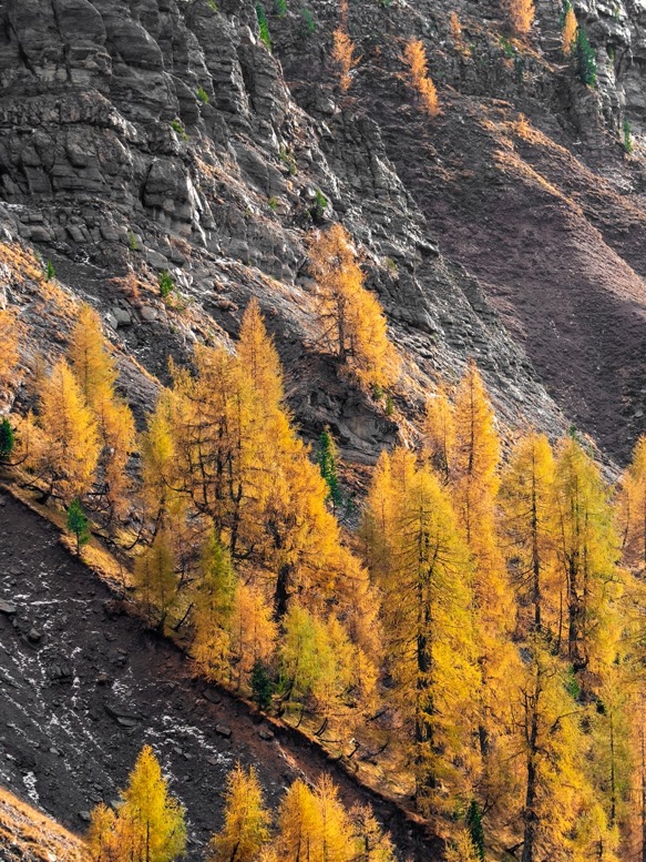
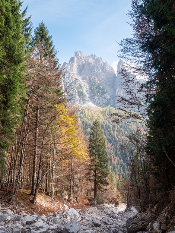
From Malga Ciapela the trail winds up through autumn colored pine forests. Having been above the tree line for most of the previous days, I didn't really see much of the Fall colors, so this was a welcome change. The forest opens up about halfway of the 1200m climb into the valley Val de Ombreta. As the trail winds up through this valley, the views were some of the best I've seen on the entire hike. On basically all sides of the valley there are towering peaks, with on the right side the Marmolada peaks disappearing into the clouds. The valley itself is sparsely covered in larch trees, that at this elevation were at the best fall colors. At the end of the valley the trail passes rifugio Onorio Falier before starting to climb steeply towards the pass Pas de Ombreta (2702m). The climb was steep and long but with several wildlife sightings of Ibexes and Rebecos.
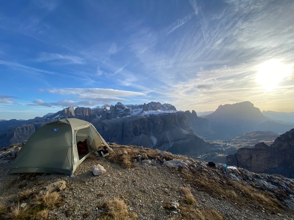
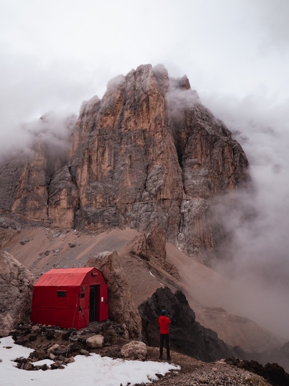
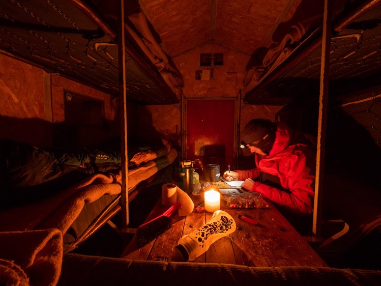
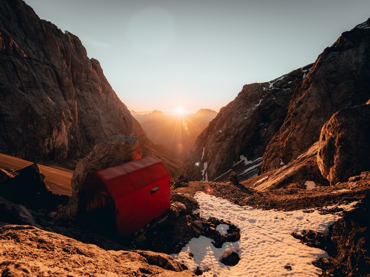
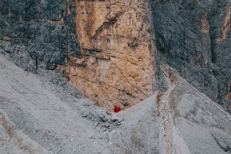
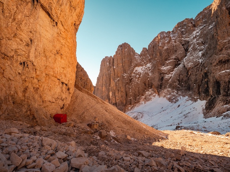
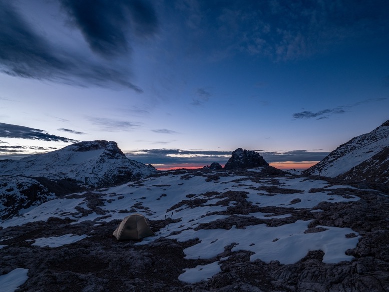
My destination for today was right on the pass: the red Bivacco Marco Dal Bianco. The Dolomites are scattered with bivaccos: small unmanned (red) huts on rather remote places. These places are, just like the refuge winter rooms, free to access and don't offer more than a place out of the wind. But in my opinion those bivaccos are so much better than the refuges. They are cozy, minimal and in the most bizarre locations. Bivacco Marco Dal Bianco is facing Val the Ombreta and is basically next to the tallest peak of the Dolomites: Punta Penia (3343m). The hut has a total of 9 beds, but I can't imagine how it would be with 9 people, as backpacks wouldn't even fit inside anymore. Being there alone was just perfect. I could fold up 2 of the beds making some room around the wooden table for sitting. According to the logbook inside, the hut hadn't been used in about a week or so, so the air was kind of pale when I entered. It added to the experience. Lucky for me there was a big icy snow patch right next to the refuge that I could melt for drinking water.
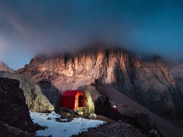
Another advantage of foggy/ cloudy weather is that lighting conditions are constantly changing. With clear weather I by now know exactly when to get which shots. But now I just kept taking videos and photos, as the colors and lighting kept changing. When I thought I already got the last outdoor shots of the day, I moved inside to read, write and eat. But when, out of curiosity, I peaked out of the door a little later I was astonished by the bizarre lighting conditions. The sun had been above the low clouds for most of the afternoon, but as the sun was setting behind the bivacco, the clouds broke up in the distance lighting the tall vertical walls of the Marmolada in this pink-orange color, while the tops were still hidden in the gray clouds. What a sight to behold!
\\ October 11 | Day 5: Scree surfing
Bivacco Marco Dal Bianco, Ombreta Orientale (3011m), Val de Cirele, Passo de le Cirèle (2683m), Passo San Pelligrino (1918m)
12.6km | 7.8mi
700m | 2200ft 1500m | 5000ft
As a runner I do quite a bit of core stability. And I guess that made for a very comfortable night. The old spring bed frames with thin mattresses bend through so much that I bet many people must have left this bivacco with a sore back before me. For me it was totally fine, and I slept great!
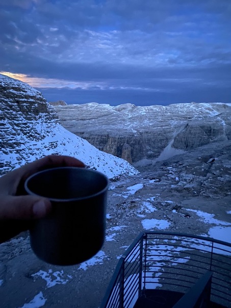
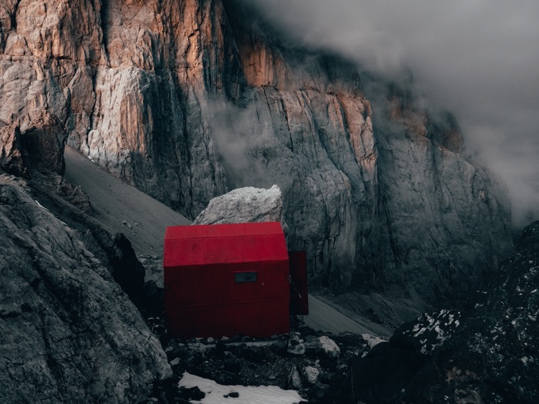
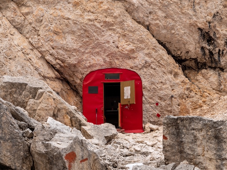
The steel red hut has a thick metal door that can also be opened halfway blocking most of the wind, while still allowing one to enjoy the view. And with the sun rising exactly in front of the bivacco, it was my favorite morning of this trip. The cool morning air in your face, a comfy blanket to sit on and a double espresso while watching the red sunlight peak above the horizon.
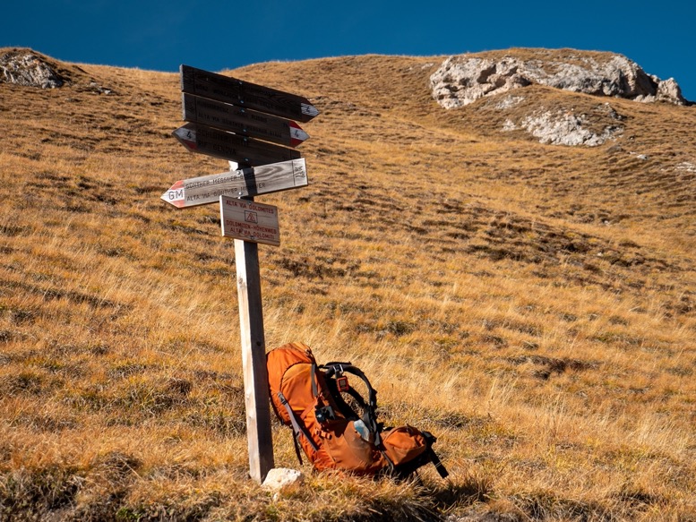
It wasn't till 10am until I got going. I spent the morning reading and relaxing knowing I only had a short day ahead of me. From the bivacco I had 2 options to get to Passo San Pelligrino: go to the mountain pass and descend a few hundred meters down, then wind around the mountain on the AV2, or go over the mountain, saving me quite some elevation gain. I chose the latter although the trail was marked with Via Ferrata (and since it's not the AV2, I didn't know how technical these sections were).
Right above the bivacco there's a section of Via Ferrata that is not technical at all, although the ice of the night's freeze made it slightly tricky. As I climbed up I got more great views of the Marmolada peaks, now fully in the sun. Those tall peaks made me feel small.
Right on the col I crossed a snowy section, and took a little detour to the neighboring peak Ombreta Orientale (3011m) to hit that 3000m.
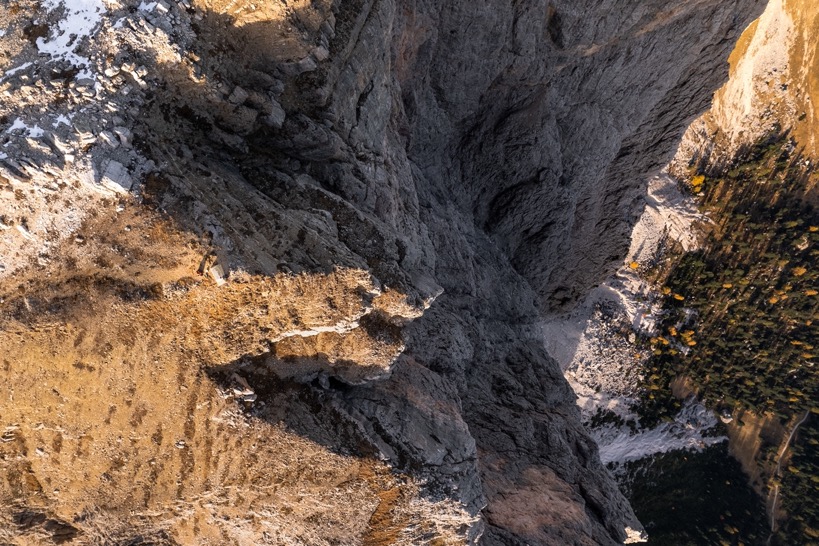
The descent from there felt really straight forwards. The trail winded through a moon landscape of gray rocks slightly losing elevation as I closed in on the AV2. But with just 300 meters to go to the AV2, there was a massive drop, not shown on my maps. More Via Ferrata. But this section wasn't anything I'd seen before. The wall was 150 meters high and averaging close to 80-90 degrees. The alternative of walking back to the bivacco and going around (>5 hours) didn't appear to me at all, so with greatest caution I started the descent down. I don't easily think 'what have I gotten myself into'; this was one of those rare moments. With my camera still on my chest and the wall so steep, I could barely see my feet as I made my way down. Going up would definitely have been a lot easier. I passed several steep sections where my backpack would get caught on the rocks, and had to stop a few times to catch my breath. But at no moment did I feel like I was taking too much risk. It is the hyper focus at these kinds of moments that makes me think and be aware of every step. I make sure I have 3 points of contact at all times, and with the cable I knew I had a solid grip. It took me perhaps 15 minutes to go down, but it felt like an hour.
Once down I noticed how focused I had been. My legs felt heavy and I suddenly felt tired. Trying to push on I quickly realized I had to take a break and relax before continuing on.
Once on the AV2, the trail passes through an interesting area with a rich WW1 history. There were several clumps of thick rusted barbed wire, as well as areas covered in rusted tin cans, or what was left from that. In WW1 there had been a lot of fighting in this area with the Austrians to the north. To this day that history is still clearly visible by the rusted debris as well as the hundreds of man made caves and bunkers that are on some of the hardest to reach places in the mountains.
I passed over the mountain pass Passo de le Cirèle (2683m). All that was left for today was a 600m descent. Being prepared for the worst (I rather ascend than descend), I actually had quite a great time going down. Most of the descent was this 45 degree deep scree with perfectly sized rocks, ideal for scree surfing! That is: you run down the mountain breaking by pushing away the stones in front of you. Only with the right consistency of the scree it is possible, so it was quite rare to find such a long section. Going down had never been so easy. Going up to grab the camera had never been so hard.

\\ October 13 | Day 6: The bivacco in the hidden canyon
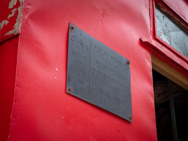
Passo Valles, Passo di Venegiotta, Refugio Mulaz, Forcella Margherita (2655m), Passo delle Farangole (2814m), Val Granda, Pian delle Comelle, Val Strut, Bivacco Giorgio Brunner (2667m)
18.3km | 11.4mi
1700m | 5600ft 1100m | 3700ft
I spent the night indoors, finally being able to wash my clothes and take a proper show for the first time in 6 days. The next day started sunny, but quickly started to turn for the worse with rain and hail storms. With still no clearing in the weather at 3pm and with a flexible schedule, I decided to not head out at all, but enjoy the day off at the Passo Valles mountain pass. The night I spent in the chapel right at that pass. Quite an experience, but not a great night in the damp and smelly building.
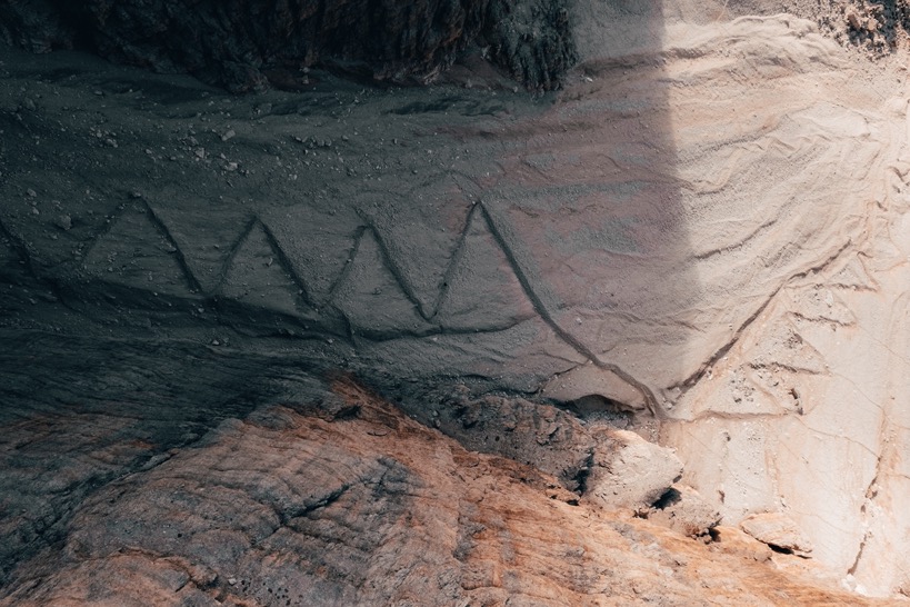
The next morning the weather was beautiful again, and I headed out into the Pale di San Martino Parco Naturale. From Passo Valles I climbed up to Passo di Venegiotta. The trail got gradually more technical with some fun sections of Via Ferrata covered in a layer of morning ice. I passed Rifugio Mulaz and got to the first of 2 mountain passes of the day: Forcella Margherita (2655m). The beautifully made zigzag trail was covered in ice and snow, but this time I brought my micro-spikes, which made the climb peanuts. With several easier routes connecting the refuge to the valleys below, I passed by several people, but as soon as I headed over the pass, I was alone. Alone for the next 48 hours actually.
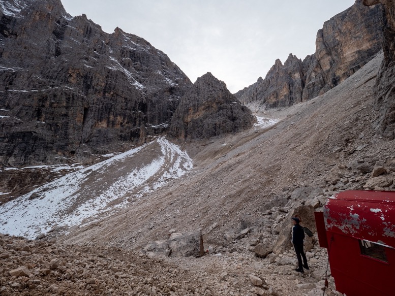
The second pass, Passo delle Farangole (2814m), was a bit trickier, with slopes over 45 degrees covered in deep snow and ice and no trail visible. So glad I brought my spikes this time! From the mountain pass I started the descent into the valley Val Grande. This gorgeous remote section is surrounded by the typical vertical peaks made of the red porphyry that looked golden with sun shining on them at a low angle. I hadn't really set on an overnight location yet but Ihad several options: wildcamping, a refuge with a winter room about an hour from here or a bivacco (Bivacco Giorgio Brunner) about halfway to the refuge somewhere off-trail. The valley merges with another big valley, the Pian delle Comelle valley. On the other side lies the massive Pale di San Martino plateau, a big relatively flat mountain group made of solid dolomite (I think so). Its flatness and moonlike appearance had already fascinated me when researching this area on maps and satellite imagery. The AV2 trail winds along the mountain high up from the valley, then at the higher end bends off and heads onto the mountain group. About halfway down this trail there is a gully with 300m higher up a bivacco I had spotted on maps. With it getting later I headed off trail into this steep gully towards this bivacco. There is sort of a trail, or at least some markings, but it was so hard to follow, that I just made my own route up.
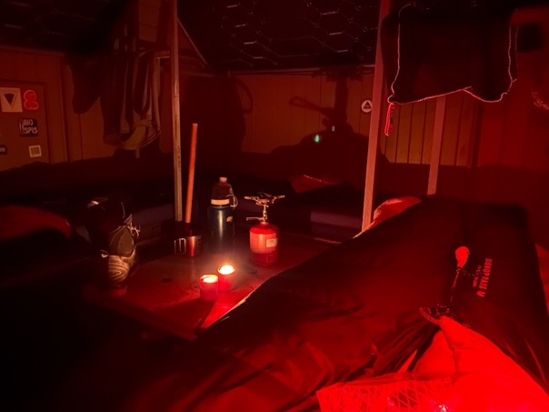
About 30 minutes later I made it to the bivacco. Another red hut just like the one a few days back. The way this gully is sort of s-shaped, the bivacco is surrounded on all sides by tall vertical walls, with a 300m high overhanging wall right above the bivacco. There is no cellphone reception, and without any wind, not a single sound apart from the occasional Alpine Choughs (family of the crow) that visited for the obvious reason of expecting to get something to eat. The echo was also amazing (see video). What a place! I instantly felt at home and so relaxed.
I pulled out a few dusty blankets from the metal can, laid them against a rock and sat down while I enjoyed some hot food and the peace of this place. When the sun had set, I made a cup of tea, crawled into my sleeping bag and read my book (Into Thin Air). Imagine having such a hut with a little electricity and food for a week. I would definitely stay there to get some editing done.
\\ October 14 | Day 7: The bivacco I couldn't reach
Bivacco Giorgio Brunner, Refugio di Rosetta, Passo di Val di Roda (2567m), Passo di Ball (2443m), Refugio Pradidali, Pale di San Martino Parco Naturale
20.7km | 12.8mi
1600m | 5200ft 1500m | 4900ft
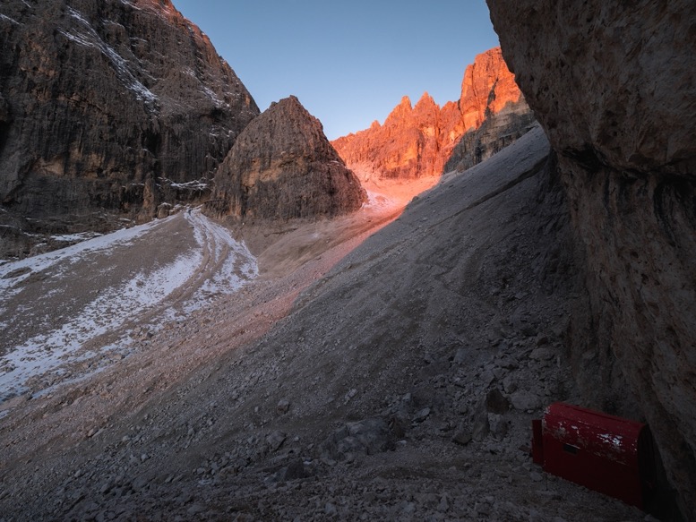
I feel like it starts to sound like I'm repeating myself when I tell myself the morning was calm, peaceful and so enjoyable with a good cup of coffee as I watched the sun turn the canyon walls in the pink, then deep orange color. It's just my favorite moment of the day.
I headed down the gully, back onto the AV2 trail and towards Refugio di Rosetta. This massive refuge, with its own cable car, was completely closed off for the winter season. Hard to imagine the crowds that overwhelm this place in the summer months.
For a reason I don't really understand, the AV2 trail does not immediately head onto the Pale di San Martino plateau. From the refuge there is an easy trail with very little elevation gain heading straight onto it. Instead, the trail goes down a bit on the other side of the mountain, then follows a canyon below the plateau before heading up via a steep and long trail at Rifugio Pradidali. The canyon is definitely beautiful, but in my opinion the plateau is THE thing to see. I can only imagine that for commercial reasons they let the trail pass another refuge.
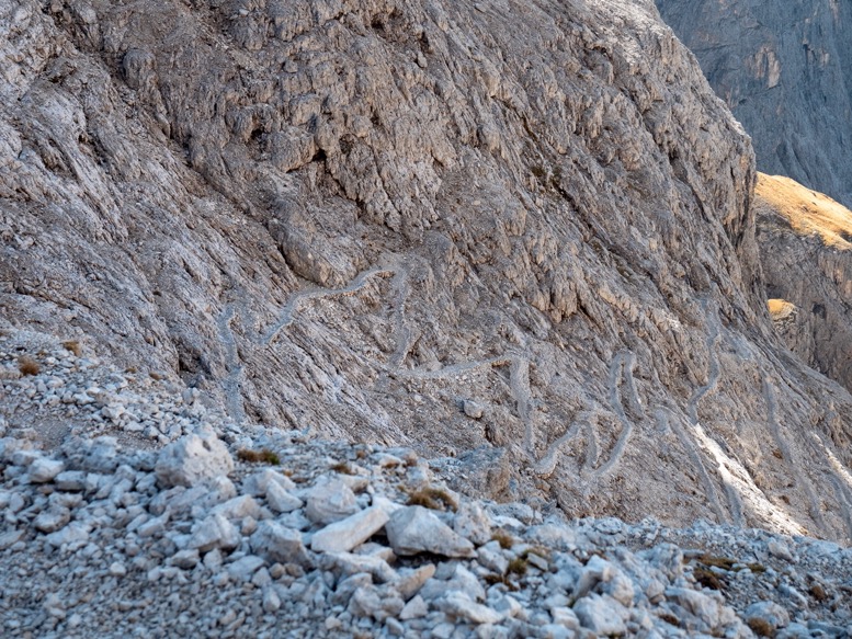
Nevertheless, I followed the trail obediently, went down the 200 switchbacks (yeah, the gradient of this trail is that low), passed several Via Ferrata sections and laid my eyes on Rifugio Pradidali as some low clouds rolled in from the valleys below. I had a little break to prepare myself (mostly mentally) for the climb still ahead of me and pushed on. Plan A by now was reaching another bivacco (Bivacco Guido Alpine di San Martino), about 800 meters above the refuge. I honestly didn't do any research on this particular bivacco. I just knew its position, and with my new love for red thin cans, I just decided to give it a try. The trail up was long and difficult, and it didn't help that I was getting tired and earlier that day had come to the realization I didn't bring enough food I had packed food for only 2.5 days, my original plan, but with the day of bad weather I changed my plans, but didn't think about repacking my food. In addition to that, this terrain was some of the hardest so far, temperatures were lower than the previous week, and I had taken several detours. Not enough food for sure.
By the time I got close to the bivacco I was quite looking forward to a comfy hut and some relaxation. The odd thing is that there is no trail to this bivacco. I didn't really think it through, especially because it looked easily accessible on my maps by following a mountain ridge up. I was about 400 horizontal meters from the bivacco, shin-deep in snow navigating the narrow ridge with some pretty massive drops on both sides, when suddenly I couldn't go any further. In front of me a 100m deep, 100m wide canyon with a few pinnacles in-between. Well, this wasn't on any maps. My attempts to find a route around or below proved to be in vain. This bivacco was unreachable.
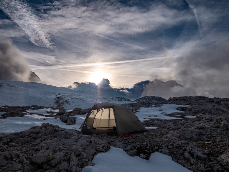
As it turned out, it is only accessible by a technical climbers route, explaining why there isn't a mapped trail leading to it. But hea, nevertheless a fun adventure. I quickly switched to plan B: wildcamping. I descended till below the snow-line, and found a perfectly flat campsite on the mountainside overlooking the moonlike plateau. It honestly surprised me how many flat gravel spots there are in these mountains.
I pitched my tent, ate all but 2 hands full of oats and a Snickers, and enjoyed the distant views from my tent. With the wind (and lack of food) it felt the coldest it had been on this trip. But by the time I crawled up into my down winter sleeping bag, the cold had no grip on me any more.
\\ October 15 | Day 8: the Pale di San Martino plateau
Pale di San Martino Parco Naturale, Passo delle Lede, Val Canali
10.6km | 6.6mi
400m | 1200ft 1800m | 6000ft
I can not really describe this landscape, other than saying it really looks like the moon. Really monotonically colored gray and with relatively little elevation gain.
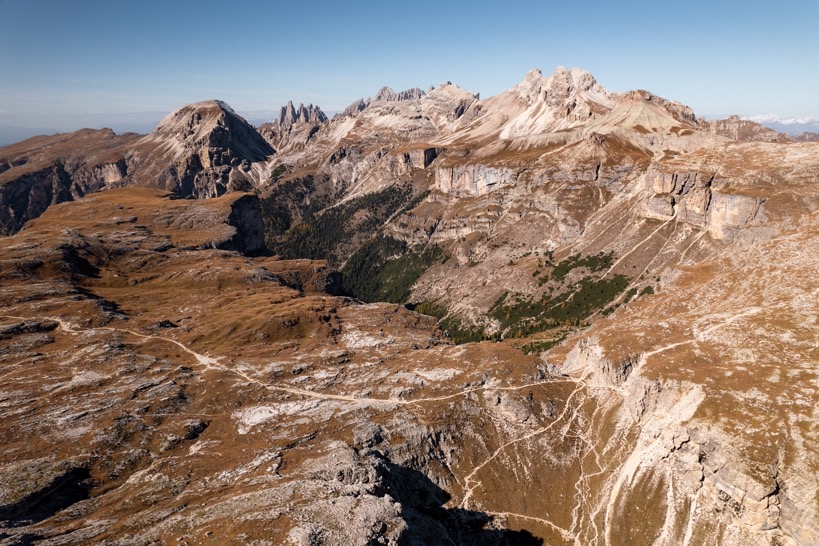
From my campsite I made a little detour following some alternative trails over the plateau before merging with the AV2 trail again. I feel like these trails should have been included on the AV2 and can highly recommend anyone heading a bit more onto the plateau. Just don't fall in one of the many sinkhole-like holes.
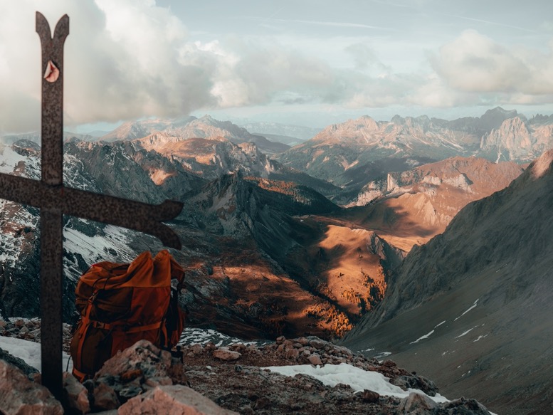
On the AV2 I passed over the mountain pass Passo delle Lede, and into Val Canali. What followed was the most exhausting knee-breaking descent of this trip: 1400 meters down on a steep and very rocky trail. That was a tough one. But the reward was some beautiful trails in autumn colored forests down in the valley. I noticed that for the first time in 48 hours I could smell something. High up in the mountains, there's nothing but rock, and maybe some grass, while down here it actually smelled like nature again.
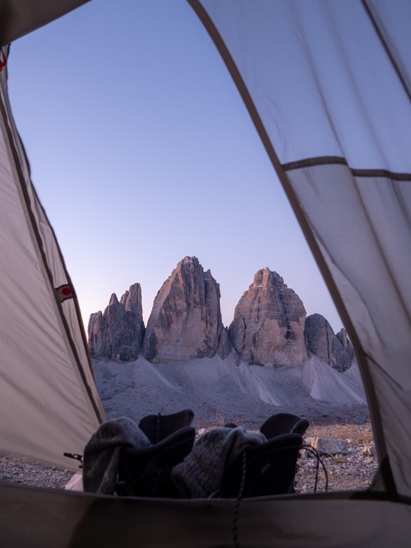
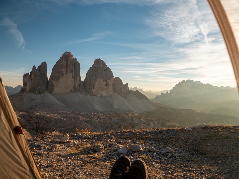
\\ October 17 | Day 9: Tre Cime
Refugio di Auronzo, Forcella Col di Mezzo, Sasso di Sesto (2539m)
10.6km | 6.6mi
700m | 2400ft 500m | 1700ft
After spending a day in Venice, I headed up north back into the Dolomites on my way home. Since I had the luxury of my own transport, I drove to the Tre Cime (Dreizinnen) area, about 40 kilometers east of the AV2 route.
The Tre Cime peaks are probably the most peaks in the Dolomites, and for that reason also one of the most touristy places.
A big advantage and at the same time disadvantage, is that there's a toll road leading up to just behind the Tre Cime peaks. From the parking lot it's an easy 30-60 minute walk to the front of the peaks. On the AV2 I had barely seen anyone for the last 10 days, now it suddenly looked like summer with all the people out here. I don't even want to know how busy it gets here in summer.
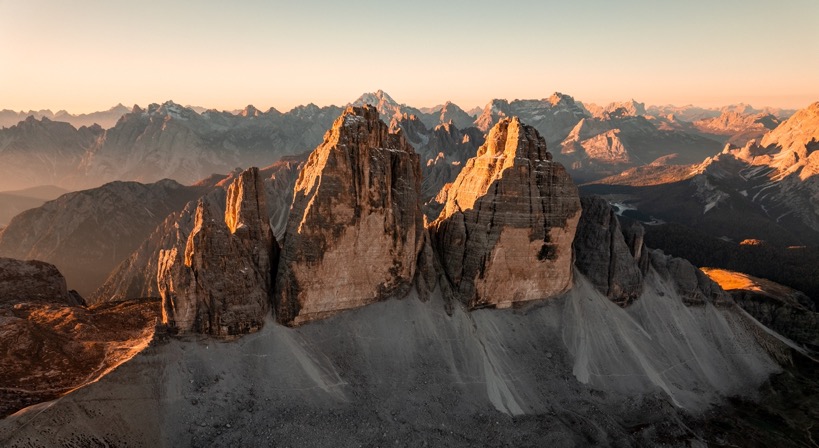
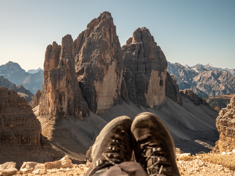
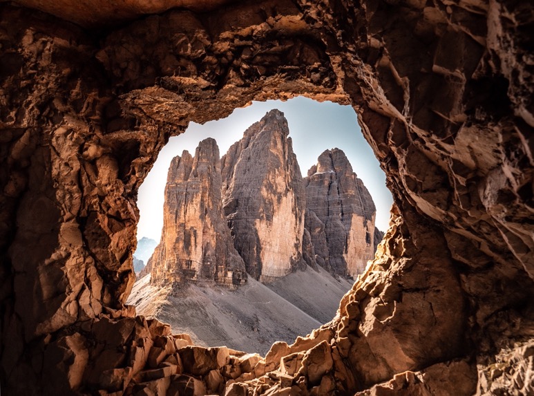
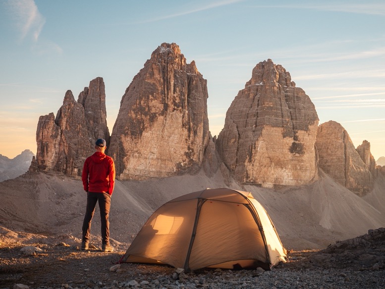
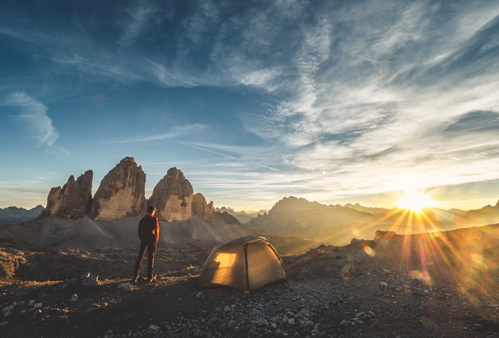
It was 3pm when I got moving, passing the hordes of people heading back to their cars on the easy gravel trail. Strangely enough the Tre Cime are not recognizable at all from the back, but winding around to the other side I laid my eyes on the 3 most iconic peaks of the Dolomites, maybe even of Italy. From left to right the Cima Piccola / Kleine Zinne ("little peak"), Cima Grande / Große Zinne ("big peak") and Cima Ovest / Westliche Zinne ("western peak") are 3 freestanding dolomite pinnacles with all 3 having front-facing vertical faces. It's not hard to understand why it attracts so many people.
The trails here are super simple, especially the main ones leading to the Dreizinnenhütte, a big refuge with views on the Tre Cime. Avoiding the crowds, I chose a more technical trail passing directly underneath the 3 iconic peaks. From there I merged with an easy trail and passed the Dreizinnenhütte. I already knew where I wanted to sleep for the night: in one of the (WWI) caves just above the refuge. But little did I know that those caves were a lot easier accessible than I initially thought. At the caves there were several people sitting and waiting to watch the sunset, and they were all smelling like pee. Regardless of how photogenic the location was, I wasn't going to spend an uncomfortable night there just for the cool shots. Instead I scrambled higher up the mountain Sasso di Sesto (2539m) where I found a great campsite all the way up top, without any tourists, without any weird smells. Perfect.
While the sun was getting lower and lower, I spent some time relaxing and reflecting on this great trip. 10 minutes before sunset, I grabbed my camera, ran around like crazy to get all the great shots, then sat down again to relax. Knowing what shots to get and when makes for these almost stressful moments, but it also helps me to not think about filming when I don't have to. The little 'me-moments'.
After sunset I ran down 200 meters in the dark to a little lake to get water, no snow around the tent this time unfortunately.
I had hauled up a decent meal: fresh bread, hummus, salami, some camembert, tomatoes and bell peppers. Celebrating my last night in the mountains I realized how perfect this trip had been. The weather, the landscapes, the campsites and the countless perfect sunrises and sunsets. I felt blessed.
\\ October 18 | Day 10: Via Ferrate along WWI ruins and fortifications
Refugio di Auronzo, Forcella Col di Mezzo, Sasso di Sesto (2539m)
10.6km | 6.6mi
700m | 2400ft 500m | 1700ft
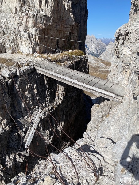
The easiest route back down to the car would probably have taken me an hour. But instead I took a much longer scenic route. From the Dreizinnenhütte I followed trail 101 in the direction opposite of the parking lot, then climbed up to Passo Passaporto. From there I took a technical route around Monte Paterno. A fun section to end the trip with. Passing dozens of ruins and caves from WWI, I climbed up and over rocks with tricky sections of Via Ferrata. I passed a few wooden railing-less bridges, and crawled on hands and feet through sections of trails carved out of the rocks some 100 years ago. People in harnesses and belay ropes looked strangely at me as I passed by without any of that. I in return laughed at how over prepared they were on sections that weren't even that dangerous.
Right before merging with the crowds next to the Tre Cime, the trail passed through a few old tunnels. One of them was so windy, narrow and dark, that I doubted several times if that was really the trail. But it was, and it was awesome. And so was this trip.