Backpacking Yosemite part 1/2
September 2019
So, here it is, my first travel itinerary. No, I won’t call it a blog.
Over the last two years I traveled a lot, filling many hard-drives with photos and videos. But I haven’t done much with all that material, and those stories are ready to be forgotten. That is why I have decided to start this travel itinerary: a simple description of my trip, with some photos and statistics. In the first place for myself to look back at those adventures, for friends and family to see what I’ve been up to, and for others that are thinking about doing something similar.
This first log is my most recent trip. My first ever backpacking trip, solo, in the Sierra Mountains in the backcountry of Yosemite National Park, California, USA.
I visited Yosemite 6 times before in the last two year. This place is just magical. The majestic granite, forests and the purity of this place draws me back every time. And ok, also because it’s only 3.5 hours from San Francisco where I happened to be a lot lately. This trip was going to be different, though. All of my visits before have been by car, doing many day hikes, but always spending the nights on developed campgrounds (or parking lots), between the (hordes of) people. This trip was going to be in the backcountry of Yosemite, away from the tourists, cell phone reception, away from basically everything. Well, except the bears and barking coyotes in the middle of the night.
I spent 5 days in the backcountry carrying everything I needed on my back. Another 4 day trip followed a few days after, the itinerary about this trip will follow soon.
About Yosemite
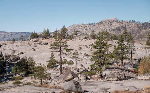
Yosemite National park lies in the middle of the Sierra Mountains, in eastern California. The park is big. With a total area of 3027 km² it is about the size of the Dutch province Overijssel, not to mention the even larger wilderness around it. The park has about 350km of roads, leaving most of the park only accessible by foot. 95% percent of the park is designated as Wilderness: regions of the park where you are free to go and camp wherever you want. These areas are only accessible by foot. For backcountry wilderness use permits are required, these limit the people starting on the same trail on the same day, ensuring solitude. But if you’re not picky, there is always something available somewhere in the park.
\\ September 22 | Day 1: Vogelsang
 Tuolumne Meadows to Vogelsang via Rafferty Creek
 14.0km | 8.7mi
 528m | 1732ft  100m | 328ft
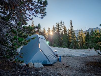
I got my wilderness permit with starting location Tuolumne Meadows, one hour outside of Yosemite Valley, the most popular part of the park. Since black bears roam the park, it’s mandatory to carry a bear canister: a hard plastic barrel that is opened and closed using a coin or something similar, so bears can’t do it (what I’ve been told at least). All scented items go in the canister at night: food, tooth paste, dental floss, trash. The canister is placed 10-20 meters away from the tent. First of all the canister prevents bears from cuddling up against you at night, but also to protect the bears, to keep them wild by not letting them associate people with food. I rented one in the valley.
I had no idea how much food to pack for the trip: first timer. I had dried meals for dinner and dried meals or oats for breakfast, the rest of the bear canister I stuffed with nuts and Cliff bars in the hope it would be enough to make it through the day. Also as a first, I brought a little notebook to write down my adventures (feels like sharing when out there). Here is my entry right before I left:
Packed most stuff. Organized! Hard to determine how much food I should bring … Worst case scenario I’m hungry all the time.
Well, 5 hours into my 5 day trip I realized I didn’t bring enough food. Unconsciously I assumed that stuffing the bear canister to the top would be enough. I never estimated my actual calorie intake before I left … Doing some quick calculations I realized I packed more like 2000 kcal per day of the 5000-6000 kcal a day I needed. Well, now the adventure really started. Hungry or not, I was going to stay in the wild for 4 nights, no less.
I arrived at Vogelsang late afternoon. The hike was beautiful. Climbing above 10,000ft the forested areas made room for stunning sub alpine meadows and lakes.
\\ September 23 | Day 2: Vogelsang Pass, Merced Lake and Echo Valley
 Vogelsang to Echo Valley via Vogelsang Pass and Merced Lake
 22.1km | 13.7mi
 322m | 1057ft  1245m | 4085ft
Day 2 started, like any other day, with 20 minutes of filtering water. Pfoah, that was probably the most time consuming and least favorite thing to do. First you have to find a proper water source, than fill a plastic bag or bottle with water, screw on the filter and push the water through the filter. And repeat that 4-5 times twice a day for 40 minutes. I got a cheap and lightweight water filter, but it’s probably the first thing I will improve on for my next trip.
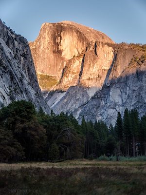
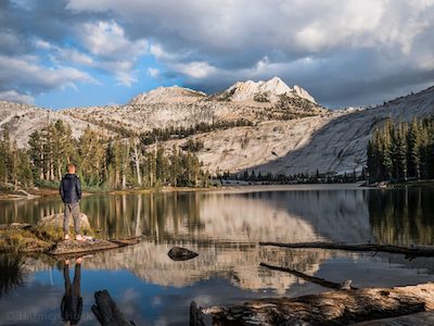
After packing up my tent i hiked up to Vogelsang Pass passing by Vogelsang Lake, a beautiful sub-alpine lake hidden at this high elevation. The views got better. I could see the top of Half Dome towering over the other mountains in the distance. At the Pass at 10,625ft elevation I made myself a good coffee. I like coffee, but I like the whole process of making it even more: heating up water in a tiny pot with on a little stove an pouring it over the coffee.
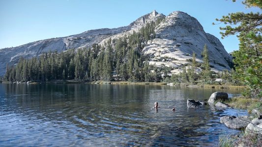
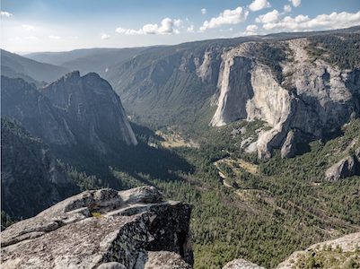
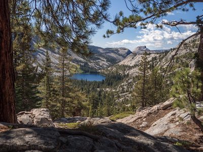
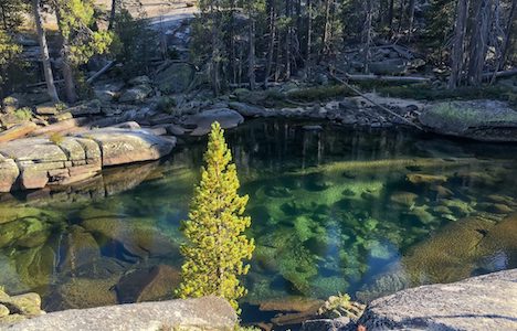
From Vogelsang Pass I zigzagged down to Lewis Creek where I got back in the forest. Following the creek I passed a hiker for the first time that day. It’s great not having noisy or slow people on the trail with you. Other people out there probably share this opinion. Further down the creek the views got better as I could overlook Merced Lake with Half Dome in the background. It’s a massive lake, but tucked away between steep granite cliffs. The water of the lake and river that flows out of it is almost perfectly clear, but with this green tint to it.
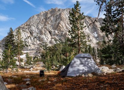
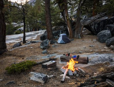
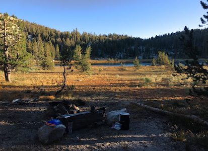
Finding a camping spot this night was harder than expected. I passed Merced Lake and got to Echo Valley. On the map Echo Valley looked flat and open. It was flat, but not open at all as it was densely forested. And I’m very picky about my camping spot too: it has to be protected from the elements, needs to be cozy and have a good view. The first camping spot I found right on the Merced River was ok, but not perfect. I spent at least another 45 minutes walking around, crossing the river and hiking up the steep cliffs finding for that one perfect spot. And I did! A nice flat spot further from the river with an already existing fire ring.
\\ September 24 | Day 3: Sunrise Lakes
 Echo Valley to Sunrise Lakes via John Muir Trail and Sunrise Mountain
 18.2km | 11.3mi
 1042m | 3419ft  333m | 1093ft
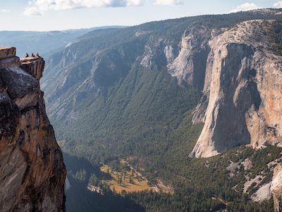
My initial plan for day 3 was to hike up Clouds Rest and camp up there. Clouds Rest is a big bold granite peak next to Half Dome above 3000m (9900ft). The views are amazing from up here, but there is no tree coverage or water up there. It was a warm day, and with my limited amount of food I decided to skip it and hike over Sunrise Mountain on my way to Sunrise Lakes. (I did go up to Clouds Rest on my second trip though: melting snow for water, coming soon).
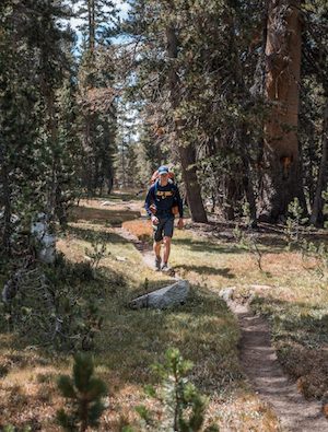
The third day into the trip was hot. No wind, no clouds and a lot of climbing, the toughest day. And part of the trail passed through a recently burned area where the black tree stumps offered no shade. The first few miles of the hike were though: a steep climb right from out of the valley where I camped. What I later realized is that the first miles of the day are the toughest, and I start feeling better throughout the day. A thousand feet below the summit of Sunrise Mountain I was lucky to find the last remnants of a stream in a dense pine forest where I could fill up my water and enjoy my coffee with beef jerky.
What I like most about these long days of hiking is the feeling of simplicity. All you need is on your back. All you have to do is walk. All you have to think about is where you are going to pitch up your tent tonight. Everything else is optional. I feel so relaxed being out here. No stress, no worries.
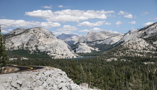
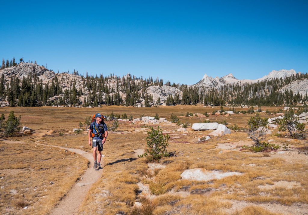
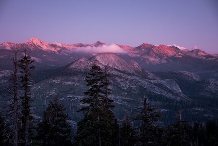
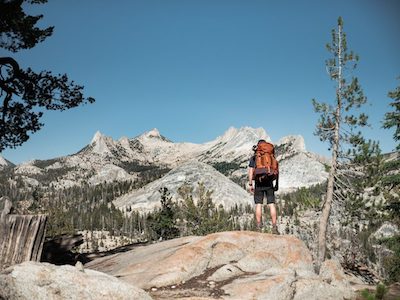
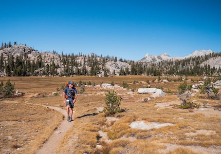
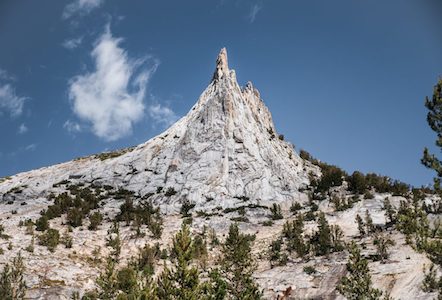
Passing over Sunrise Mountain opened up another new valley of Yosemite I had never seen before, and which is not visible from any roads in the park. The valley is surrounded by these spiky granite peaks (Tressider Peak, Echo Peaks, Cathedral Peak and Teneya Peak) that form this bowl. Inside the bowl is another funky granite dome (Columbia Finger) and on it’s right I could see Sunrise Meadows where I was heading.
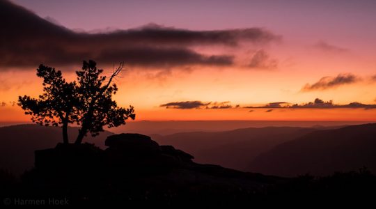
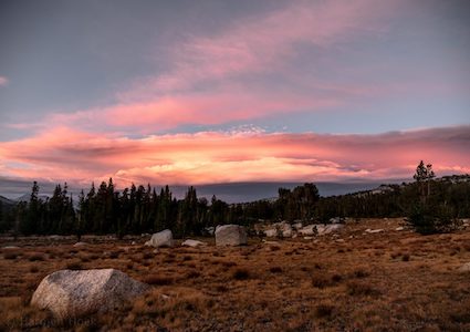
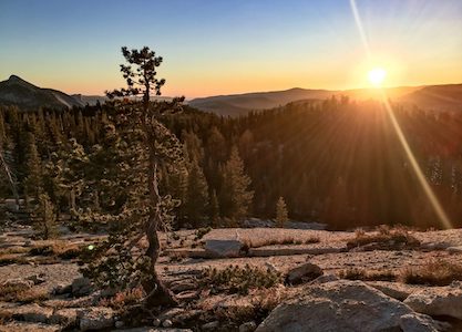
Arriving at Sunrise Meadows, with some amazing camping spots, I decided do one more climb to get to Sunrise Lakes. Reaching Sunrise Lakes I realized I was not the only one, guess it’s a popular spot. But the lake is big enough to find solitude. With the sun still out, and barely any wind I took a refreshing late afternoon swim. Although I washed myself every night in (freezing cold) creeks, this really felt refreshing. Around sunset I took a little hike to the other side of the lake overlooking the Lower Sunrise Lake. I guess a better name for this lake would be Sunset Lake, ’cause this sunset was am-a-zing! Despite the fact that beautiful sunsets are so common, being in such a remote place it felt like seeing it for the first time.
For food on this trip I brought oats or dried meals for breakfast, nuts and bars for lunch, and dried meals for diner. It really surprised me how well and varied the dried meals tasted. Just add boiling water, wait 15 minutes, and done. But I guess everything tastes good after a full day of intense hiking. My personal favorite on this trip: Himalayan Lentils & Rice!
\\ September 25 | Day 4: Cathedral Lakes
 Sunrise Lakes to Cathedral Lakes including bushwhacking
 13.1km | 8.1mi
 349m | 1145ft  384m | 1259ft
Day 4 started slow and relaxed with some good coffee and some easy walking around camp. I knew today’s hike to Cathedral Lakes would be easy. Walking around on the sunny but cool morning I realized how far I had come with my solo traveling. Two years ago I spent my first night ‘alone’ (read: 50 meters from a busy road) in my car near Point Reyes (100km above San Francisco). I was on my very first adventure for a long weekend. I remember being anxious and going to bed as soon as possible when it got dark. That first night was uncomfortable waking up many many times with every noise. Over the last two years I slept over 60 nights in my Toyota 4Runner from Canada to Utah (I’m planning on writing an itinerary about those trips too) growing more and more confident. And now I was here, in Yosemite, solo backpacking in bear country away from cell phone reception on my very first backpacking trip. Nights are no longer scary and not many things scare me at all. I’ve pushed my boundaries many times and feel like I’ve expended my comfort zone. I see the beauty in the nights, the quietness, the stars.
But why solo travel? It’s not that I’m anti-social, at least I don’t think I am. It’s the whole experience of being alone. I feel like I’m more immersed in where I am and what I am doing. I can go wherever I want, for how long I want, can make a coffee wherever I want and pitch my tent where and whenever I want to. And I never have to make any compromises. But above all I think it’s the adventure, being 100% self-reliant.
We like companionship, see, but we can’t stand to be around people for very long. So we go get ourselves lost, come back for a while, then get the hell out again.
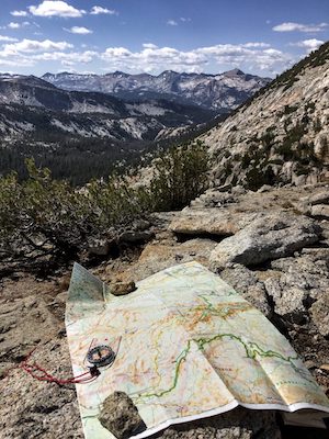
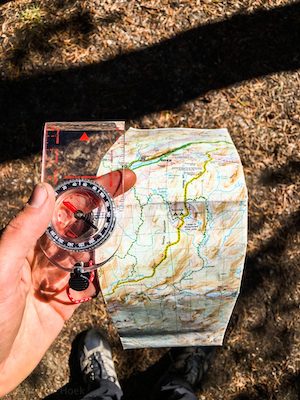
I left my camp at Sunrise Lakes around 10:30 and headed for Cathedral Lakes. Getting there I had two options: tracking back a few kilometers to get to the right trail, with a mountain to climb and descent, or cut my own off-trail shortcut. Making my own trail sounded like a lot of fun, so off I went. Instead of using my phone for navigation I wanted to test my navigation skill by using an old-school (topographic) paper map and compass. I love maps, so being able to play with one for an hour or so was good fun. Using the right declination (difference between true north and magnetic north, yeah I know it’s getting a nerdy) I got my good heading and using visual way-points I bushwhacked my way to the right trail. I wondered how long it would take for someone to find me here if I broke my leg. But that’s not what happened, luckily.
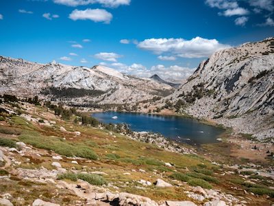
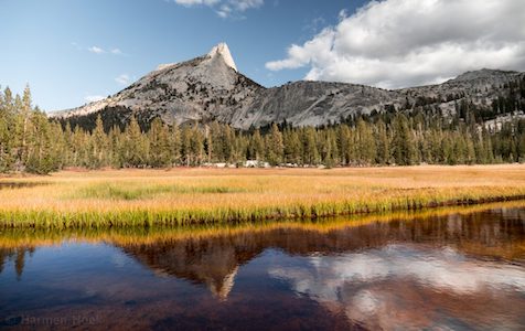
The rest of the hike to Cathedral Lake was relatively easy, with not too much elevation gain. On the way some great views of the Clark Range and Cathedral Range. At the upper Cathedral Lake I spend some good time with coffee and a nice view reading ‘Into The Wild‘ before heading to the lower Cathedral Lake to spent the night.
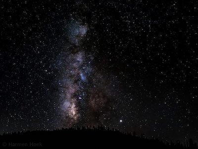
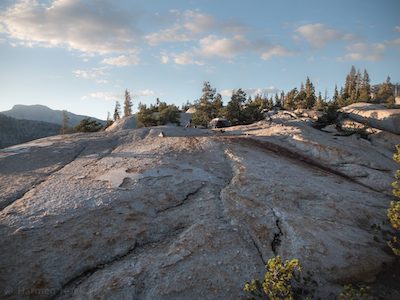
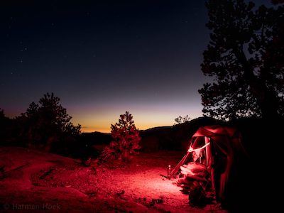
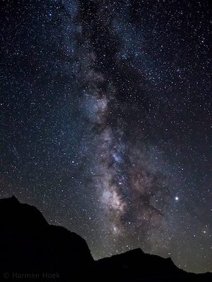
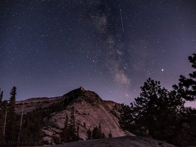
I found an a-ma-zing camp spot at the far end of the lake! Between giant slaps of granite I found a nice flat spot with fine gravel up on the slopes of Medlicott Dome. The views around were amazing. To the east the granite dropped down steeply giving great views of Tenaya Lake down in the valley in the distance, Polly Dome and the Mount Hoffmann range. To the east rough spiky peaks of Echo and Cathedral Peaks towered above the pine tree surrounding the lake. A thousand photos and videos later when the sun had set beautifully, I was amazed by the amount of stars. I think I had never seen the full 180 degrees of the Milky Way like I did that night. Just WOW. And except for the commercial airplanes flying over 30,000 above, not a single sound. (They should ban airplanes from flying over the Sierras.)
Woke up in the middle of the night by dogs barking close to tent. Sleepy, heart pounding like crazy. What are those?
Yeah, that freaked me out, especially because it woke me up. Guess it were some wild coyotes.
\\ September 26 | Day 5: Back to civilization
 Cathedral Lakes to Tuolumne Meadows
 11.0km | 6.9mi
 204m | 669ft  377m | 1237ft
The morning was cold, but sunny and barely any wind. I couldn’t think of a better way to start the day by taking a fresh dive in the crystal clear lake. When I get a crazy idea in my head, I can’t get it out of my mind. And yes, it was cold, but a good way to wake up.
The hike back felt like a hurry. Mostly because I could almost smell the food, I was hungry. Hiking back I could feel gradually getting back into civilization passing more and more people on their (day)hike. Once back, I ate ate and ate before heading to the Valley where I would spend a night under the stars to get a camping spot in the over-packed Valley. Yup, for 4 nights I slept at the most amazing places, for free, and death quite, and now I had to wait in line all night to get a camping spot …
What an amazing trip it was! The experience of full self-reliance is a valuable lesson. And the thing that strikes me every time is how little you actually need.
2 days later I got my wilderness permit for my second trip around Tenaya Canyon. And with an abrupt change in the weather, it was going to be cold: -20°C (-4°C) right below the top of Clouds Rest, a massive granite peak in Yosemite. Part 2 is coming soon.